Part of a series of articles titled Park Paleontology News - Vol. 13, No. 1, Spring 2021.
Article
Survival is Still Tough for Dinosaurs at Curecanti National Recreation Area

Alison Mims, Jack Wood, Michael Bozek, and Forest Frost
National Park Service
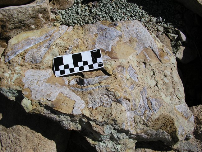
Dinosaur (fossils) at Curecanti National Recreation Area are having a tough time. It wasn’t enough that a short life on earth was followed by death, scavengers picking over the carcass, bones broken and tumbled in a river channel, and the final crushing aspect of existence, being fossilized into hard rock. After all this, they are now facing the harsh realities of a fluctuating shoreline environment in western Colorado.
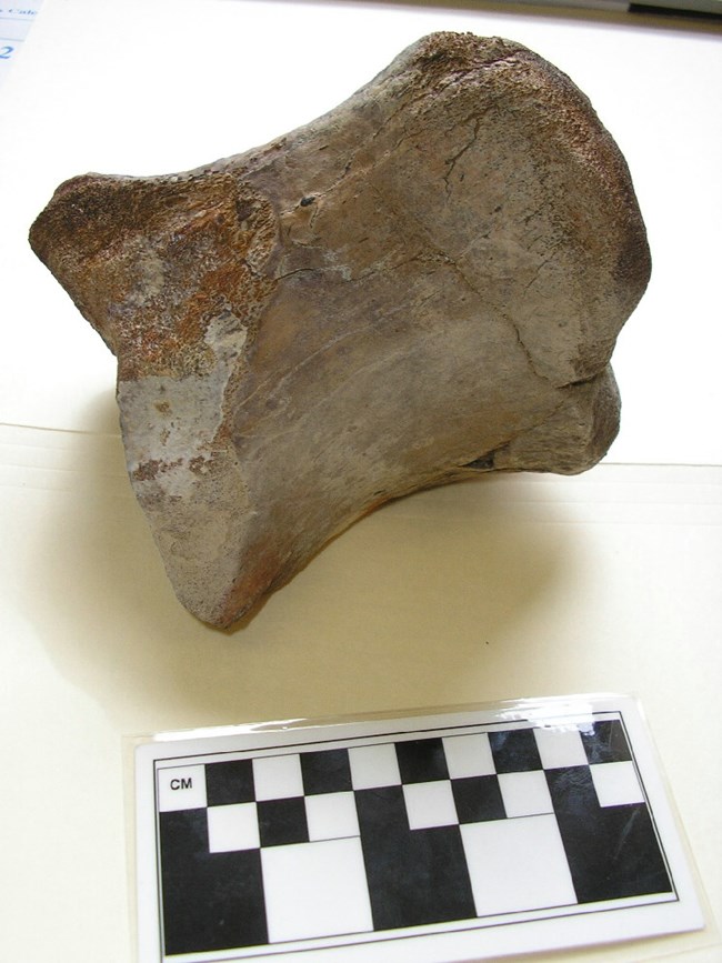
Park staff are in an uphill battle trying to determine how to best monitor fossil sites and rescue important dinosaur specimens eroding along the shoreline of Colorado’s largest body of water, Blue Mesa Reservoir. This battle is compounded by the seasonal variations of the reservoir that cyclically submerge and expose fossil locations. Although most of the specimens are broken, disarticulated fragments, the shoreline sites have produced 15 identifiable fossil vertebrate taxa, most of which are dinosaurs. The more recognizable dinosaur genera include Apatosaurus, Allosaurus, Camarasaurus, Ceratosaurus, Diplodocus, and Stegosaurus. Specimens from these localities fill in a geographic gap in the known distribution of certain Late Jurassic taxa across the mid-continent of North America. There is high potential for future discoveries of scientifically important specimens.
Erosion: A Frenemy?
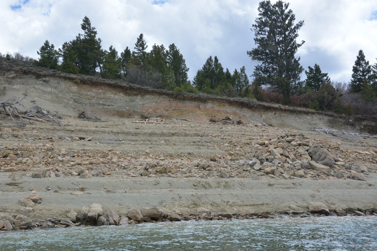
In the case of fossils, erosion can be your friend for helping to expose new specimens. Other times it can feel like your worst enemy for the damage it can do to specimens and the site in general. The tug-of-war erosional environment at these shoreline fossil sites is severe, as there are a number of destabilizing issues at play. Reservoir-controlled water levels can rise and fall around 92 feet at Blue Mesa. The sandy and muddy shoreline experiences rain, snow, high winds, and a high freeze/thaw index. During storm fronts, the lake surface experiences crashing waves around 3 feet in height. Water in the reservoir also freezes several feet thick in winter and ice sheets expand and scrape against the shoreline or pile up along beaches after high winds. Due to reservoir-induced erosion, the high-water cliffs calve off blocks of sediment, which progressively transport clay, sand, gravel, and rocks over the site and downhill into the reservoir. This all results in that, each year, a fossil on the beach could experience open air exposure, coverage by a frozen layer of ice, inundation, wave action, scraping by ice sheets, and burial by sediment.
Due to the intense erosional environment, but also the potential for important fossil discoveries, park staff wanted to take the Triceratops by the horns and get more information to successfully deal with the monitoring challenges. The fossil material can be heavy and difficult to transport. The logistics of using a rock saw at the sites are time-consuming. If a tip of a fossil fragment is barely exposed in a rock block, how long until the block erodes further to expose whether or not the fossil may be identifiable? If we don’t collect it this year, just in case the fossil turns out to be significant, will we lose it forever? There can be hundreds of fossil fragments discovered in a single site visit; how do we decide what to collect, what to leave in place, and when to check the site again?
Taking the First Step
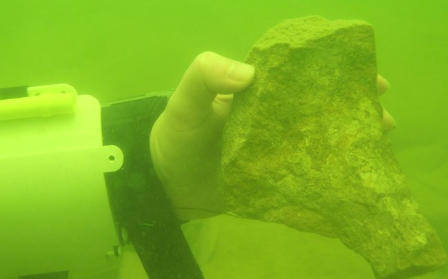
To get started answering some of these questions, we began tracking environmental data such as water levels, days the site is inundated, wind speeds, precipitation amounts, and temperature data. Scuba diving trips into the reservoir were conducted to determine the likelihood of specimen discovery underwater (spoiler alert: it’s not easy). A remote camera was also set up to take daily shoreline photographs. All of this information allowed us to get a broad understanding of the destabilization issues facing the localities.
Subsequently, we wanted to get a closer look at how quickly damage to specimens occurs and how long it takes for broken blocks of rock to move downslope and become lost under the waves of the reservoir. With the assistance of two National Park Service Divisions, Geologic Resources and Inventory & Monitoring, a pilot monitoring project was initiated in 2016.
The project focuses on two main areas. On a smaller scale, individual specimen erosion and downslope movement is tracked. Larger scale locality mass-wasting and erosional changes are detected by performing repeat digital photogrammetry.
Small Scale: Bone Recovery Investigations
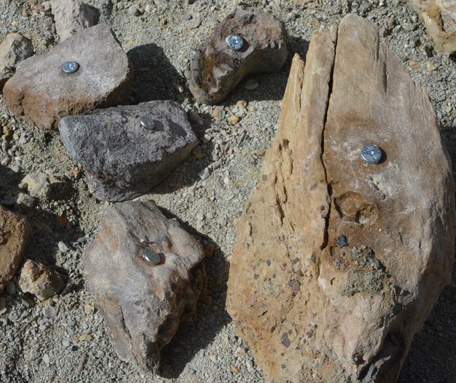
Numerous fossil specimens were marked with metal pins and placed along the slope from high water to the water’s edge. Baseline GPS locations were taken. Over several years, specimens were relocated either visually or with a metal detector and new GPS locations were recorded. A few of the marked specimens were photographed to produce digital 3D models, using a method called photogrammetry. This method uses digital photographic images, software, and computers to map the surface of an object in three dimensions and create a “virtual” replica. Repeated photography and photogrammetric modeling on those specimens left and later recovered from the shore was conducted to detect even minute loss of bone or matrix material. Attempts to relocate specimens were made annually and occasionally twice a year when the water levels are lowest (end of April and beginning of November).
Did we learn anything?
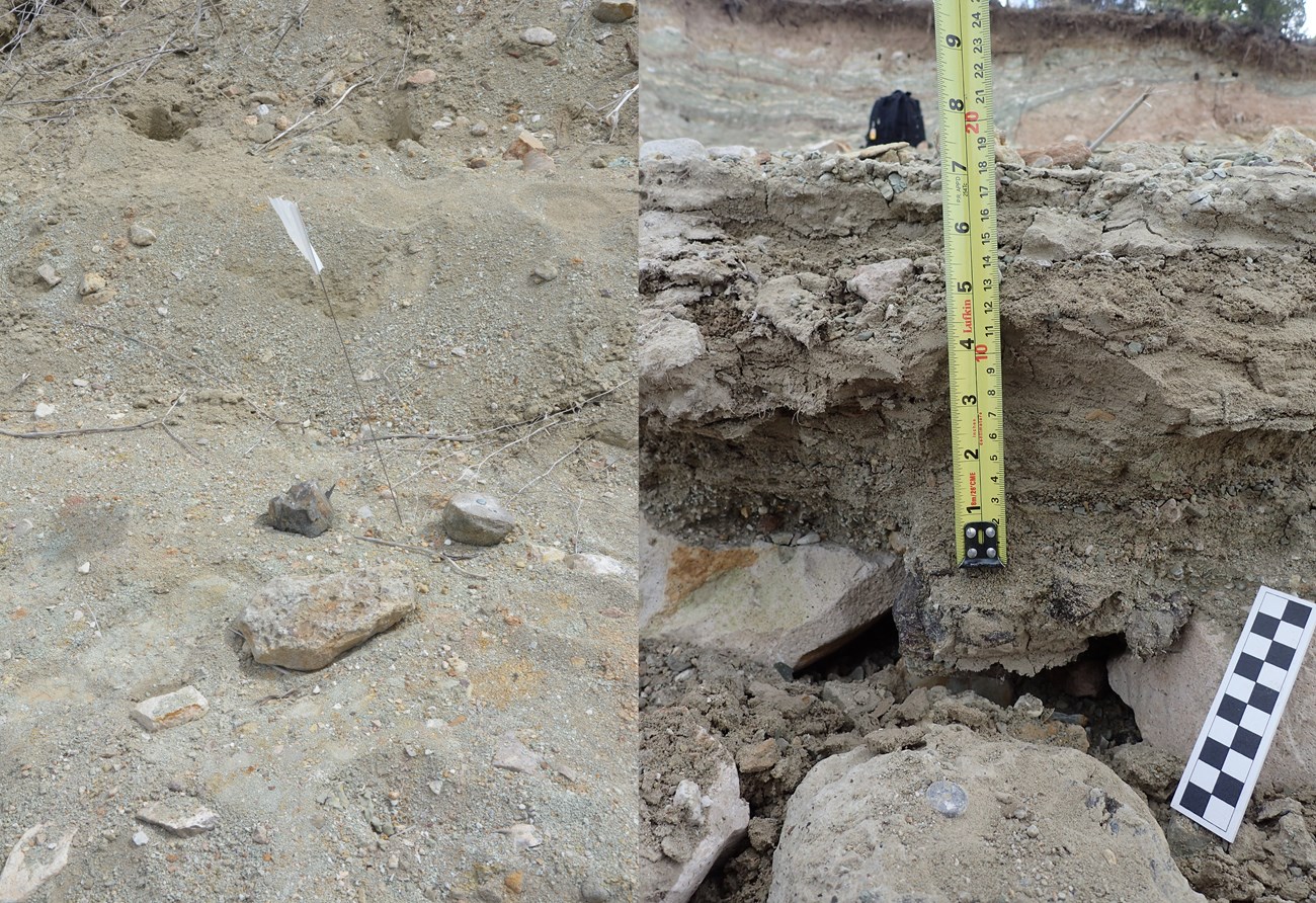
Specimens at the site are buried and some lost, even on an annual time scale. Some were below the water line during the site visit and others were deeply buried on site.
The burial that occurred was totally unexpected as we didn’t initially predict that large sediment loads would move across the site seasonally. Some specimens were recovered under several inches of overlying sediment; some were totally undetectable and unrecoverable.
Those specimens that were recovered did transport downslope annually (aka gravity works!). The distance moved could be as much as several feet downhill from spring to fall.
What could be improved in the monitoring?
We need to mark each specimen uniquely (e.g. number pins) as it can be hard to re-identify individual bone fragments with pictures and description only.
We may want to use different metal detectors or Passive Integrated Transponders (PIT tags) that work better for deeply buried objects.
Weight measurements might be more useful than the time-consuming specimen 3D photogrammetry to detect direct degradation to the specimen and/or matrix.
The dynamics at the site suggest bone recovery surveys should occur a minimum of every year as new bones are exposed and ones on site get buried or transported away from the site.
Large Scale: Site-Change Investigations
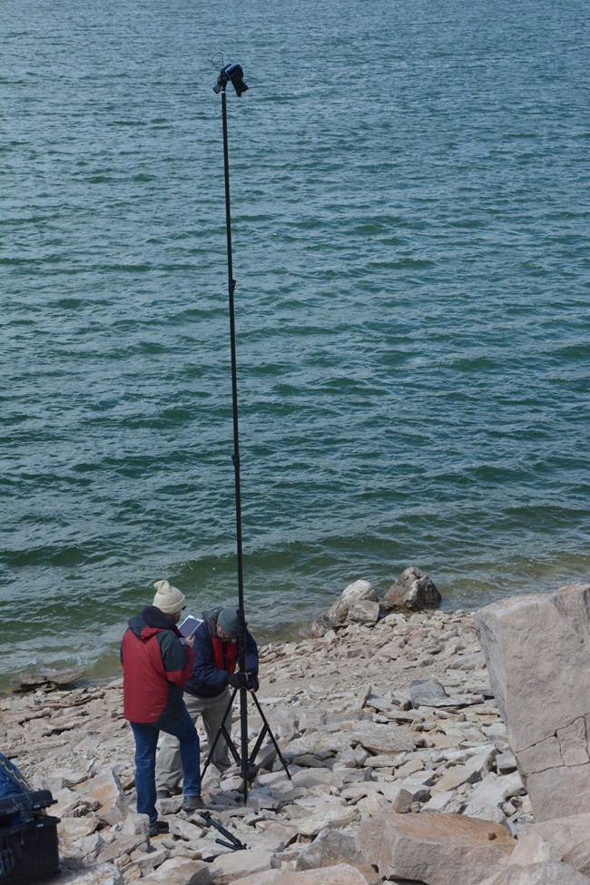
Photogrammetry of two shoreline sites was conducted in 2016 and again in 2019. The photography covered an area roughly 20 feet by 20 feet. Point clouds of the ground surfaces derived from the photogrammetry data from the different years were compared using functions within specialized software that looks for and highlights areas that have changed. The degree of change is thus colorized such that one color is no change and another color denotes significant, and those shades in between can help quantify differences in the modeled ground surface, including those cobbles and rocks with fossils in them.
Did we learn anything?
Sediment accumulation and erosion processes, both at work on the site annually, are detected to a centimeter scale using repeat photogrammetry. Block movement and widening rock cracks are also detectable.
What could be improved in the monitoring?
Requesting assistance to use trained personnel with higher quality GPS and photogrammetry tools and software works better for us than attempting to do it ourselves. A 5- to 10-year schedule is probably appropriate for monitoring change at this scale.
Consider employing terrestrial lidar for broader scale change assessments along the shoreline.

Dinosaur Lifeguards
Park staff have a clearer picture of just how tough the “after-life” of a dinosaur fossil can be at Curecanti National Recreation Area. It is clear that important specimens may become undiscoverable between April and November annually because of direct damage to specimens, burial from slope collapse, or from loss into the deep waters of the reservoir. With this increased knowledge, we’ll need to spend more time on the beach trying to locate and rescue fossils, and resuscitate the exciting life story of our dinosaurs!
Related Links
- Curecanti National Recreation Area, Colorado—[Geodiversity Atlas] [Park Home]
- NPS—Fossils Through Geologic Time
- NPS—Fossils and Paleontology
- NPS—Geology
Last updated: March 15, 2021
