Last updated: August 19, 2024
Article
Citizen Science Data Inform Park Managers of Ecological Threats
The Race to Stop Stinknet
It was a dry summer in Arizona’s Maricopa County when the Aguila Fire tore through over 800 acres of northern Phoenix. The 2020 wildfire scorched the Sonoran Desert plants in its path, including keystone species like Saguaro National Park’s namesake, the saguaro cactus (Carnegiea gigantea).
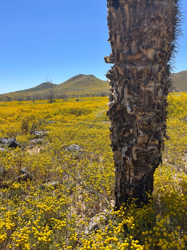
In the fire’s wake, an invasive species entered the cleared landscape. What was once a diverse community of desert plants is now dominated by stinknet (Oncosiphon pilulifer), a plant native to southern Africa that has spread rapidly across California and Arizona since it was first observed on the West Coast in 1981.
Stinknet, also known as globe chamomile, has yellow, petal-less flower heads and dark green leaves resembling carrot tops. Its name stems from the pungent, turpentine-like odor released by its foliage when crushed. Depending on local soil moisture, mature plants can range from about six inches to two feet tall.
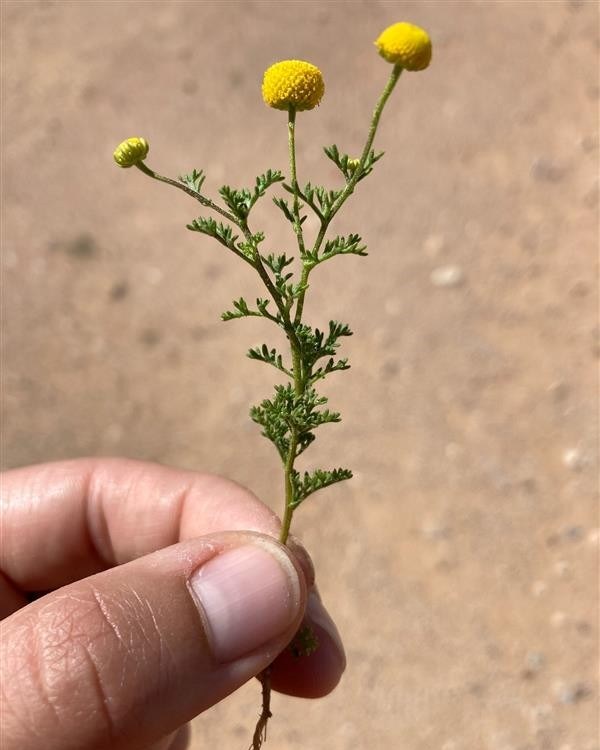
Don’t be fooled by stinknet’s whimsical appearance; the plant poses a significant threat to ecological health. A single pea-sized flower head can produce up to 100 tiny, lightweight seeds that spread easily via wind, water, vehicles, shoes, and clothing. The prolific seed producer spreads at the expense of native plants that provide food and shelter for a variety of animals, such as the Parry’s penstemon (Penstemon parryi), a bright pink wildflower favored by Arizona’s hummingbirds. Stinknet also poses human health risks, causing headaches, rashes, blisters, and severe respiratory reactions in sensitive individuals. When dense stands of stinknet dry, they become fuel for wildfires that produce caustic smoke.
In Phoenix and surrounding areas, stinknet plants have spread to such an extent that they are nearly impossible to manage. In southern Arizona, however, there may still be time to keep stinknet populations at bay. With the help of citizen scientists, also known as participatory scientists, Saguaro National Park and a coalition of Tucson organizations are working to map, monitor, and remove stinknet before it becomes unmanageable.
The first patch of stinknet in Tucson was spotted in 2015. Having witnessed stinknet’s explosive spread in California and northern Arizona, local organizations and agencies knew that they needed to monitor the situation closely and take action to prevent the species from growing out of control.
“One of the rules for invasive plants is that if you can nip these invasions in the bud when they’re just starting, you’ll have a lot more success over the long run,” explained Don Swann, Saguaro National Park biologist.
In the years that followed this initial observation, Saguaro, Tucson Audubon, and other local groups decided to combine their resources and expertise to address the rising prevalence of the invasive species. But they needed the community’s help.
“It’s too much for a small group of people to keep up with. It’s a really challenging threat, and it’s clear that we need the whole community involved to have any chance of curbing this from having negative effects on the local environment,” said Saguaro botanist Dan Beckman.
The local leaders launched stinknet.org to engage the public in stinknet management. The website encourages citizen scientists to identify and report patches of stinknet, contributing valuable information that resource managers can use to monitor the plant’s presence in the region and to coordinate treatment. The observations, which include a site location and photograph, populate an online map of stinknet’s spread. In the 2024 stinknet season alone, the website received almost 2,500 submissions.
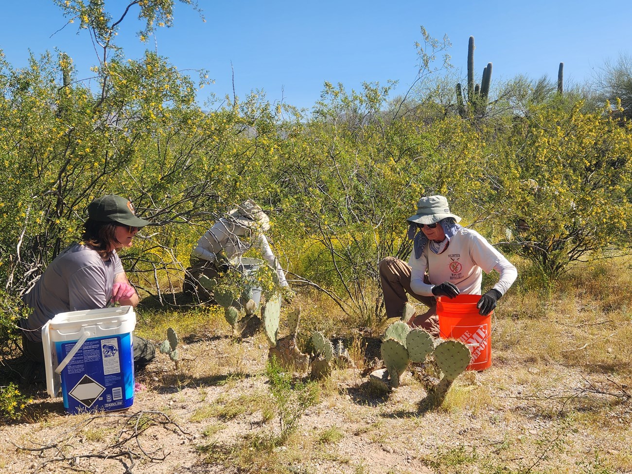
At Saguaro, vegetation management crews can remove stinknet from mapped sites and return to the locations in subsequent years to check for regrowth of the invasive species. Without observations made by visitors and local residents, managers would lack the necessary data to effectively contain growing stinknet populations on the lands under their stewardship.
Outside of the park, Tucson community members are encouraged to carefully remove stinknet in addition to reporting it. Wearing gloves and a face mask, volunteers can dig up stinknet or pluck it from the soil at its base, then discard the plant in a sealed bag.
“Eradication is not possible. But you have to celebrate every time you pull a plant out, because that’s 10,000 plants that you just eliminated from next year’s population,” said Tony Figueroa, senior manager of Tucson Audubon’s Invasive Plant Program.
Saguaro National Park biologists consider stinknet to be the most dangerous invasive plant locally since buffelgrass (Cenchrus ciliaris) was introduced in the 1930s. Collaboration between the park, local partners, and citizen scientists is essential for coordinating effective stinknet management before it’s too late. Together, they can survey stinknet populations across a greater land area and swiftly handle new outbreaks that would otherwise threaten native vegetation, wildlife, and human health.
BioBlitzes in Boston
Saguaro’s stinknet management approach asks volunteers to focus on a single species. In other cases, national parks require more comprehensive biodiversity data to monitor ecological shifts over time. Advances in mobile-friendly citizen science platforms like iNaturalist and eBird have made it easier than ever for park visitors to contribute to enormous datasets that staff and external scientists would never have the capacity to collect on their own. The NPS is also working with Wild Spotter™ to add parks to its program, which engages the public in the early detection of invasive species.
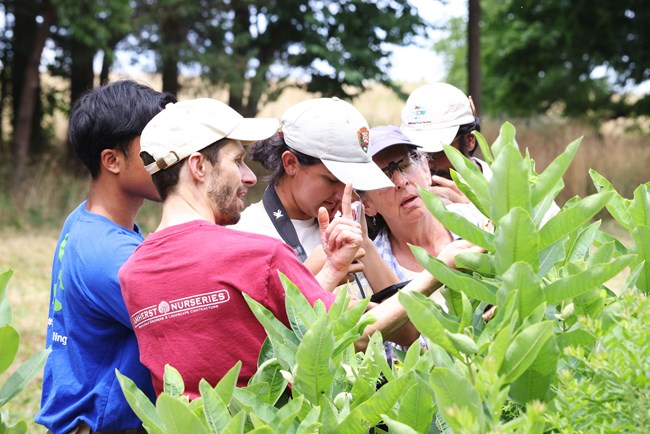
Many parks have incorporated these mobile-friendly platforms into their participatory science activities. BioBlitzes are popular offerings that challenge volunteers to document as many species as possible with iNaturalist in a specific area over a short period of time. At the National Parks of Boston, self-guided and park-facilitated BioBlitzes support an ongoing biodiversity survey of Boston Harbor Islands National and State Park.
University of Massachusetts Boston’s Honors College has collaborated with the park since 2017 to incorporate a BioBlitz into their autumn orientation program for first-year students. Before the fall semester starts, groups of about 100 rising first-year students travel to Cathleen Stone/Thompson Island in Boston Harbor for a two-day retreat. With the guidance of park rangers and using iNaturalist, they spend three hours surveying species across the island’s diverse habitats including open meadows, forests, salt marshes, and beaches. The trip is an opportunity to meet other incoming students while connecting with nature near their campus and collecting useful scientific data.
“We’ve taken students who had no idea what citizen science was and given them hands-on, real-life exposure to it,” said Megan Rokop, associate dean of the Honors College. “It helps them see their city in a way they haven’t before.”
Most students from the Honors College are first-time iNaturalist users, which may raise concerns about the validity of the data they collect. Researchers at UMass Boston and Suffolk University answered these questions of data quality by reviewing observations from three years of Cathleen Stone/Thompson Island BioBlitzes. They evaluated more than 2,000 observations and over 5,700 photographs using criteria such as photo quality and the likelihood that an expert in a specific taxonomic group could identify the species using the images taken. Their 2021 paper concluded that students using iNaturalist, even first-time users, produce reliable and applicable data for biodiversity research.
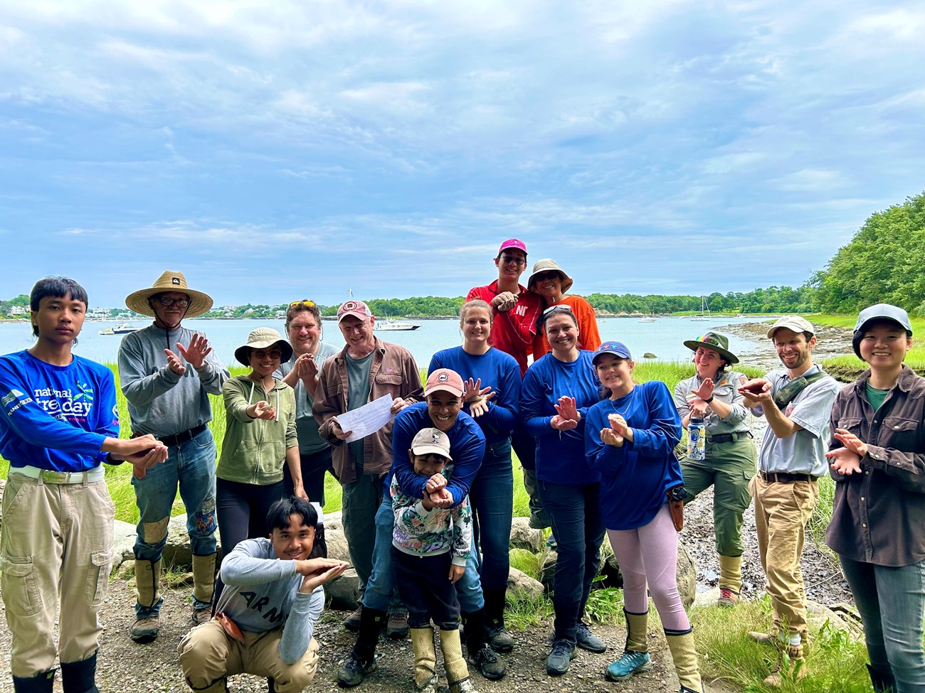
Students have observed hundreds of species on the island. Some of their most common sightings represent growing threats to New England coastal ecosystems, such as the invasive European green crab (Carcinus maenas) and Asian shore crab (Hemigrapsus sanguineus). Others are noteworthy for their novelty; in 2019, a student made the first and only observation of DeKay's brownsnake (Storeria dekay) on the island.
Participatory science is not always the most effective tool for addressing a park’s most pressing environmental concerns. In Boston, for instance, park managers use remote sensing to record the loss of parkland to erosion and sea level rise. But when it comes to biodiversity monitoring, the public can provide crucial scientific information about the presence of species in national park ecosystems.
“Knowing where organisms live helps parks assess the impacts of potential management actions in those locations,” said Marc Albert, program director of science and stewardship partnerships at the National Parks of Boston. “If a project is proposed, we can draw a map around the area on iNaturalist and see what observations were there.” For example, park managers can utilize iNaturalist data to prioritize habitats with more native biodiversity among areas planned for invasive plant treatment.
Crowdsourced biodiversity data allow parks to understand how different species interact over time and space. As time goes by, parks will be able to track the impacts of climate change on biodiversity and can adjust management and restoration efforts to safeguard native species, curb the risk of invasive species, and respond to other ecological threats.
Translating Data for Park Managers
Schoodic Institute, a partner of Acadia National Park, is making it even easier for participatory science data to reach park managers. Since 2003, members of the public have made more than half a million observations of plants, animals, and fungi in Acadia National Park and roughly 16,000 observations at Katahdin Woods and Waters National Monument. With funding from the National Park Foundation, Schoodic Institute data analyst Kyle Lima and his colleagues have spent the past two years designing automated systems that analyze and communicate the latest citizen science findings from these NPS sites to key audiences including natural resource managers.Lima created a program that delivers a summary of iNaturalist and eBird observations from the past week to park managers and science staff every Monday. The digest, which focuses on 180 species of management concern, is broken down into four sections: pest and invasive species, threatened and endangered species, rare species, and species new to the park. The report serves as an early detection tool, notifying recipients of interesting observations and potential threats to the ecosystem soon after they are documented.
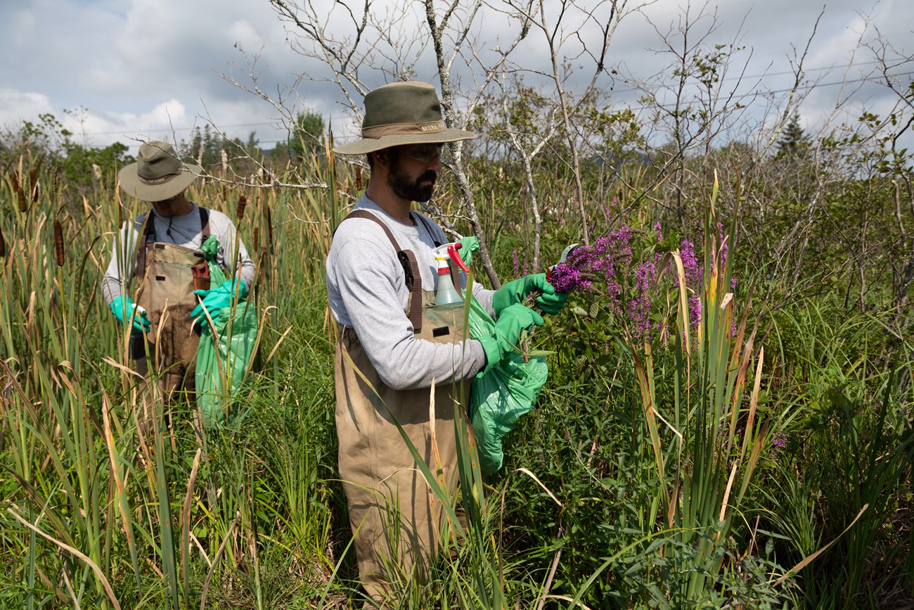
As with stinknet, park managers are more likely to succeed in mitigating the impacts of pests, diseases, and invasive species if they catch the problems early. But with nearly 50,000 acres of parkland to supervise, Acadia’s vegetation management team could miss the signs of a budding infestation. That’s where citizen scientists come in.
“Getting more eyes and ears out there helps us,” explained Jesse Wheeler, Acadia’s vegetation program manager. “Many of our forest pest observations in new areas have come from residents of the community.”
The vegetation management team responds swiftly and strategically to invasive species observations in Acadia, especially if it’s a species of high concern or in a new location. Within days of the report, they visit the site to determine the severity of the situation. Sometimes, the solution is simple; a small, isolated Japanese barberry shrub, for instance, requires little time or resources for removal. In other cases, management becomes more complex. When forest pests or pathogens overtake an entire stand of trees, there’s little to do beyond monitoring and slowing the spread.
One emerging threat to Acadia’s forests is the hemlock woolly adelgid (Adelges tsugae): a non-native, invasive, aphid-like insect that has devastated eastern hemlock (Tsuga canadensis) populations in the eastern United States and Canada. The insects themselves are hardly visible to the naked eye, but their overwhelmingly large populations have the power to kill towering hemlock trees in as little as four years. The adelgid has already pervaded hemlock forests in other national parks, including Great Smoky Mountains and Shenandoah.
In 2022, NPS confirmed the arrival of the hemlock woolly adelgid in Acadia. Its presence can be identified by the small, white, cottony masses that it produces on the underside of hemlock branches. The pest has yet to decimate Acadia’s hemlock populations, and resource managers are working to keep it that way. Participatory scientists can help the park monitor the extent of the problem by identifying and reporting the hemlock woolly adelgid in iNaturalist. These data inform Acadia’s management responses, such as cutting back hemlock branches that may contact people, pets, and vehicles to minimize the spread of the invasive species.
Schoodic Institute’s automated managers’ report is designed to be transferable across the NPS. Eventually, other national parks and partner organizations will be able to use the tool to better communicate citizen science data to those making park management decisions.
Next time you go outside, consider identifying the species you encounter in iNaturalist or eBird. A pretty flower may turn out to be an invasive species. A beautiful hemlock could be showing early signs of a woolly adelgid infestation. An interesting insect could be the first of its kind to arrive in your area or could represent a population that deserves special protections. Regardless of the species, your observations can support biodiversity research and natural resource management efforts for years to come.
Written by Nina Foster, a 2024 Scientists in Parks intern at Acadia National Park. Nina is exploring her professional interests in writing about people, places, science, and history.