Last updated: January 21, 2026
Article
Boxley Valley Cultural Landscape

NPS
Introduction
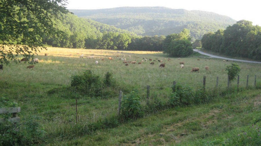
Boxley Valley cultural landscape contains structures and other features associated with an enduring agrarian community in Buffalo National River, Arkansas. Historically, the community economy relied on livestock and the most prevalent land use was agricultural. The landscape contains rolling farm fields, steep forested slopes, single family dwellings, barns, a school, and community buildings.
NPS
The period of significance is from 1840 to 1972 beginning with the settlement by Euro-American in the area and ends with the establishment of the Buffalo National River. The original intent of the National Park Service acquisition was to help retain the Boxley Valley as living community. Some small family farms continue to operate today. They maintain some of the traditions that give the valley character, such as maintaining extensive garden plots near their farmhouses.
Landscape Description
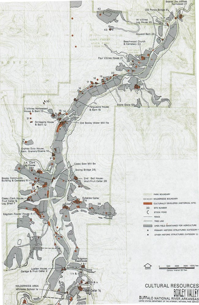
Boxley Valley cultural landscape is located along the upper Buffalo River and Highway 43. The Valley is approximately 8,000 acres over 7 miles. The cultural landscape aligns with the topography of the Valley floor and, on average, it is 1,500 feet across. Agricultural lands and most development are situated between the river and bordering steep slopes of the mountain sides. Oak-hickory forest occupy the mountain bluffs.
The cultural landscape includes around 170 historic structures. Many of these structures exemplify vernacular type architecture related to various period of Ozarks culture. Traditionally, the one-room log house was a typical form. Beginning in the 1870s, with increased prosperity, houses became more complex and structures diversified to support the developing community. Small scale features primarily relate to a functional need, such as fence lines, stone walls, fence posts, wells, cisterns, and cemeteries.
Historic Use
The Osage Tribe used the area around the Buffalo River as a hunting ground from the protohistoric to historic period (estimated 1650 – 1940 AD). Later, the Cherokee likely occupied the area starting in the late 1700s. The Buffalo River area was also included as part of the Cherokee treaty lands from 1817 to 1828 and some Boxley residents trace their ancestry back to this tribe. An influx of Euro-American settlement occurred around 1830.

NPS
Three distinct period of development occurred from this time up to present day. The “Old Ozarks Frontier” period constituted the first period and includes the Beaver Jim Villines farmstead log house, the earliest log portions of the Casey-Clark, Orphea Duty and Clyde Villines homestead houses. During the period from 1870 to 1930, deemed the “New South Ozarks” phase, economic prosperity supported more community institutions and a number of new structures were added. These included the old Boxley Watermill, the Boxley Community Building, and Casey Sawmill. The “Cosmopolitan Ozarks” period began around the 20th century, defined by federal and state public improvements.

NPS

NPS
Today, visitors to Boxley Valley can experience a cultural landscape that retains a high degree of integrity, or similarity to its historical identity as a small-scale farming community. Many extant structures exemplify traditional building methods and are situated in their original locations. Some farms are operated by descendants of the original settlers. These residents and later arrivals to the valley graze cows and sheep and grow commercial crops, cotinuing the historic land use and helping to maintain the area's pastoral character.

NPS
Quick Facts
- Cultural Landscape Type: Historic Vernacular Landscape
- National Register Significance Level: State
- National Register Significance Criteria: A, C, D
- Periods of Significance
- 7000 BCE - 3000 BCE: Archeology, Middle Archaic
- 3000 BCE - 1800 BCE: Archeology, Late Archaic/Early Woodland
- 1000 BCE - 300 BCE: Archeology, Mississippian
- 1840 CE - 1972 CE: Agriculture, Architecture
