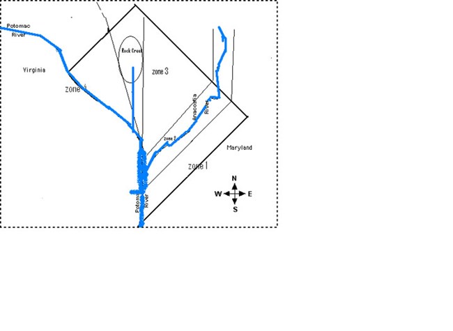
park image There are two ways to participate in the study. The easiest is to look at the zones in the map on this page and the description of each zone below. Identify which zone you are in. Track weather data once a week and keep a record of it for a year. Zone 1 East of South Capital Street and the Anacostia Freeway. East of Minnesota Avenue and Kenilworth Avenue in Northeast Washington. Zone 2 Includes places near Anacostia Park, west of Kenilworth Avenue and Minnesota Avenue, west of South Capital Street, places east of Bladensburg Road and Potomac Avenue. Zone 3 is between Rock Creek Park and Anacostia Park. It includes places west of Bladensburg Road and Potomac Avenue, and east of Georgia Avenue. Zone 4 is west of Rock Creek Park and includes Tenleytown, Chevy Chase Village, and places west of Connecticut Avenue. Data collected at the park on weather will be posted on this page as a link to a PDF for the years of the study. You can compare your data to that of the park to see if Anacostia Park is a microclimate keeping Zone 2 cooler in summer, or warmer in winter, and see if it affects rain fall and other weather factors. The study will end in 2016. To provide data for park managers to use in their decision making, collect data for a year and call the park at (202) 426-6905 for an email address to send data to. This data will be tracked at the park on a grid to make a determination of the park's role in climate change. |
Last updated: April 30, 2022
