
NPS/Jay Elhard Watch Fish from Fishing BridgeThe original bridge was built in 1902. It was a rough-hewn corduroy log bridge with a slightly different alignment than the current bridge. The existing bridge was built in 1937. Fishing Bridge was historically a tremendously popular place to fish. Angling from the bridge was quite good, due to the fact that it was a major spawning area for cutthroat trout. However, because of the decline of the cutthroat population (in part, a result of this practice), the bridge was closed to fishing in 1973. 
NPS/Jim Peaco Visit Yellowstone LakeLarge volcanic eruptions have occurred in Yellowstone approximately every 600,000 years. The most recent of these erupted from two large vents, one near Old Faithful and one just north of Fishing Bridge. Ash from this huge explosion—1,000 times the size of Mount St. Helens—has been found all across the continent. The magma chamber then collapsed, forming a large caldera filled partially by subsequent lava flows. Part of this caldera is the 136-square mile (352.2-square km) basin of Yellowstone Lake. The original lake was 200 feet (61 m). higher than the present-day lake, extending northward across Hayden Valley to the base of Mt. Washburn. 
NPS Listen to Mud Gurgle at Mud VolcanoThe hydrothermal features at Mud Volcano are primarily mudpots and fumaroles because the area is situated on a perched water system with little water available. Thanks to thermophiles, the vapors are rich in sulfuric acid that breaks the surrounding rock down into clay. Hydrogen sulfide gas is present deep in the earth at Mud Volcano. As this gas combines with water and the sulfur is metabolized by cyanobacteria, a solution of sulfuric acid is formed that dissolves the surface soils to create pools and cones of clay and mud. Along with hydrogen sulfide, steam, carbon dioxide, and other gases explode through the layers of mud. A series of shallow earthquakes associated with the volcanic activity in Yellowstone struck this area in 1978. Soil temperatures increased to nearly 200°F (93°C). 
NPS/Jim Peaco View Wildlife in Hayden and Pelican ValleysHayden Valley is located six miles north of Fishing Bridge Junction and Pelican Valley is situated three miles to the east of the junction. These two vast valleys comprise some of the best habitat in the lower 48 states for viewing wildlife like grizzly bears, bison, and elk. Hayden Valley was once filled by an arm of Yellowstone Lake. Therefore, it contains fine-grained lake sediments that are now covered with glacial till left from the most recent glacial retreat 13,000 years ago. Because the glacial till contains many different grain sizes, including clay and a thin layer of lake sediments, water cannot percolate readily into the ground. This is why Hayden Valley is marshy and has little encroachment of trees. Remember: Do not approach or encircle bears or wolves on foot within 100 yards (91 m) or other wildlife within 25 yards (23 m). Always maintain a safe distance. Each year, park visitors are injured by wildlife when approaching too closely. 
NPS/Diane Renkin Walk to Natural BridgeLocated just south of Bridge Bay Campground, it is an easy one-mile walk to the Natural Bridge. There is also a bicycle trail leading to the bridge. The Natural Bridge was formed by erosion of the rhyolite outcrop by Bridge Creek. The top of the bridge is approximately 51 feet (16 m) above the creek. A short switchback trail leads to the top, though travel across the bridge is prohibited to protect this feature. Stay HereThis region has four options for staying overnight in Yellowstone: Lake Hotel and Cabins, Lake Lodge Cabins, Bridge Bay Campground, and Fishing Bridge RV Park. 
Camp in a Campground
Plan a night in one of twelve park campgrounds. 
Stay in a Lodge
Pick a lodge that's right for you and make a reservation early! Lake Area Frequently Asked QuestionsIt begins on the slopes of Younts Peak in the Absaroka Mountains southeast of the park and completes its 671-mile (1080-km) run by joining the Missouri River near the Montana–North Dakota border. Its waters then travel to the Mississippi River and into the Atlantic Ocean at the Gulf of America. It is the longest undammed river in the contiguous United States.
The lake is natural and has 131.7 square miles (341.1 square km) of surface area and 141 miles (227 km) of shoreline. Yellowstone Lake is 20 miles (32.2 km) long by 14 miles (22.5 km) wide. Its deepest spot is about 410 feet (125 m) and its average depth is 140 feet (42.7 m). The lake's basin has an estimated capacity of 12,095,264 acre-feet (14.9 cubic km) of water. Because its annual outflow is about 1,100,000 acre-feet (1.4 cubic km), the lake's water is completely replaced only about every eight to ten years. Since 1952, the annual water level fluctuation has been less than six feet.
The lake's main basin is part of the Yellowstone Caldera, which was formed 640,000 years ago. West Thumb was formed by a later, smaller eruption. The arms of the lake were formed by uplift along fault lines and sculpting by glaciers. The lake drains north at Fishing Bridge. Some scientists consider LeHardy's Rapids to be the geologic northern boundary of the lake because the periodic rise and fall of that site appears to control lake outflow.
No, but it is the largest lake at high elevation (above 7,000 feet) in North America.
Overfishing for cutthroat trout here contributed to their decline in the lake. The trout also spawn here. For these reasons, fishing is prohibited from the bridge. It's still a good place to watch trout.
During late summer, Yellowstone Lake becomes thermally stratified with several water layers having different temperatures. The topmost layer rarely exceeds 66°F (18.9°C), and the lower layers are much colder. Because of the extremely cold water, survival time for anyone in the lake is estimated to be only 20 to 30 minutes. In winter, ice thickness on Yellowstone Lake varies from a few inches to more than two feet with many feet of snow on top of the ice.
The National Park Service campground was located where bears came to fish, and many bear conflicts occurred. It was closed in 1989. A recreational vehicle park, operated by a concessioner, still exists in the area. Only hard-sided camping units or RVs are allowed at this campground.
The lake is home to the largest population of Yellowstone cutthroat trout in North America. You can see these trout and longnose suckers from Fishing Bridge. In spring, you might be able to see trout leaping upstream at LeHardy's Rapids, three miles north of Fishing Bridge. Also look for white pelicans, bald eagles, osprey, and a variety of ducks and other water birds. The Fishing Bridge area, including Pelican Valley to the north and east, is especially significant to bears and other wildlife because lake, river, and terrestrial ecosystems merge here to create a diverse natural complex. Bears visit numerous streams in the spring and early summer to eat spawning trout. A bison herd winters in Pelican Valley, and individuals can be seen throughout the area. Moose used to be seen in the Yellowstone Lake area much more than they are today; look along water edges and in marshes. At Bridge Bay Marina, look for river otters. That "rotten egg" smell comes from hydrogen sulfide gas. Sulfur, in the form of iron sulfide, gives the features their many shades of gray.
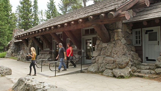
Fishing Bridge Visitor Center
Discover the opportunities available in the Lake area by stopping by this historic visitor center. 
Fishing
If you're planning on casting a rod here, help us protect our native species by following all park fishing regulations. 
Fishing Bridge & Lake Hikes
Hikes in this area provide views of Yellowstone Lake and the surrounding mountains. 
Accessibility
Discover Yellowstone's accessibility resources like the NPS Mobile App, Access Pass, and assistive services. 
Boating
Take in the view from the water. 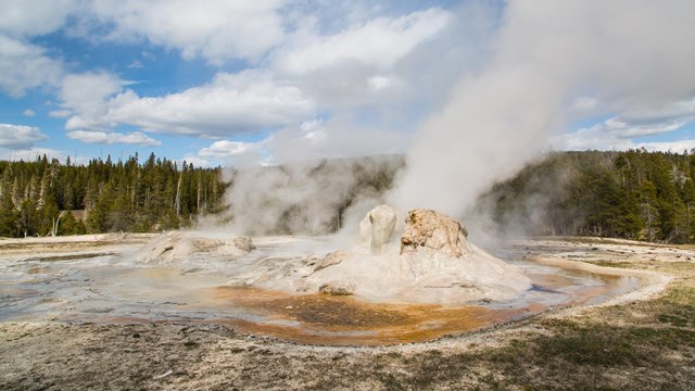
Places To Go
Discover the highlights of Yellowstone's vast 2.2 million acres, ten visitor centers, and eight developed areas. 
Plan Your Visit
Yellowstone changes with the seasons—make the most of your visit! Plan ahead to keep your trip safe, fun, and unforgettable. |
Last updated: June 2, 2025