
NPS / Diane Renkin Most of Earth’s history (from the formation of the earth 4.6 billion years ago to approximately 541 million years ago) is known as the Precambrian time. Rocks of this age are found in northern Yellowstone and in the hearts of the nearby Teton, Beartooth, Wind River, and Gros Ventre mountain ranges. During the Precambrian and the subsequent Paleozoic and Mesozoic eras (541 to 66 million years ago), the western United States was covered at times by oceans, sand dunes, tidal flats, and vast plains. From the end of the Mesozoic through the early Cenozoic, mountain-building processes formed the Rocky Mountains. During the Cenozoic era (approximately the last 66 million years of Earth’s history), widespread mountain-building, volcanism, faulting, and glaciation sculpted the Yellowstone area. The Absaroka Range along the park’s north and east sides was formed by numerous volcanic eruptions about 50 million years ago. This period of volcanism is not related to the present Yellowstone volcano. Approximately 30 million years ago, vast expanses of today’s West began stretching apart along an east–west axis. This ongoing stretching process increased about 17 million years ago and created the modern basin and range topography (north–south mountain ranges with long north–south valleys) which characterizes much of the West, including the Yellowstone area. About 16.5 million years ago, an intense period of volcanism initiated near the borders of present-day Nevada, Oregon, and Idaho. Subsequent volcanic eruptions can be traced across southern Idaho towards Yellowstone. This 500-mile trail of more than 100 calderas was created as the North American plate moved in a southwestern direction over a shallow body of magma. About 2.1 million years ago, the movement of the North American plate brought the Yellowstone area closer to the shallow magma body. This volcanism remains a driving force in Yellowstone today. 
Adapted with permission from Windows into the Earth by Robert Smith and Lee J. Siegel, 2000 Magma, Hot Spots, and the Yellowstone SupervolcanoMagma (molten rock from below the earth’s crust) is close to the surface in the greater Yellowstone area. This shallow body of magma is caused by heat convection in the mantle. Plumes of magma rise through the mantle, melting rocks in the crust, and creating magma reservoirs of partially molten, partially solid rock. Mantle plumes transport heat from deep in the mantle to the crust and create what we call “hot spot” volcanism. Hot spots leave a trail of volcanic activity as tectonic plates drift over them. As the North American Plate drifted westward over the last 16.5 million years, the hot spot that now resides under the greater Yellowstone area left a swath of volcanic deposits across Idaho’s Snake River Plain. Heat from the mantle plume has melted rocks in the crust, and created two magma chambers of partially molten, partially solid rock near Yellowstone’s surface. Heat from the shallowest magma chamber caused an area of the crust above it to expand and rise. Stress on the overlying crust resulted in increased earthquake activity along newly formed faults. Eventually, these faults reached the magma chamber and magma oozed through the cracks. Escaping magma released pressure within the chamber, which also allowed volcanic gasses to escape and expand explosively in a massive volcanic eruption. The eruption spewed copious volcanic ash and gas into the atmosphere and produced fast, super-hot debris flows (pyroclastic flows) over the existing landscape. As the underground magma chamber emptied, the ground above it collapsed and created the first of Yellowstone’s three calderas. This eruption 2.1 million years ago—among the largest volcanic eruptions known to man—coated 5,790 square miles with ash, as far away as Missouri. The total volcanic material ejected is estimated to have been 6,000 times the volume of material ejected during the 1980 eruption of Mt. St. Helens, in Washington. A second significant, though smaller, volcanic eruption occurred within the western edge of the first caldera approximately 1.3 million years ago. The third and most recent massive volcanic eruption 631,000 years ago created the present 30- by 45-mile-wide Yellowstone Caldera. Since then, 80 smaller eruptions have occurred. Approximately 174,000 years ago, one of these created what is now the West Thumb of Yellowstone Lake. During and after these explosive eruptions huge lava flows of viscous rhyolitic lava and less voluminous basalt lava flows partially filled the caldera floor and surrounding terrain. The youngest of these lava flows is the 70,000 year old Pitchstone rhyolite flow in the southwest corner of Yellowstone National Park. Since the last of three caldera-forming eruptions, pressure from the shallow magma body has formed two resurgent domes inside the Yellowstone Caldera. Magma may be as little as 3–8 miles beneath Sour Creek Dome and 8–12 miles beneath Mallard Lake Dome, and both domes inflate and subside as the volume of magma or hydrothermal fluids changes beneath them. The entire caldera floor lifts up or subsides, too, but not as much as the two domes. In the past century, the net inflation has tilted the caldera floor toward the south. As a result, Yellowstone Lake’s southern shores have subsided and trees now stand in water, and the north end of the lake has risen into a sandy beach at Fishing Bridge. 
Adapted with permission from Windows into the Earth by Robert Smith and Lee J. Siegel, 2000 Recent ActivityRemarkable ground deformation has been documented along the central axis of the caldera between Old Faithful and White Lake in Pelican Valley in historic time. Surveys of suspected ground deformation began in 1975 using vertical-motion surveys of benchmarks in the ground. By 1985 the surveys documented unprecedented uplift of the entire caldera in excess of a meter (3 ft). Later GPS measurements revealed that the caldera went into an episode of subsidence (sinking) until 2005 when the caldera returned to an episode of extreme uplift. The largest vertical movement was recorded at the White Lake GPS station, inside the caldera’s eastern rim, where the total uplift from 2004 to 2010 was about 27 centimeters (10.6 in). The rate of rise slowed in 2008 and the caldera began to subside again during the first half of 2010. The uplift is believed to be caused by the movement of deep hydrothermal fluids or molten rock into the shallow crustal magma system at a depth of about 10 km beneath the surface. A caldera may undergo episodes of uplift and subsidence for thousands of years without erupting. Notably, changes in uplift and subsidence have been correlated with increases of earthquake activity. Lateral discharge of these fluids away from the caldera, and the accompanying earthquakes, subsidence, and uplift relieves pressure and could act as a natural pressure release valve balancing magma recharge and keeping Yellowstone safe from volcanic eruptions. Future Volcanic ActivityWill Yellowstone’s volcano erupt again? Over the next thousands to millions of years? Probably. In the next few hundred years? Not likely. The most likely activity would be lava flows, such as those that occurred after the last major eruption. A lava flow would ooze slowly over months and years, allowing plenty of time for park managers to evaluate the situation and protect people. No scientific evidence indicates such a lava flow will occur soon. To monitor volcanic and seismic activity in the Yellowstone area the Yellowstone Volcano Observatory (YVO) was established in 2001. YVO is partnership of scientists from the US Geological Survey, National Park Service, University of Utah, University of Wyoming, University NAVSTAR Consortium (UNAVCO) and the state Geological Surveys of Wyoming, Montana and Idaho. YVO scientists monitor Yellowstone volcano with a real time and near real-time monitoring network of 26 seismic stations, 16 GPS receivers, and 11 stream gauging stations. Scientists also collect information is on temperature, chemistry, and gas concentrations at selected hydrothermal features and chloride concentrations in major rivers. A monthly activity summary, real-time monitoring of seismicity and water flow, and near real-time monitoring of ground deformation, can be found at the Yellowstone Volcanic Observatory website. 
Adapted with permission from Windows into the Earth by Robert Smith and Lee J. Siegel, 2000 Frequently Asked QuestionsYes. Within the past two million years, some volcanic eruptions have occurred in the Yellowstone area—three of them super eruptions.
The Yellowstone caldera was created by a massive volcanic eruption approximately 631,000 years ago. Later lava flows filled in much of the caldera, now it is 30 x 45 miles. Its rim can best be seen from the Washburn Hot Springs overlook, south of Dunraven Pass. Gibbon Falls, Lewis Falls, Lake Butte, and Flat Mountain Arm of Yellowstone Lake are part of the rim.
Approximately 174,000 years ago, creating what is now the West Thumb of Yellowstone Lake. There have been more than 60 smaller eruptions since then and the last of the 60–80 post-caldera lava flows was about 70,000 years ago.
Yes. The park’s many hydrothermal features attest to the heat still beneath this area. Earthquakes—700 to 3,000 per year— also reveal activity below ground. The University of Utah Seismograph Station tracks this activity closely.
Nothing can be done to prevent an eruption. The temperatures, pressures, physical characteristics of partially molten rock, and immensity of the magma chamber are beyond human ability to impact—much less control.
A “supervolcano” refers to volcano capable of an eruption more than 240 cubic miles of magma. Two of Yellowstone’s three major eruptions met the criteria.
Another caldera-forming eruption is theoretically possible, but it is very unlikely in the next thousand or even 10,000 years. Scientists have also found no indication of an imminent smaller eruption of lava in more than 30 years of monitoring.
Scientists from the Yellowstone Volcano Observatory watch an array of monitors in place throughout the region. These monitors would detect sudden or strong earthquake activity, ground shifts, and volcanic gasses that would indicate increasing activity. No such evidence exists at this time. In addition, Yellowstone Volcano Observatory scientists collaborate with scientists from all over the world to study the hazards of the Yellowstone volcano. View current data about earthquakes, ground movement, and stream flow. All geysers are highly dynamic, including Old Faithful. We expect Old Faithful to change in response to the ongoing geologic processes associated with mineral deposition and earthquakes. Thus, a change in Old Faithful Geyser will not necessarily indicate a change in volcanic activity.
Source: NPS DataStore Collection 7682. To search for additional information, visit the NPS DataStore. 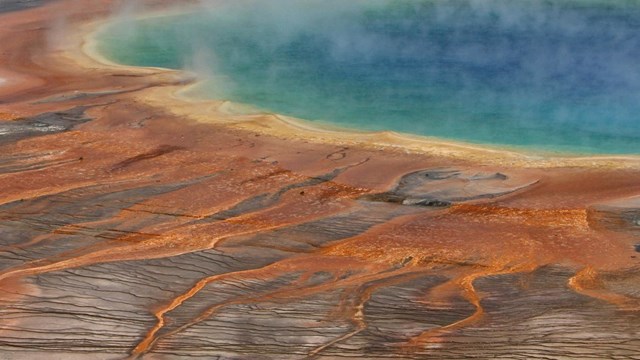
Hydrothermal Systems
Yellowstone's hydrothermal systems are the visible expression of the immense Yellowstone volcano. 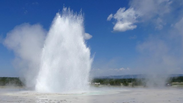
Hydrothermal Features
Yellowstone preserves earth's most extraordinary collection of hot springs, geysers, mudpots, fumaroles, and travertine terraces. 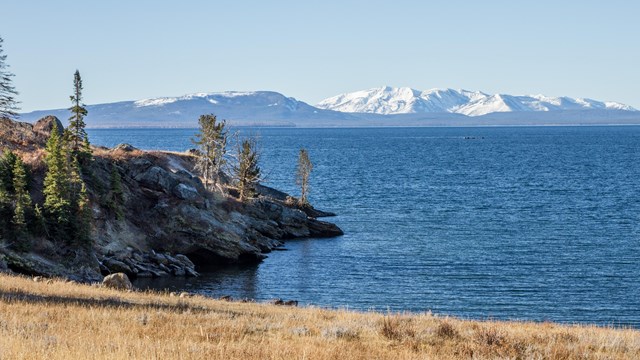
Hydrothermal Dynamics of Lake Project
Explore how the Hydrothermal Dynamics of Lake (HD-YLake) Project studies the hydrothermal system located beneath Yellowstone Lake. 
Red Mountains
A mountain range near Heart Lake located entirely within Yellowstone and named for their red volcanic rock. 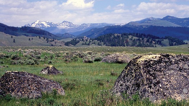
Geology
A volcano, geysers and other thermal features, earthquakes, and glaciers shape Yellowstone's landscape. |
Last updated: April 18, 2025