
NPS photo.
Introduction
Where tectonic plates converge, a plate capped by thin oceanic crust descends (subducts) beneath a plate with much thicker continental crust. The landscapes of many National Park Service sites show convergent plate boundary processes that result in a variety of mountain ranges and complex geological structures characteristic of subduction zones, accreted terranes and collisional mountain ranges.

Modified from “Parks and Plates: The Geology of our National Parks, Monuments and Seashores,” by Robert J. Lillie, New York, W. W. Norton and Company, 298 pp., 2005, www.amazon.com/dp/0134905172.
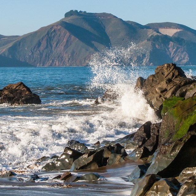
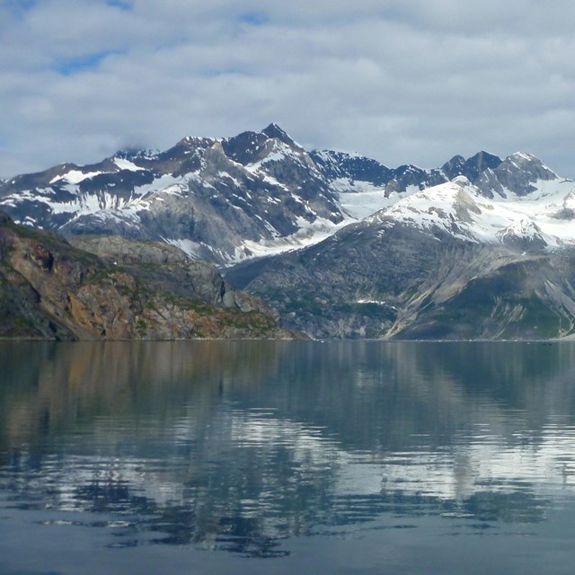
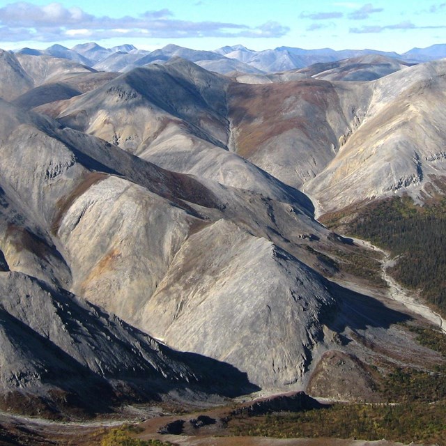
The Cascadia Subduction Zone and Southern Alaska Subduction Zone reveal two mountain ranges formed during plate convergence: an accretionary wedge near the coast and a volcanic arc farther inland. Rocks in California’s Sierra Nevada are cooled magma chambers that fed volcanoes of an ancient subduction zone. Examples of accreted terranes are found in southeast Alaska and northern Washington state. The Appalachian, Ouachita, and Marathon mountains comprise a collisional mountain range formed 500 to 300 million years ago, whereas the Brooks Range is the result of a more recent continental collision.
Convergent Plate Boundary Development

Subduction
Where tectonic plates converge, the one with thin oceanic crust subducts beneath the one capped by thick continental crust. A subduction zone consists of material scraped off the ocean floor near the coast (accretionary wedge) and a chain of volcanoes farther inland (volcanic arc).

Terrane Accretion
Oceanic islands and continental fragments approaching the subduction zone are too thick and buoyant to subduct. Instead, they attach to the edge of the continent as accreted terranes.

Continental Collision
Continents collide where subduction completely closes an ocean. The buoyant continental crust lifts up a broad region known as a collisional mountain range.
Images above modified from “Parks and Plates: The Geology of our National Parks, Monuments and Seashores,” by Robert J. Lillie, New York, W. W. Norton and Company, 298 pp., 2005, www.amazon.com/dp/0134905172
Continents grow outward as volcanic islands and continental fragments enter a subduction zone and attach to the edge of the continent. Examples of such accreted terranes are found in NPS sites in southern Alaska and northern Washington State. Sometimes plate convergence closes an entire ocean. The crusts of the continents are too thick and buoyant to subduct, forming a collisional mountain range, such as the Appalachian/Ouachita/Marathon chain in the eastern United States and the Brooks Range in northern Alaska.
Tectonic Settings—Convergent Boundaries
Figures Used
Site Index & Credits
Plate Tectonics and Our National Parks
- Plate Tectonics—The Unifying Theory of Geology
- Inner Earth Model
- Evidence of Plate Motions
- Types of Plate Boundaries
- Tectonic Settings of NPS Sites—Master List
Teaching Resources—Plate Tectonics
Photos and Multimedia—Plate Tectonics
Geological Monitoring—Plate Tectonics
Plate Tectonics and Our National Parks (2020)
-
Text and Illustrations by Robert J. Lillie, Emeritus Professor of Geosciences, Oregon State University [E-mail]
-
Produced under a Cooperative Agreement for earth science education between the National Park Service's Geologic Resources Division and the American Geosciences Institute.
Last updated: February 11, 2020