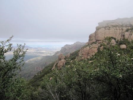
On Saturday, we traversed 8.1 miles through rugged terrain, foggy mountain tops, breezy saddles, and hiked to the highest point in the Santa Monica Mountains. Was it all just in the name of completing the next segment of the Backbone Trail. Or was there more? What is the reason the trail takes us through these landscapes? What is the purpose of this land? Most importantly, what makes this place so significant that the land we cross is seen as having both national and state importance? Over the years, I've enjoyed asking visitors various forms of those questions. Not to be snooty or intrusive of ones emotions, but to hear from them, what they think the value is in places like this. Furthermore, how do they feel about it. As you can imagine, it's no easy task to venture where we went so there must be something that pushes us to take upon ourselves to complete this arduous task. 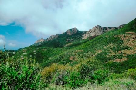
We began in the morning at the Mishe Mokwa Trailhead at Circle X Ranch. The ground was damp from the previous night's cloud cover. From here we would travel 1.6 miles and cover an 850 foot elevation gain in our first section - even steeper than Hike #1! It was here at the trailhead that some of us debated on whether to take a jacket; questioning if the peaks would be hidden behind a shroud once we got to the top. As we arrived to the stop beneath the final push to the summit of the mountains, we took a moment to gather our breath before those remaining 150 plus feet were conquered. On most clear days from Sandstone Peak, a view of the Channel Islands, Conejo Valley, Los Padres and Angeles National Forests, Malibu, and the eastern end of the Santa Monica Mountains can be experienced as you feel you are as far away from civilization as possible. However, this day we were engulfed in a deep, heavy, cool mist that wrapped its quiet and fast moving arms around us moments after getting to the top stealing away our view. 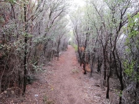
The air became still. The ground more moist. The world was eerily quiet as we each took step after step to come down from the peak in order to continue on our journey west towards Danielson Ranch. Here the smell of the chaparral is most intense and pausing to take notice of the adaptation by plants to survive in this rough, rocky, windswept terrain is just one part of the story. Our next section took us from just below Sandstone Peak across the backcountry of the Santa Monica Mountains further away from the hustle and bustle of city life and into a wild and untamed world. Here ceanothus, red shanks, manzanitas, and a plethora of flowers greeted us as we explored another 1.6 miles to our lunch spot at the western edge Circle X Ranch. 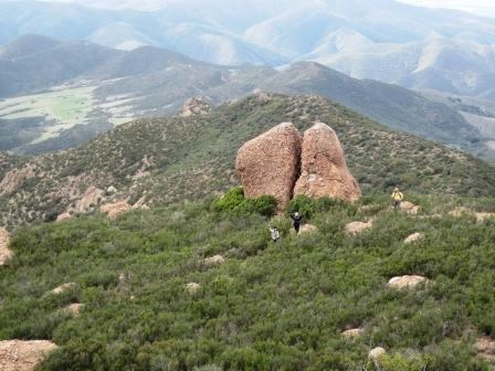
Entering the Boney Mountain State Wilderness we embark on a steep descent down the Chamberlain Trail for 2.8 miles, where we drop back beneath the clouds' protective blanket and for the first time see the cliffs of Boney Mountain, the Tri Peaks Area, and are reminded that even though it's easy to forget, urban life is not that far away. We voyage past Chamberlain Rock (seen to your right), and onto the junction with the Blue Canyon Trail. 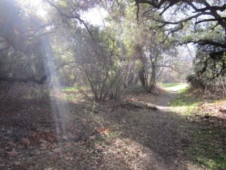
It is that last 1.9 miles that we realize we are near the end of the hike, caravanning along the Blue Canyon Trail. It was a few weeks ago we arrived into Sycamore Canyon and Danielson Ranch from the opposite direction. The familiar coastal sage scrub and oak woodland soared over our heads while sun poked through the branches of trees standing like sentinels of the trail. Moments later we arrived at Danielson Ranch, our end point for the day. We made it. We did it. We are here. Now, after all of that, what is the reason for our hike? Is it the distance we covered, the landscapes we saw, the path we took, the plants we smelled, or the temperatures we felt? Or is it something more? Something that can't be explained easily in words. An emotion that is so powerful it pushes one's mind to the edge of known language and draws a feeling of peace that can only be explained by being there. It's not just one thing that makes a place, a destination, significant to a state or a nation; it is all of these factors! It is up to the individual, you the visitor, to find out which ones matter the most as you visit this unique world known as the Santa Monica Mountains. The park is yours. Go forth, explore it, and find that reason. ---------------------------------------------------------------------------- To learn more about this section of trail, you can visit the information page by clicking the name of the section: Danielson Ranch (Pt. Mugu State Park) to Circle X Ranch. (Click here to return to the 2012 Backbone Trail Blog homepage.) |
Last updated: March 1, 2015
