|
summary of construction under phase I and II includes: Dairy Barn Demolition: 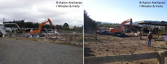
Manure Areas: 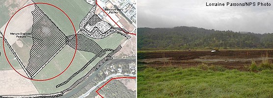
Levee Removal: 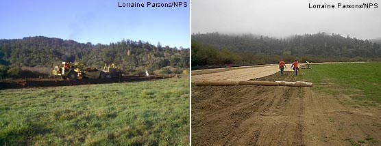

Infrastructure Removal:
Grading of the Manure Ponds and Dairy Mesa: As part of the deconstruction of the dairy facility, the manure pond and immediately surrounding area (total of 2.36 acres) in the Giacomini dairy complex was regraded and compacted. Historically, manure generated from the dairy was stored in the manure ponds and spread either in a thick layer in the manure pastures or loosely throughout the East Pasture during the dry summer months. The two ponds covered approximately 1.69 acres. Soils from the Manure Disposal Pasture that were heavily laden from years of manure slurry application were placed on the bottom of the ponds, with clean soils from levee excavation and the Tomasini Triangle Marsh creation used to "cap" the ponds and provide a clean, relatively weed-free soil surface. The final grading was designed and constructed to support future public access spur trail and overlook area. 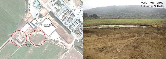
Creation of Habitat for the Federally Threatened California Red-Legged Frog: 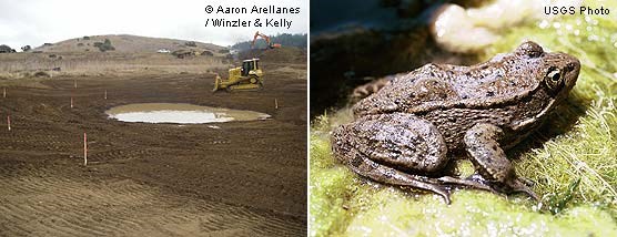

In addition to the Olema Creek Frog Ponds, a 5.2-acre freshwater marsh was created in the southeastern portion of the East Pasture near Point Reyes Station in the Tomasini Triangle. Removal of levees from the Giacomini Ranch would increase salinities, including in the area that has been used principally by red-legged frog for breeding, the West Pasture Freshwater Marsh. At the newly created Tomasini Triangle Marsh, a low-lying berm was built to ensure that higher high tides to not intrude into the marsh. As noted above, red-legged frog are reported to not breed successfully in waters with even low to moderate salinities. Based on computer hydraulic modeling, this portion of the Project Area is one of the least affected by extreme high tides. This marsh starts to fill in the fall even prior to heavy rains from increases in groundwater flow and is designed to pond through most of the spring and early summer, drying up almost entirely in late summer–early fall. summary of construction under phase I and II includes: |
Last updated: September 18, 2022