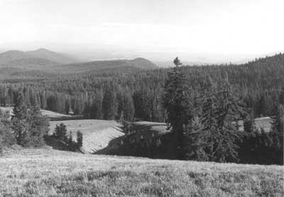

Looking south toward the
Klamath Basin from Dutton Ridge.
|
|
Construction and Use of Other
Roads
Designation of roads as "secondary" and
"service" for purposes of documentation is simply a way to classify what
cannot be termed a "primary" route such as a circuit or approach road.
In this context secondary roads are available for both visitor and
administrative use, but remain in an unsurfaced condition so that annual
re-grading is needed. There is only one such road in Crater Lake
National Park, the so-called "Grayback Motor Nature Trail," which
connects Lost Creek Campground with what is presently a picnic area and
trailhead below Vidae Falls. A number of secondary roads originally
built for fighting forest fires have been converted to trails. Vehicles
on these roads were largely restricted to administrative use until 1971,
when the NPS banned all motorized travel in the backcountry. Service
roads, by contrast, are shorter but more broadly defined to encompass
surfaced access available for either public or administrative use.
These are largely confined, however, to the three main developed areas
of Rim Village, Park Headquarters, and the Annie Spring vicinity. Paved
campground loops and access to residential facilities predominate in
those three localities, though this category also includes two
unsurfaced loops at Lost Creek Campground, as well as entry to a pair of
bone yards on one approach road.
Secondary Roads
Route 6 (Lost Creek to Vidae
Falls)
This remnant section of the old Rim Road is
really an alternate to a portion of Rim Drive, so one BPR engineer
recommended it be known as "Route 7 Alt." in 1946. It was used as such
during the first decade following the end of World War II because rock
fall on Anderson Point, Dutton Cliff, and Sun Grade often blocked Rim
Drive for at least part of several summer travel seasons. By the mid
1950s, however, NPS master plan drawings indicated that this road had
assumed the designation of "Route 6." Some grading of it by park crews
for maintenance purposes undoubtedly took place, most likely on an
annual basis, yet planners in 1968 described this road as having been
"abandoned" almost three decades earlier. They nevertheless found it in
"fair to good condition" and easily passable by automobile.
The impetus for identifying at least one
"motor nature trail" in national parks such as Crater Lake has often
been attributed to NPS Director George Hartzog, who ordered that this
type of experience be considered as part of the master planning process
in 1968. As originally conceived, planners of that time saw the
"Grayback Ridge Motor Nature Trail" as a one-way gravel road destined to
receive "minimal use" given its location away from the main travel
corridor between Annie Spring and the North Entrance. They nonetheless
called the interpretive possibilities "exceptional," so R.G. Bruce, a
park naturalist, designed sixteen wayside exhibits for placement at
regular intervals between Lost Creek and Vidae Falls. Once installed,
however, these devices were criticized in one interpretive plan as being
overly lengthy in regard to text while also failing to effectively
develop the designated theme. By the time the NPS undertook its first
general management plan for Crater Lake in 1976, a new group of planners
called the Grayback wayside exhibits "obsolete," noting that a newly
printed guidebook removed the need for them.
Rapidly escalating fuel costs and gasoline
shortages affecting park operations led Superintendent James Rouse to
propose closing the Grayback Road to the regional director in September
1979. He justified such a move by presenting the idea that vehicle
access by way of segments 7-D and 7-E made the Grayback Road redundant
as a motor nature trail, given the one-way circulation system clockwise
then in force on this portion of Rim Drive. Less than four years later,
however, he wrote to a new regional director about abandoning those
segments of Rim Drive in favor of widening and improving the Grayback
Road. Rouse mentioned having recently met Lange, who told him of the
road location controversy involving 7-D and 7-E1 during the 1930s,
though he placed greater emphasis on cost savings derived from
abandoning 5.5 miles of Rim Drive extending from Kerr Notch to Vidae
Falls.
His successor, Robert E. Benton, eventually
opted for the status quo in keeping all of Rim Drive open for summer
travel and then directing that circulation on it return to a two-way
system in 1987. The Grayback Road, meanwhile, remained one-way and at
roughly the same graded width (12') as when originally constructed in
1913, though Benton thought the motor nature trail designation was
outmoded and at one point asked his division chiefs for recommendations
on possible uses. Declining fuel prices and an increasing park budget
over the last half of the 1980s insured annual re-grading of the road,
though its status as a "motor nature trail" became a casualty to
shifting priorities in NPS planning.
Routes 25-49 (fire
roads)
What were called "motorways" or "truck
trails" at one time originated in 1929, when park employees began laying
out a "fire control system" of access roads intended to cross the
largest number of sections possible in the backcountry. Construction
began the following year, with the initial 22 miles built without
cutting what Sager called "larger" trees. He described the roads as
being of a low standard, being built by a bulldozer that simply scraped
away forest litter down to mineral soil and then pushing material to one
side. This method did not provide for drainage, so the roadbed often
became a ditch or gully where it traversed the lowest part of the
terrain.
Almost 130 miles of fire roads became part of
this system, with most of the construction completed by 1934. Grades
varied between flat and 10 percent along most of the motorways, where
12' became the standard width. The fire roads remained unsurfaced, so
portions damaged by erosion or characterized by high centers sometimes
made travel on them a challenge. Their proliferation came in response
to a desire to suppress fires started by lightning in remote corners of
the park, or to reach patrol cabins built by the CCC in 1933-34.
Employees could drive the roads for recreational purposes by permit, but
the rangers installed locked gates at public entry points to stop
visitor use of the motorways, since there were fears in the NPS about
intentional or inadvertent ignitions in the backcountry.
Regular maintenance of the motorways
commenced in 1941 as part of fire suppression activities and continued
sporadically until 1971, when the NPS stopped virtually all motorized
administrative access to areas in the park now studied for their
suitability as legally designated wilderness. The shift toward managing
much of the backcountry as wilderness, even though Congress failed to
act on formal NPS recommendations made in 1974, led to making roughly 52
miles of fire roads part of the park's maintained trail system.
Subsequent trail reroutes aimed at enhancing the wilderness experience
of backcountry visitors have since slightly reduced that
total.
Service Roads
Rim Village
All three service roads at this site extend
from the main roadway that links Crater Lake Lodge with a cafeteria and
plaza. The Rim Cabin road (Route 10) runs for one-fifth of a mile,
beginning west of the cafeteria and going behind that structure to a
point down slope of the plaza. A sinuous network of roads in the former
Rim Campground (Route 11) allow for vehicle circulation through what is
currently a picnic area. Another road approximately 800' in length
provides employees with access to the concessionaire's dormitory, a
building erected in 1973.
The concessionaire funded the construction of
twelve cabins clustered behind the cafeteria in 1931, each being located
along the outer edge of an unsurfaced road loop. Twelve additional
cabins were built slightly further east of the first group over the
ensuing decade, thus necessitating extension of the road to a point
below, but not connected with, the plaza. With removal of the cabins in
1985, most vehicle traffic on this service road went to a loading dock
located at the rear of the cafeteria.
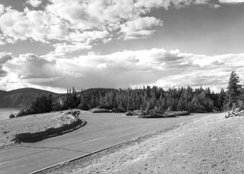
A parking area on East Rim Drive above Grotto Cove.
|
Formalizing the Rim Campground with a defined
set of roads and designated sites began in 1933, as a way to control
impacts in the face of heavy use. CCC enrollees planted shrubs to
screen sites, installed picnic tables and fireplaces, and partially
buried logs in order to define parking spurs. Driving on unsurfaced
roads created dust, so the NPS preferred using oil as a palliative
rather than crushed stone surfacing, given higher costs and noise
associated with the latter. Increases in visitation and the popularity
of camping, even during the Depression, generated a need to expand the
campground, so the NPS responded by adding a new road loop south of the
existing one in 1934. Aside from providing more campsites, the new loop
had enough room for an "open air theater," one where interpretive
programs could be held on summer evenings.
The theater never materialized, but more
expansion along with reconstruction of the campground came during the
summer of 1957. The contracted portion of this Mission 66 project
consisted of clearing and grubbing for new road construction, building
new subgrades with a crushed stone base, then paving with asphalt.
Obliteration of several old road sections and restoration of
construction scars continued on a day labor basis for the next two
seasons, in conjunction with setting barrier rocks to define fifty-five
campsites. In addition to a paved surface at least 12' wide that
extended over nine-tenths of a mile through the campground, the project
brought about a new entrance road from the main roadway through Rim
Village, one wide enough to allow two way traffic. The need for a more
spacious entrance, as well as several wider arterial roads, became moot
in the summer of 1975 when the NPS discontinued overnight camping at Rim
Village in favor of a picnic area that received only a small fraction of
previous visitor use.
A service road leading to the
concessionaire's dormitory overtopped a portion of the road built by the
Army Corps of Engineers in 1914. Located just east of the Rim Campground
and at the outer edge of a broad pumice field south of Crater Lake
Lodge, this service road leads to an employee parking lot situated
adjacent to the dormitory. After burial of electrical, water and sewer
lines underneath the old roadbed to serve the dormitory, the road was
paved to a width of 14' as part of construction activities taking place
over the summer and fall of 1973.
Park Headquarters
Of the three service roads at this site, the
oldest connects a utility area or maintenance yard with an
administrative plaza situated at an entry point with the Munson Valley
Road. This road also extends uphill from the administrative plaza and
provides vehicular access to a residential area built with the intention
of housing permanent NPS employees during the summer season. At the
south end of the maintenance yard is another service road, a one-way
loop serving the residential area for temporary NPS employees called
"Sleepy Hollow." Across the Munson Valley Road from Sleepy Hollow is
the park's largest residential complex, "Steel Circle." The road
through it (Route 21) consists of an outer loop where housing units were
located and an inner access that allows employees to reach a building
used for social functions and gatherings.
Metamorphosis of what the Army Corps of
Engineers initially called "Camp 2" began in 1926, when the NPS built a
warehouse and incorporated stone masonry in its ground floor walls.
This type of construction immediately gained favor over earlier log
structures and became the preferred mode of construction as the
headquarters development expanded over a wider area over the next seven
years. The need to establish a defined circulation system quickly
became evident in the wake of largely unconfined vehicular access to the
site.
Grading of a service road to connect the new
administrative plaza with both the utility and residential areas took
place in 1933, with all excavation done by hand to maximize the numbers
of men hired on this public works project. With most of the grading
completed that fall, laborers began surfacing a portion of the roadway
with 4" of crushed rock obtained from a contractor who used a
preexisting quarry located about 5 miles from Park Headquarters. A short
construction season dictated that the contract had to be completed in
1934, though subsequent settling under traffic meant surfacing needed
water, then be mixed, and re-laid. The NPS let another contract for
crushed rock in 1935, so that this material could be integrated with
emulsified asphalt and spread roughly 1" in depth. It was then rolled,
and the process repeated twice more before motorists began to use the
road surface.
Some rough grading of a service road from the
utility area to Sleepy Hollow began in 1933 as part of building the
first five cabins there for temporary employees. They appeared on both
sides of the road and were joined by three additional structures in
1936. Finish grading, surfacing, and paving took place over the
following summer to the same specifications as the service road through
the administrative plaza. Lange added two parking areas along the Sleepy
Hollow road in 1937 as part of accommodating employees still housed in
tents. The parking areas disappeared when the utility area expanded in
1957, an undertaking that included establishing a road connection
between it and the new residential area to be built across the Munson
Valley Road. Piecemeal removal of cabins in Sleepy Hollow started in
1984 and continued over the next five years so that a new housing area
for temporary employees could be constructed on the site in 1990.
Contractors realigned the service road as part of the project so that
new structures were situated on the inside of a paved access loop.
Grading of the road through the Steel Circle
housing area occurred in 1956 as a precursor to building a number of
units largely consisting of duplexes with flat roofs. A portion of the
site had once been used as a landfill, so the contract included grading
the original access road from Rim Drive in addition to creating a main
entrance from the Munson Valley Road. The former connection did not
last long, due to fears that visitors might unduly disturb residents, so
the road in Steel Circle has only one entry point. Contractors surfaced
this road in September 1957 so that paving could be completed prior to
the end of the construction season.
Annie Spring
vicinity
Much like they had at Rim Village and Park
Headquarters, NPS landscape architects turned their attention to this
site once collaborative planning and design with BPR engineers
established the alignment for the road junction and stream crossing. By
1926, planners envisioned a surfaced "plaza area" where Routes 1 and 2
met adjacent to the Annie Creek Bridge, yet they also called for less
development in this area in favor of more facilities at Park
Headquarters and Rim Village in the future.
One exception was a campground to be located
next to the new plaza, where in 1928, the NPS hoped to eventually
accommodate 200 visitors. In the mean time, however, officials knew
visitors preferred the Rim Campground, so improvements such as surfaced
roadways and hardened sites with rustic log tables were centered on it.
Annie Spring Campground thus consisted of an informal main parking area
flanked by comfort stations and was largely used on an overnight basis
by a few visitors who arrived late in the day. CCC laborers built a new
comfort station there in 1934 and began clearing a loop road for an
expanded campground that summer. Tables and fireplaces for fifteen
sites followed over the next three years, so that by 1938, the official
park brochure described the Annie Spring Campground as a comfortable
alternative (in being situated at a lower elevation) to the larger and
more popular Rim Campground.
Reconfiguration of the campground began in
September 1956 with the aim of increasing its size to twenty-five sites.
Contractors made a longer loop road, one sometimes referenced as Route
12, by moving the intersection with approach roads 300' further south in
conjunction with realigning the Annie Spring road junction. Adding
parking loops between the extant fifteen sites and along a slightly
extended access road produced the desired expansion, one that included
new comfort stations, tables, and fireplaces in 1957. Surfacing to a
width of 15' also took place that summer so the campground could serve
visitors displaced by construction associated with reconfiguring the
camp facilities at Rim Village. Closure of the Annie Spring Campground
came in 1968, in the midst of another road junction realignment, though
its facilities had been pressed into service during the intervening
decade only when the adjacent Mazama Campground filled to capacity.
Self-imposed limitations by the NPS on a
wholesale expansion of the Rim Campground after 1941 stemmed from
chronic impacts associated with over use. As annual visitation climbed
above 250,000 in the immediate postwar period and then exceeded 370,000
in 1954, the need to develop one large campground away from the rim
became more acute. Rather than expand southward from the Annie Spring
Campground as envisioned in 1928, the NPS chose to develop a site
located across Route 2 and used as CCC Camp Annie Spring from 1934 to
1941.
Grading of the first four campground loops
occurred from August to November 1956, concurrent with placement of
utilities. Over the following summer, surfacing of the campground roads
(referenced collectively as Route 15) occurred at roughly the same time
as installation of new tables having concrete bases and metal fireplace
grates. Roads in the campground continued to expand with the clearing
of a fifth loop in 1960, so that development of forty-five new campsites
along it could commence the following July. Like loops A through D, the
road that defined E loop had a surfaced width of 15' due to one-way
circulation, though the main two-way access between loops went to 20'.
Placement of barrier rocks around the sites finally completed the
project in September 1963, only to be followed by construction of two
additional loops (F and G) starting in August 1965. The last two loops
were bid as a "package," one containing items such as road construction,
extension of utilities, and development of fifty additional campsites.
Placement of surfacing material followed by an oil treatment constituted
what was virtually the last step in completing the job, one accepted by
the NPS during the early part of August 1966.
A prospective realignment of the South
Entrance Road adjacent to Mazama Campground that came to pass in 1968-69
allowed planners to consider how to allocate space between the old road
location and the new. They initially foresaw adding more than 110
campsites in four new loops to the existing total of 190 in 1966, but
two years later opted for a "trailer village" divided into units
totaling 100 sites. Public opposition to the trailer village idea
helped to stifle any new development there until 1987, when ten new
quadriplex units were built to replace cabins demolished in Rim Village
two years earlier. Although the concessionaire funded construction of
these units, the NPS extended utilities and a service road with two
loops to them. The NPS also funded a large parking lot for what it now
called "Mazama Village," (given the new development's proximity to the
campground) one largely aimed at supporting a camper store erected by
the concessionaire in 1990.
A contractor began grading another service
road in the vicinity during the summer of 1996 as the initial step to
building a housing complex for concession employees supposedly displaced
by the rehabilitated Crater Lake Lodge. Work completed over the
following summer even included the park's first paved bicycle path, one
that joined Mazama Campground with the construction site located across
Route 2. It also included two loop roads that provided vehicle access
to the central housing and service facility, a satellite dormitory,
garage, and sites for recreational vehicles.
Outlying Areas
Two service roads located away from the three
main developed areas are surfaced with gravel and can be found along the
South Entrance Road, although they are restricted to administrative use.
The roads are entries to the South Utility Area (Route 17), a bone yard
located near the park boundary, and the Pole Bridge Quarry (Route 50)
situated across Route 2 from the abandoned Cold Spring Campground. At
Lost Creek Campground, by contrast, the two road loops (Route 14) have
remained unsurfaced as part of a conscious effort to retain its
primitive character in combination with the relatively informal
campsites. The graded roads there have thus remained at 12'
wide.
|

