
As you plan your trip, keep in mind that Olympic National Park is very big! Planning to explore the mountains of Hurricane Ridge or the waterfalls of Sol Duc? You may want to make your home base in Port Angeles, Washington, or near Lake Crescent. Want to stroll through the lush Hoh Rain Forest or tidepool along the coast? Consider a home base in the Forks, Washington, area. Want to get closer to nature? Explore our campgrounds! Don't feel like roughing it? There are also several lodging options within the park. Once you've decided how you'll get here and where you'll stay, use our Getting Around page linked below to see transportation times between the places you'd like to visit. Plan ahead to make the most of your time in this breathtaking national park! And be sure to check road conditions before you go - especially if you're planning your visit in fall or winter! 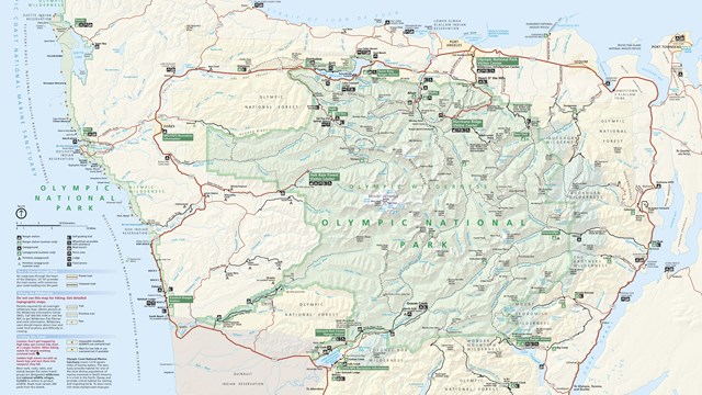
Maps
Maps to help you find your way and plan your trip to Olympic. 
Getting Around
Find information about distances between locations in the park and how to travel around Olympic National Park. 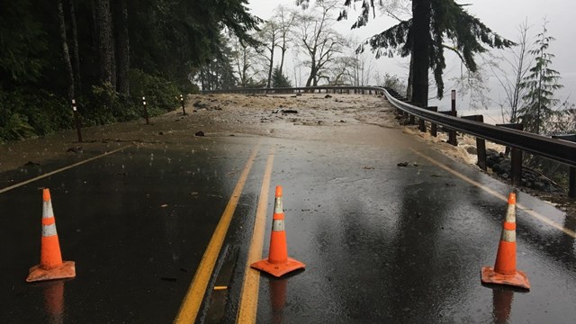
Current Road Conditions
Find information about current road conditions. Directions

Traveling by Car

The Washington State Ferries system has a number of routes which access the Olympic Peninsula via Puget Sound. There are several port destinations that will get you across the sound and onto the peninsula and on your way to Olympic National Park.

Traveling by Bus 
Traveling by Air |
Last updated: September 22, 2025