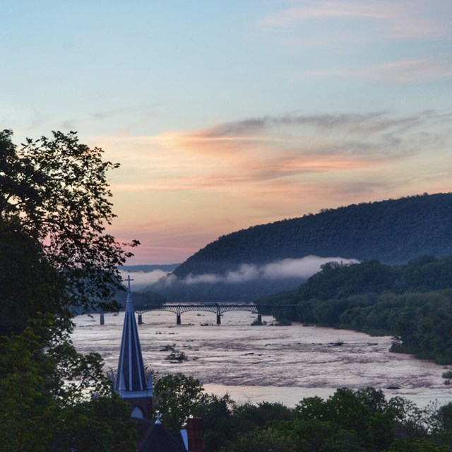
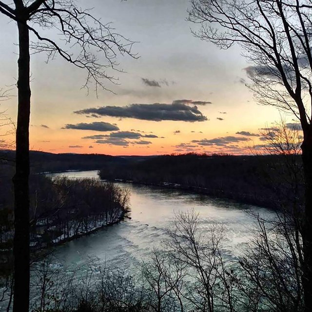
Approximately 360 million years ago, when the continent of Africa collided with North America, land comprising the park began to take its current shape. At this time the Appalachian Mountains rose and the Potomac River began cutting through them, forming the water gap we see today between Maryland and Loudoun Heights. From numerous places throughout the park, visitors are able to enjoy this and many other scenic vistas Harpers Ferry has to offer.
Large seasonal temperature variations characterize the climate of this region. Highs sometimes reach 100 degrees F in July and August, whereas lows can fall below 15 degrees F in January. On average though, annual high and low temperatures here are 63- and 40-degrees Fahrenheit respectively. The average annual precipitation from thunderstorms, rain showers, Atlantic coastal storms, and snow combine to equal 38 inches in the park. The month of June typically receives the most precipitation, whereas February receives the least.
Floods reaching heights of 20 feet or more occur about every 5 to 10 years. When floods do occur, they tend to be fairly deep since there is not much room for water to spread out once it overflows its banks. Flooding in the park is caused by many factors including rugged topography, changes in vegetation, and meandering stream courses that cause large volumes of water to slow down in their channels and consequently overflow their banks. Another main flood-causing factor is heavy precipitation that produces rapid runoff, especially during the early months of the year.
Natural sources of water hardness and pollution in Harpers Ferry are calcium and magnesium. These elements are very common due to the large quantities of limestone in this area. Yet the presence of limestone also helps to buffer river waters against acidic conditions. Sodium, potassium, iron, and manganese are also present in the Potomac and Shenandoah rivers. If large enough amounts are present, iron and manganese can be indicators of acidic water.
Both domestic and industrial wastes are sources of water pollution in the Harpers Ferry area. Predominantly agricultural practices, including the use of fertilizers and pesticides, and heavy rainfall events have contributed to the contamination of the streams and rivers. The amount of forest cover, land use, and waste from industries each affect sedimentation. Most of the suspended materials in the Potomac and Shenandoah rivers are the products of soil and channel erosion, while some are industrial wastes.