
|
Lobby > Exhibits > Scientific Research > Research in The Deep > Charting Yellowstone Lake Charting Yellowstone LakeThe combination of depth, cold water temperatures, and hydrothermal features makes exploring the lake bottom dangerous. A submersible remotely operated vehicle (ROV) was used to photograph the lake bottom and collect samples. This scientific tool has helped provide a clearer understanding of the underwater landscape. 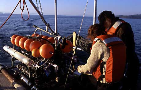 High resolution computer imaging shows that the northern part of the bottom of Yellowstone Lake is marked with active hydrothermal vents, fissures, spires, isolated gas pockets, and steep-sided craters caused by underwater hydrothermal explosions. Next | 1 > 2 > 3 > 4 | Next Section: Spires of the Deep |
|
||||||||||||||||||||||||||||||