Last updated: August 11, 2022
Place
Erie Canalway National Heritage Corridor
Erie Canalway NHC
Quick Facts
Location:
NY
Significance:
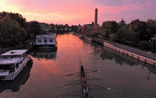
Stretching more than 500 miles across the full expanse of upstate New York, the Erie Canalway National Heritage Corridor encompasses New York's canal system and the communities that grew along its shores.
Designation:
National Heritage Area
MANAGED BY:
The Erie Canalway National Heritage Corridor (Erie Canalway NHC) was established by Congress in 2000. The Corridor spans 524 miles across the full expanse of the upstate New York. It includes the Erie, Cayuga-Seneca, Oswego, and Champlain Canals and their historic alignments. The Corridor encompasses 4,834 square miles in 23 counties and is home to 3.2 million people.
New York’s canals established a transportation network which made New York the “Empire State’’ and the Nation’s premier commercial and financial center. New York’s canal system has been in continuous operation since 1825, longer than any other constructed transportation system in North America.
The Erie Canalway proved the depth and force of American ingenuity, solidified a national identity, and found an enduring place in American legend, song, and art. The canal also opened the interior of the continent to settlement. Population along the canal route in Syracuse, Rochester, and Buffalo quadrupled from 1830 to 1850; Today, 80 percent of upstate New York residents live within 25 miles of the canal. Its waterways include approximately 40 percent of New York State’s freshwater resources and drain nearly half of the state’s total area. Its rivers, streams, lakes, wetlands, and rich woodlands are home to an impressive variety of fish, birds, and forest animals, including a number of threatened and endangered species.
Erie Canalway NHC is home to the following NPS units:
-
Over 800 listings on the National Register of Historic Places, including over 1,400 properties
For a complete listing, visit Erie Canalway NHC.