Alerts
|
Updated 9/14/2024 11:12 am PDT Road Status— Open Roads 
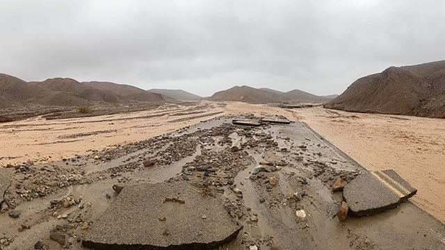
NPS PAVED ROADSCLOSED:Bonnie Clare Road and Scotty’s Castle due to flood recovery work. Unlikely to open before late 2025. No access permitted. No foot, bicycle, motorcycle, vehicle, etc. use allowed. CAUTION:CA 190 - Expect delays up to 20 min along CA 190 as Caltrans installs gabion structures to reduce the risk of road damage during flooding. UNPAVED/BACKCOUNTRY ROADSCAUTION:
CLOSED:Note that road closures listed below apply to ALL motorized vehicles, including motorcycles.The roads were completely washed out in places and entry will cause tire tracks and braided roads in wilderness as users try to locate what was once the road. Thank you for your patience as we work to reopen these locations. Bicycles are permitted except on Titus Canyon Rd.
ROADS OUTSIDE THE PARK
CAMPGROUNDSAll campgrounds except Furnace Creek Campground are first come first served year-round. OPEN:
CLOSED for the summer:
Weather Conditions
Check weather before your planned travel days, conditions can swiftly change in Death Valley. 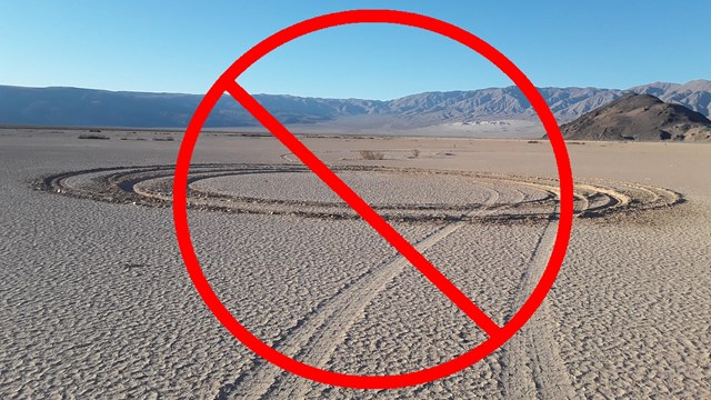
Stay on Roads with your Vehicle
Illegal driving off designated roads negatively impacts the landscape, ecosystem, view, and more. |
Last updated: September 14, 2024