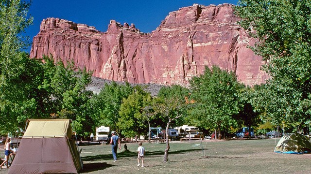
National Park Service LogoU.S. Department of the InteriorNational Park ServiceNational Park Service
National Park Service:  U.S. Department of the InteriorNational Park Service Arrowhead
Capitol Reef National Park The Wingate Sandstone Castle is perched on the banded Chinle formation
view map
text size: largest larger normal
printer friendly
Capitol Reef National Park
Camping in Capitol Reef
Campground
NPS
 

Developed Camping
The 71-site Fruita campground is the only developed campground in the park, located south of the visitor center in the Fruita Historic District. 

Primitive Campgrounds
The no-fee Cathedral and Cedar Mesa Primitive Campgrounds, located in more remote parts of the park, have pit toilets and picnic tables, but no water.

Group Campsite
The Group Site is available by reservation and can accommodate a maximum of 40 people.

Backcountry Camping
A free backcountry permit is required for camping outside of campgrounds.

Review our Campground Regulations for more information.

You are exiting the National Park Service website

Thank you for visiting our site.

You will now be redirected to:

We hope your visit was informative and enjoyable.

Junior Geologist with Dutton Sketch

Did You Know?
Geologist Clarence Dutton, a member of John Wesley Powelll's scientific team, surveyed the Capitol Reef area in 1875. Dutton mapped a fault line adjacent to Chimney Rock along Utah Highway 24, and a copy of his field sketch is incorporated into the park’s Junior Geologist program.
more...

Last Updated: January 30, 2012 at 18:13 MST