National Park Service LogoU.S. Department of the InteriorNational Park ServiceNational Park Service
National Park Service:  U.S. Department of the InteriorNational Park Service Arrowhead
California National Historic TrailEarly snowfall trapped the Donner & Reed wagon train at this site in late October of 1846.
view map
text size:largestlargernormal
printer friendly
California National Historic Trail
Auto Tour Route - Missouri

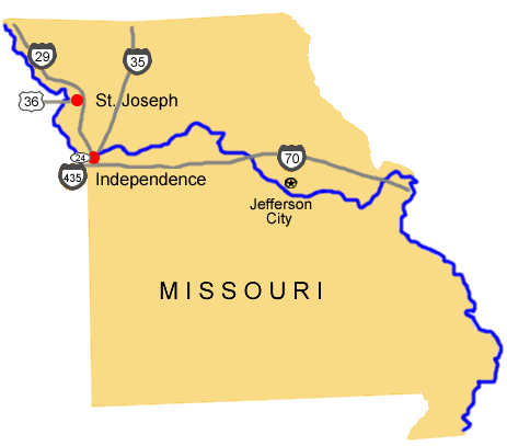
Below the map are driving directions to follow the auto tour route of the California National Historic Trail west from Missouri:


Missouri Auto Tour Route map.
NPS Image


From St. Joseph, MO:

1. Take U.S. Route 36 west.

From Independence, MO:

1. Take U.S. Route 24 west to Interstate 435.
2. Turn south onto Interstate 435.
3. Take Interstate 435 west into Kansas.


Total original route miles
in Missouri: 18


Back to auto tour route map page.

Top of Page

Bubbling carbonated waters of Sulphur Springs Lake near Soda Springs in Southeastern Idaho.  

Did You Know?
1840s Pioneers to California followed the road to Oregon through Southeastern Idaho before heading Southwest to the Humboldt River. The Soda Springs area of Idaho had many natural wonders never seen by most of these emigrants. Many remarked about its wonderfully tasting carbonated waters.
more...

Last Updated: November 21, 2008 at 15:50 EST