Where is the Water?

When the ancestral people of the Sonoran Desert lived here hundreds of years ago, there was more surface water available to help them survive than what we have today. Most of the major rivers in Arizona ran all year round. The fish in these rivers provided food, and along the river beds were riparian areas where many useful water-loving plants like reeds, grasses, and cottonwood trees grew.
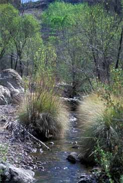
 
Queen Creek flowing in Arnette Canyon, Arizona
Queen Creek in Arnette Canyon, Arizona

Copyright © Denise Shultz

In Casa Grande Ruins, Arizona: A Centennial History of the First Prehistoric Reserve 1892 - 1992, A. Berle Clemensen wrote:

"All adjustments in Hohokam society
were tied to the preservation of their
irrigation based society… Between 1200
and 1350, periodic years of high volume
river flow caused a deepening of the Gila
River channel. These times were
interspersed with periods of low water…
Canal intakes had to be moved further
upstream and it became a struggle to
continue farming… Following 1355 times
got worse as more catastrophic flooding
appears to have taken place… sometime
between 1355 and 1450 the Hohokam
abandoned their large, central settlements."


Last updated: May 19, 2019

Park footer

Contact Info

Mailing Address:

1100 W. Ruins Drive
Coolidge, AZ 85128

Phone:

520 723-3172
General park contact number includes a phone tree for finding the employee you wish to contact. Callers may dial zero for the phone attendant. Voicemail is available for many of the extensions.

Contact Us