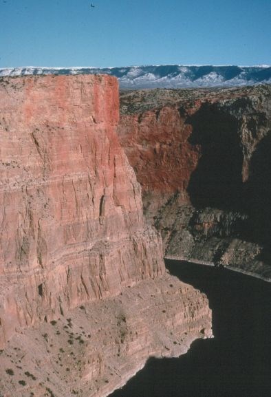
NPS Water Erosion If we experiment and take measurements we can learn much more about the powers of erosion. When we measure how much sediment the water holds and how much water is moving downstream, we can calculate how much sediment the river is carrying, and thus how much the river can erode over a set period of time. But if we increase the amount of water or increase the steepness of the river, we will also increase the erosive powers of the river. Rocks and Resistance If we can reverse all the processes, we can get a good idea of what the land looked like further and further back in time. The problem is calculating all the factors. The river is like a never ending saw that cuts down through the rock and erodes the rock away. Every time it rains or snows upstream, our “saw” gets longer and longer. Rock Falls and Other Forms of Erosion When the land was uplifted, the stress of that uplift cracked the rock. Water flowing into those cracks in the winter can freeze and when it does it expands and cracks the rock apart further. This frost wedging is also part of the erosion. Wind erosion is also a factor here as anyone who has tent camped at Horseshoe Bend can attest. Thousands of Feet Already Eroded What we really should do is look at the rocks at one end of the canyon at Horseshoe Bend and match them up with the same rock layers at the other end of the canyon fifty miles to the north at Fort Smith. Then we realize that thousands of feet of younger rock layers have been eroded off from above the top of the canyon for the whole length of the canyon. Finally... Chapter 4: The Future |
Last updated: June 8, 2022