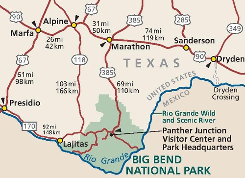
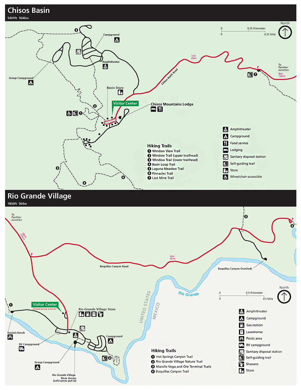
• Sierra del Carmen

    Big Bend

    National Park Texas

There are park alerts in effect.
show Alerts »
  • PANTHER JUNCTION VISITOR CENTER TEMPORARY CLOSURE

    The Panther Junction Visitor Center will be closed Tuesday May 28 and Wednesday May 29 for needed maintenance. Information, backcountry permits, and entrance fee payments can be taken care of at the Chisos Basin Visitor Center.

Maps

Area Map (50k PDF file)
A travelers map showing all routes to and from Big Bend National Park.

Backcountry Zone Map [220k PDF File]
Map of backcountry zone camping areas with names, codes, and capacities. Formatted to fit on legal-size paper.

Basic Park Map (641k PDF file)
Full-color basic park map showing most facilities, but not backcountry road sites. Includes a map of Texas showing major routes to the park. Updated in 2004.

Chisos Basin and Rio Grande Village Developed Area Map (624k PDF file)
Detail maps of the Chisos Basin and Rio Grande Village developed areas, showing the location of visitor centers, trailheads, campgrounds, and other facilities. Updated in 2007.

Detailed Park Map (896k PDF file)
Full-color, shaded relief park map showing all campgrounds, backcountry road campsites, trails, and facilities. Updated in 2007

Looking for Topo Maps?
Detailed topographic maps in a variety of formats are available through the Big Bend Natural History Association bookstore.
Topographic map index for Big Bend National Park


Did You Know?

At the top of the Lost Mine Trail

Some people who take the Lost Mine trail in Big Bend National Park may be secretly looking for the lost mine, but most take the climb to enjoy the scenery, vegetation, and wildlife. The rocks are mostly lava, but a few dikes of igneous rock filling fissures are seen along the way. More...