Last updated: June 17, 2024
Article
NPS Geodiversity Atlas—Aniakchak National Monument & Preserve, Alaska
Geodiversity refers to the full variety of natural geologic (rocks, minerals, sediments, fossils, landforms, and physical processes) and soil resources and processes that occur in the park. A product of the Geologic Resources Inventory, the NPS Geodiversity Atlas delivers information in support of education, Geoconservation, and integrated management of living (biotic) and non-living (abiotic) components of the ecosystem.

Geologic Features and Processes
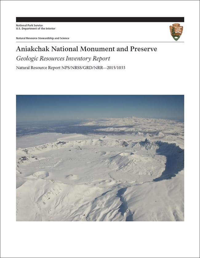
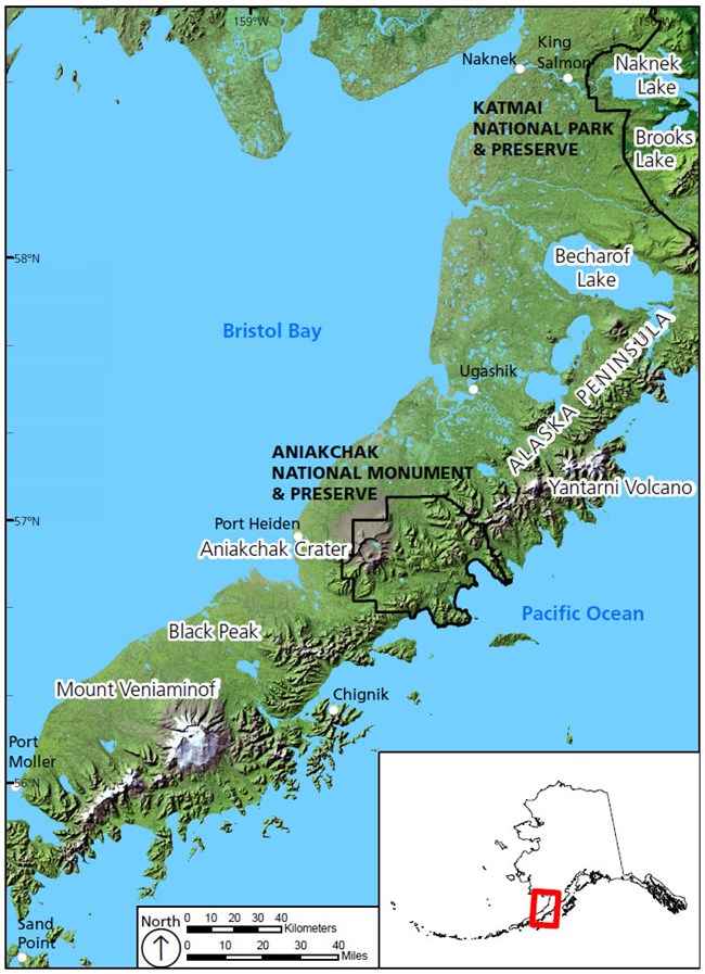
Aniakchak National Monument and Preserve, located in the heart of the Alaska Peninsula, encompasses 244,226 ha or 2,442 km2 (603,497 ac or 943 mi2) of volcanic landscapes, glaciated mountains, and coastal landforms. The park unit is approximately 190 km (120 mi) from NPS headquarters in King Salmon, and approximately 650 km (400 mi) from Anchorage, the state’s largest city. Aniakchak is often considered one of the most remote park units managed by the National Park Service and receives the fewest visitors of any park (less than 300 visitors per year for the last 10 years). Most visitors access the area by passenger plane, landing on Surprise Lake in the caldera and floating down the Aniakchak River to the Pacific Ocean. Packrafts have provided a new, and increasingly popular, way to access the caldera by hiking up the north flank of the caldera from Port Heiden and floating down the Aniakchak River.
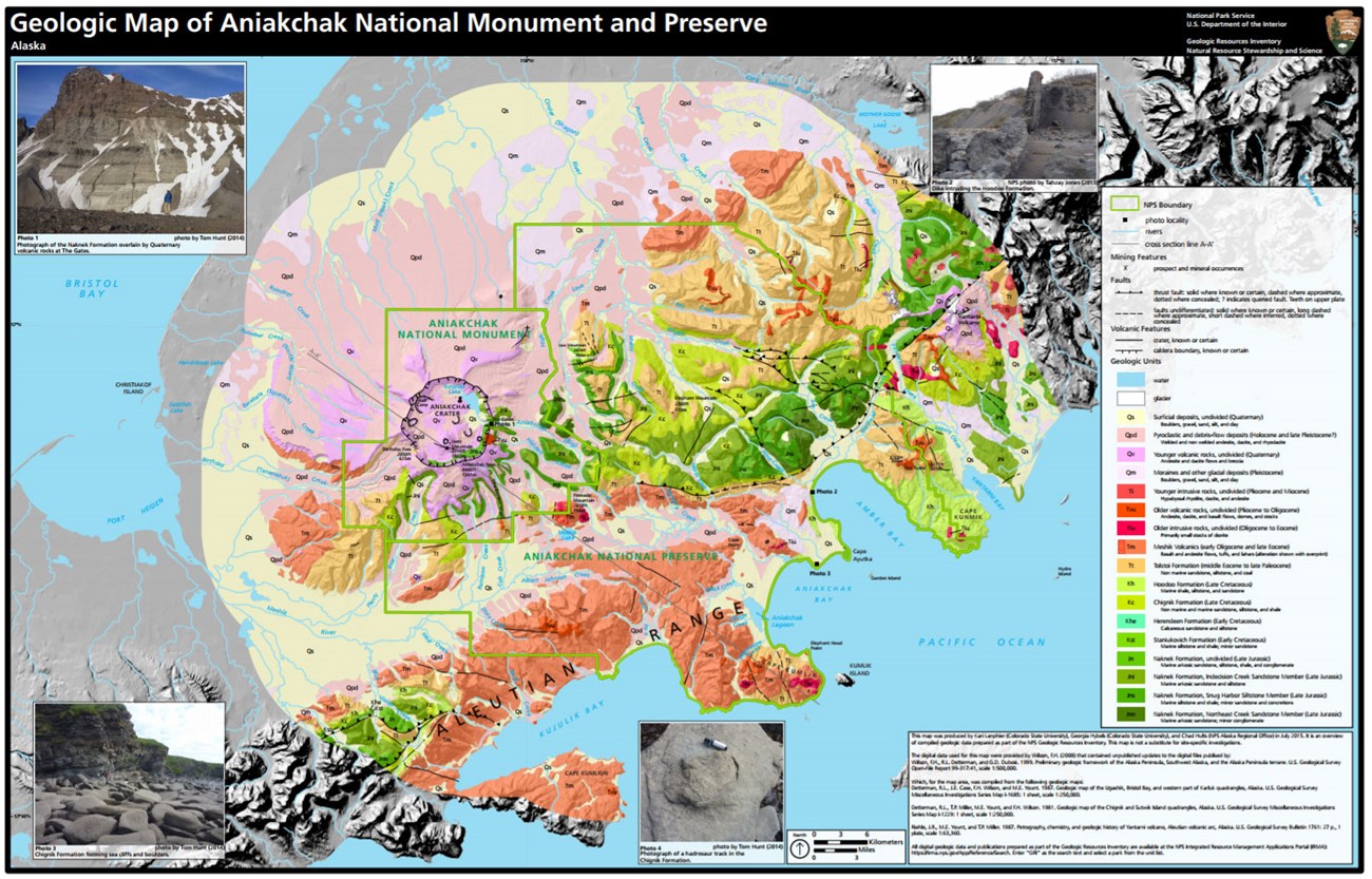
The dominant landform of Aniakchak National Monument and Preserve is the large Aniakchak Crater. The crater was formed during an eruption 3,660 ± 70 cal. yr BP and contains younger volcanic features, the latest of which formed during an eruption in 1931. The volcanic deposits lie over older bedrock made up of Tertiary (66–3 million years ago) volcanic, intrusive, and sedimentary rocks; and late Mesozoic (161–66 million years ago) sedimentary rocks. The rocks of Aniakchak National Monument and Preserve record a complex history of volcanism and sedimentary rock deposition that spans the last 161 million years. These rocks and geomorphic features provide evidence for ancient plate tectonic motions of large portions of southern Alaska, and recent tectonically driven processes.
Volcanic Landforms: Extrusive Igneous
Aniakchak II, The Caldera Forming Eruption
Aniakchak Crater is one of the largest and most spectacular calderas of the Aleutian volcanic arc. The caldera is 10.5 km (6.6 mi) in diameter and averages 610 m (2,000 ft) deep. The highest point stands 1,340 m (4,400 ft) above sea level at Aniakchak Peak, and the lowest point is 302 m (991 ft) at the bottom of Surprise Lake; the lake itself is 19.5 m (64 ft) deep. The caldera formed as voluminous magma erupted from the underlying magma chamber, creating a void. The top of the volcano collapsed into the vacated magma chamber. An explosive eruption (volcano explosivity index [VEI] 6) accompanied caldera formation 3,660 ± 70 years ago (cal. yr BP1). The eruption that created the present caldera is referred to as the Aniakchak II eruption; it was the second of two possible caldera forming eruptions in the last 10,000 years (Miller and Smith 1987).
Erupted Material
The Aniakchak II eruption formed an extensive ignimbrite sheet that extends to the coasts on both sides of the Alaska Peninsula. The eruption produced a voluminous amount of material, estimated at 70 km3 (17 mi3) bulk volume. The ignimbrite sheet covers an area greater than 2,500 km2 (965 mi2). The eruption ejected material high into the atmosphere where winds carried fine ash 1,000 km (620 mi) to the north to create tephra deposits on the Seward Peninsula (Riehle et al. 1987a, Beget et al. 1992). The deposits of the Aniakchak II eruption include an initial pumice fall deposit overlain by a thick layered ignimbrite.
Tsunami
Deposits on the north shore of Bristol Bay indicate that the pyroclastic flow likely generated a tsunami when it entered Bristol Bay. Waythomas and Neal (1998) found pumiceous sand interbedded in peat as high as 12 m (39 ft) above mean high tide at numerous sites along the north coast of Bristol Bay. In a couple places, the pumiceous sand overlies a tephra layer that was deposited from ash fall before the arrival of the tsunami. Waythomas and Neal (1998) proposed that the tsunami was preceded by pumice and ash fall (Figure 13). Rafted pumice was subsequently transported inland by the tsunami depositing an anomalous pumiceous sand layer in backshore peat deposits.
Post-Caldera Eruption Features
- Vulcan, West, Pumice, Bolshoi Domes
- Surprise, Windy, and Breezy Cones
- Vent Mountain and Half Cone
- SW and NE Maars
- Caldera Lake
Outburst Floods
- Caldera Outburst Flood
- 2010 Maar Breakout Flood
Geothermal Features
The Aniakchak Crater contains 15 warm springs that range from 18° to 22° C (64° to 72°F), and warm ground with a measured temperature of 85°C (185°F) at depths of 25 cm (10 in) near Half Cone (Lyle and Dobey 1973; Miller 1990; Cameron and Larson 1992; Motyka et al. 1993). The mineral rich (iron-soda) warm springs enter Surprise Lake along the northwestern shore and have low dissolved oxygen (5%–10%), high alkalinity (400–500 mg/l), and moderately low pH (5.0–6.0) levels (Cameron and Larson 1992). The largest spring near Surprise Lake emits carbon dioxide and helium gasses of magmatic origin, but not at toxic levels (Neal et al. 2001). These features are subject to monitoring as required by the Geothermal Steam Act of 1970 (amended in 1988).
Paleontological Resources
Aniakchak National Monument and Preserve contains abundant and scientifically significant paleontological resources. The Jurassic and Cretaceous sedimentary units contain many marine invertebrate fossils, dinosaur tracks, and minor plant debris. The Mesozoic rocks have not yielded any well-preserved plant fossils to date, though minor petrified wood with preserved tree rings was found in the Hoodoo Formation and coal and plant debris are present in the Chignik Formation. The Naknek Formation contains abundant Buchia fossils and some ammonite fossils. Three hadrosaur dinosaur tracks have been found in the Chignik Formation.
The Tertiary sedimentary rocks, and interbedded sedimentary rocks in the volcanic units, contain plant fossils that are well-preserved. Fossils from the Tolstoi Formation indicate the environment of deposition was subtropical.
All NPS fossil resources are protected under the Paleontological Resources Preservation Act of 2009 (Public Law 111-11, Title VI, Subtitle D; 16 U.S.C. §§ 470aaa - 470aaa-11).
- Scoping summaries are records of scoping meetings where NPS staff and local geologists determined the park’s geologic mapping plan and what content should be included in the report.
- Digital geologic maps include files for viewing in GIS software, a guide to using the data, and a document with ancillary map information. Newer products also include data viewable in Google Earth and online map services.
- Reports use the maps to discuss the park’s setting and significance, notable geologic features and processes, geologic resource management issues, and geologic history.
- Posters are a static view of the GIS data in PDF format. Newer posters include aerial imagery or shaded relief and other park information. They are also included with the reports.
- Projects list basic information about the program and all products available for a park.
Source: Data Store Saved Search 2680. To search for additional information, visit the Data Store.
A NPS Soil Resources Inventory project has been completed for Aniakchak National Monument & Preserve and can be found on the NPS Data Store.
Source: Data Store Saved Search 2694. To search for additional information, visit the Data Store.

Related Links
Related Articles
Aniakchak National Monument & Preserve
National Park Service Geodiversity Atlas
The servicewide Geodiversity Atlas provides information on geoheritage and geodiversity resources and values within the National Park System. This information supports science-based geoconservation and interpretation in the NPS, as well as STEM education in schools, museums, and field camps. The NPS Geologic Resources Division and many parks work with National and International geoconservation communities to ensure that NPS abiotic resources are managed using the highest standards and best practices available.

