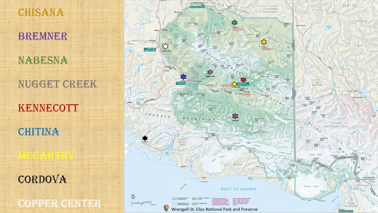
NPS These historic places allow us a nostalgic glimpse into the past, where people ventured into remote areas and endured the hardships of wilderness, wildlife and weather. 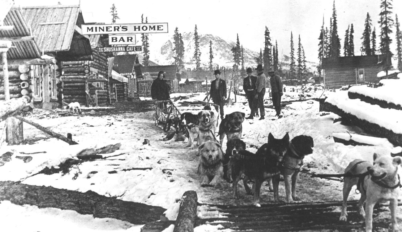
Bleakley Collection ChisanaChisana (pronounced shoo-shana), also known as Shushana, Chathanda City and Johnson City, is nestled in a remote valley between the Nutzotin and Wrangell Mountains, half-way between Nabesna and McCarthy, the Chisana area provides visitors with a unique glimpse into Alaska's gold rush era. Unlike many better known and more accessible regions, this area retains extensive evidence of its early mining use, including the deteriorating remains of two towns, numerous tent camps, various water diversion and delivery systems, a full range of hand, hydraulic, and mechanical mining operations and a well-developed transportation network. 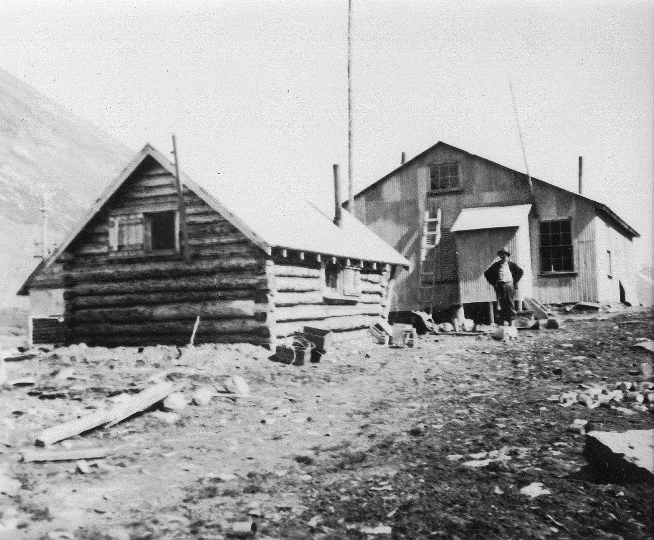
Bleakley Collection BremnerLocated near Golconda Creek just to the north of the Bremner River, about 50 miles east of Chitina, the area was the scene of an important placer gold discovery in 1902, and played a key role in the history of the Copper River Basin. Named in 1885 by Lieutenant H. T. Allen afterJohn Bremner, who in 1884-1885 was the first non-native person to live in the area and who prospected for gold along the Bremner River. Only a few miners struck it rich, but the resulting demand for materials and supplies helped establish regional transportation networks, encouraged supporting industries, and hastened the exploration and settlement of the entire region. 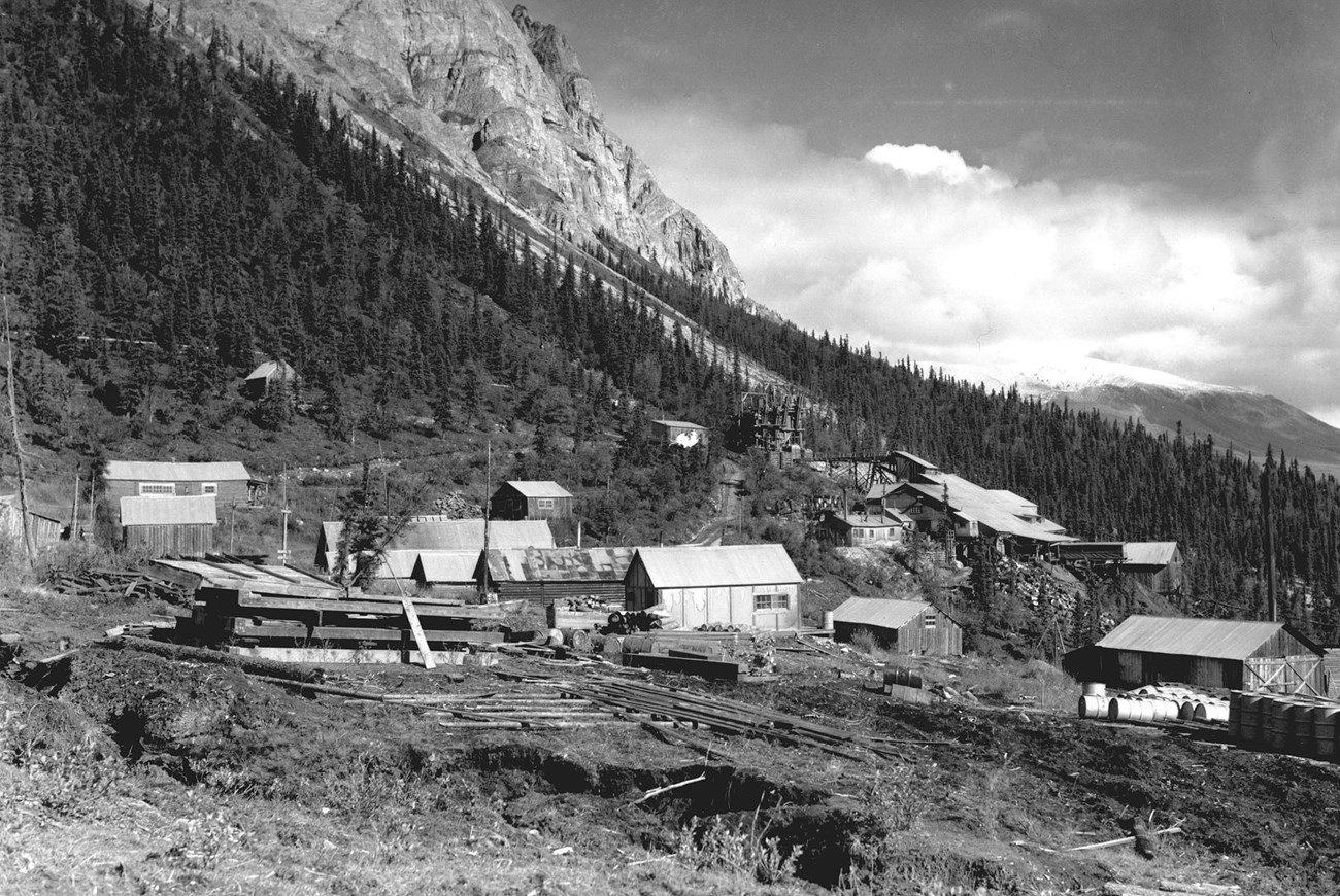
Bleakley Collection NabesnaLocated at the end of a 42 mile gravel road, east from the Tok Cut-Off Hwy at Slana, Nabesna Road is one of two roads into Wrangell-St. Elias National Park and Preserve. Nabesna was founded by the Nabesna Mining Company and named after the new post office in 1909. Gold was discovered at White Mountain in 1891, and the site was first developed in the early 20th century. The Nabesna Mining Company was formed in 1929, resulting in an expansion of the camp and the construction of Nabesna Road. The mine was closed during World War II, and only briefly reopened afterward, closing permanently after 1947. The location was used as a secret supply cache by the United States Army during the Cold War. The mine produced 2.5 tons of gold during its active period, as well as many tons of silver, copper, and lead. 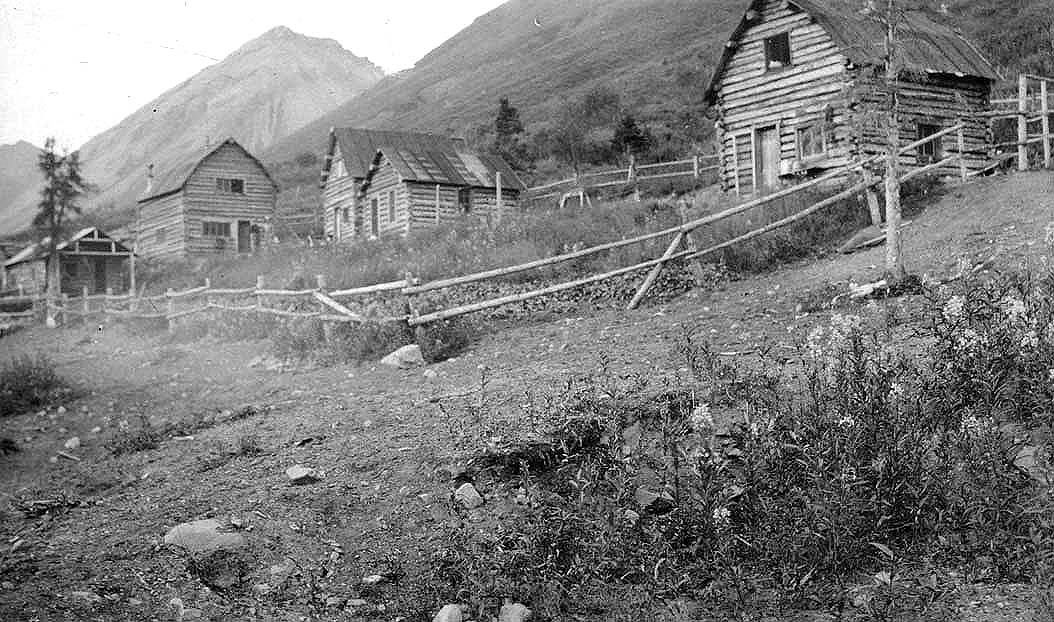
Bleakley Collection Nugget CreekThe Kuskulana drainage is situated along the western slope of the Wrangell Mountains, and is a tributary of the Chitina River, which is the major western flowing tributary of the Copper River. Access starts at mile 14.5 of the McCarthy Road from the Kotsina Road near Strelna and then hiking up the 18 mile historic Nugget Creek Trail. In 1902, James McCarthy and friend Warren Leach in 1907 staked a number of gold claims on both sides of the Kuskulana River near Nugget Creek and Trail Creek. Within several years, a copper mining camp and operations had been developed by the Alaska Copper Corporation. The site developed as the demand for copper grew at the onset of WWI. The mining operation was short lived, ending in 1919, yet traces of the Nugget Creek Mine and its associated road remain to commemorate this historic activity in the larger Kotsina-Kuskulana Historic Mining District. 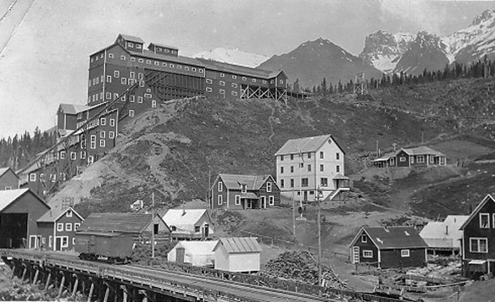
Bleakley Collection KennecottLocated five miles beyond the Kennicott River footbridge at the end of McCarthy Road, it includes the land and mining claims that formed the foundation for the Kennecott Copper Corporation. The operation had three components: the mines where copper ore was extracted from the mountains, the mill town where the ore was processed and the extensive railway to transport the ore to Cordova. From 1911 to 1938, nearly $200 million worth of copper was processed. At the peak of operation, approximately 300 people worked in the mill town and 200-300 in the mines. Kennecott was a self-contained company town that included a hospital, general store, school, skating rink, tennis court, recreation hall, and dairy. By the late 1920s, the supply of high-grade ore was diminishing, and Kennecott Copper Corporation was diversifying into other mines elsewhere. Declining profits and increasing costs of railroad repairs led to the eventual closure of the Kennecott operation by 1938. 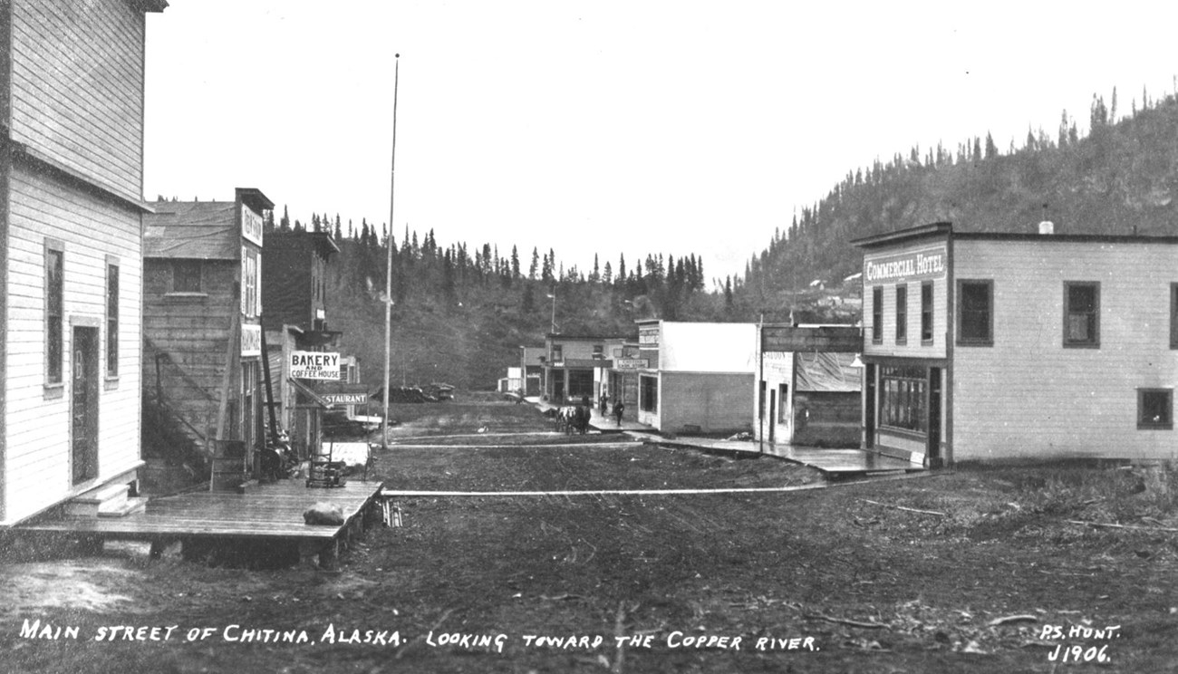
Bleakley Collection ChitinaChitina town is located at mile 34 of the Edgerton Highway, on the west bank of the Copper River at the confluence with the Chitina River, 53 miles southeast of Copper Center. Rich copper deposits were discovered at the turn of the century along the northern flanks of the Chitina River Valley, bringing a rush of prospectors and homesteaders to the area. The Copper River & Northwestern Railway enabled Chitina, a train depot, to develop into a thriving community by 1914. It had a general store, clothing store, meat market, stables, a tinsmith, five hotels, rooming houses, a pool hall, bars, restaurants, dance halls and a movie theater. At that time, almost all of Chitina was owned by a surveying engineer for the Kennecott Mines, who supplied electric power to the town with a unique hydroelectric system. 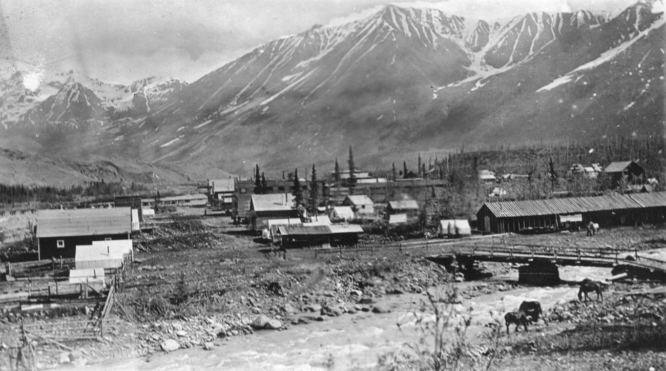
Bleakley Collection McCarthyMcCarthy, originally called Shushana Junction is located on the Kennicott River at the mouth of McCarthy Creek, in the heart of Wrangell-St. Elias National Park and Preserve. It is 61 miles east on the gravel McCarthy Road from the town of Chitina. Access to town is by foot across the Kennicott River footbridge and a small ½ mile walk. The town was established in the early 20th century around 1906 as the nearby copper mining town of Kennecott was developing five miles away. Named after James McCarthy, a local prospector, by 1911 the town had restaurants, pool halls, hotels, saloons, two newspapers, a dress shop, a photography shop, auto repair shop, shoe shop, a red light district and a hardware store. Before Anchorage was established in 1914, McCarthy was considered the largest town in Alaska with over 1,000 residents. McCarthy town grew rapidly as the Copper River and Northwestern Railway line transported copper ore to Cordova. Between 1938 when Kennecott closed to the late 1960’s, McCarthy town was almost abandoned, inhabited by just a few families. With increased tourism and the Alaska Pipeline in the 1970’s, the town was revived. 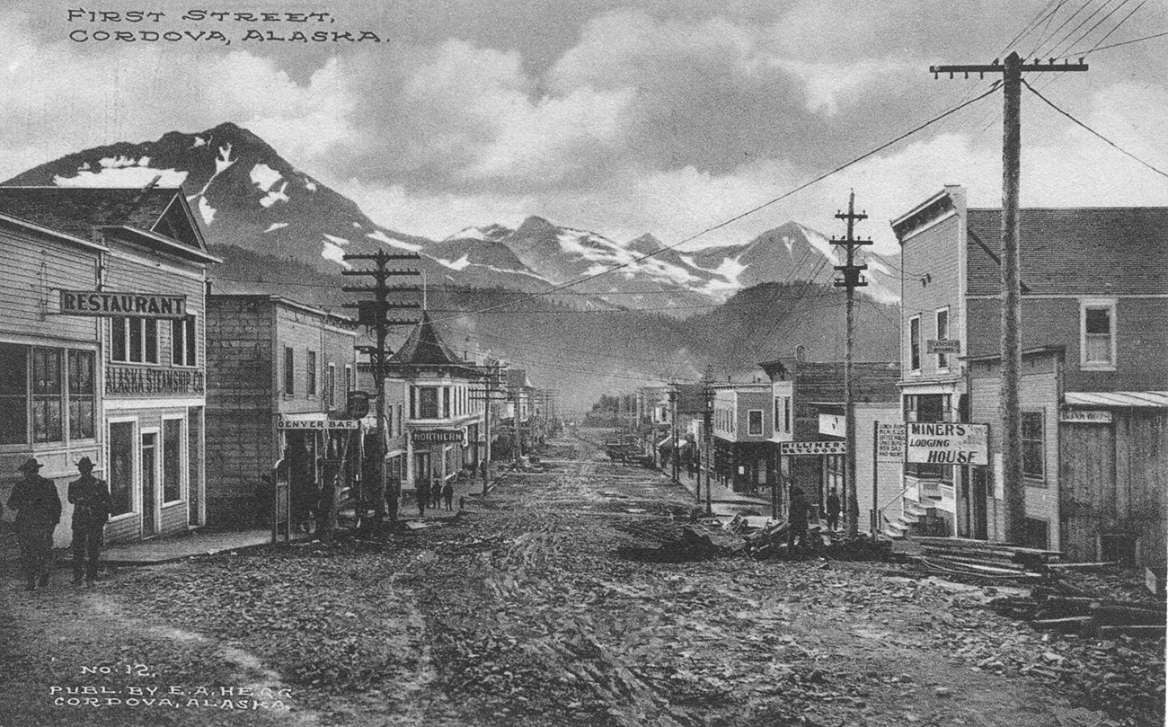
Bleakley Collection CordovaCordova a small remote village located along the Alaska coast near the mouth of the Copper River in Prince William Sound. It was founded as a result of the discovery of high-grade copper ore at the Kennecott mines. A group of surveyors from Valdez laid out a town site and an engineer railroad builder purchased half the land for the terminus of the Copper River and Northwestern Railway in 1906. The new townsite was named Cordova in reference to the name Puerto Cordova that Spanish explorer Salvador Fidalgogave to Orca Inlet in 1790. As Kennecott and the railroad grew, so did the town. Eventually schools, businesses, a hospital, and utilities were established. After the railroad was completed in 1911, Cordova became the transportation hub for the ore coming out of Kennecott and supplies going there and to all of the train depots along the train route. In the years from 1911 to 1938, more than 200 million tons of copper ore was transported through Cordova to the smelter in Tacoma, Washington. 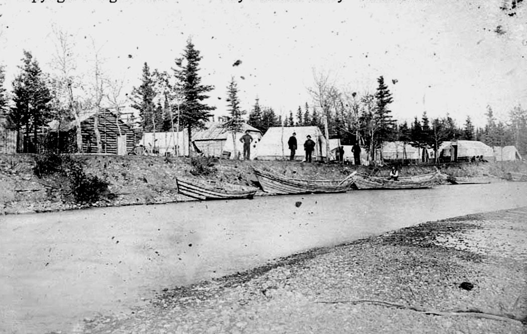
Bleakley Collection Copper CenterCopper Center is located at the confluence of the Klutina and Copper rivers, 100 miles north of Valdez. Founded in 1898 during the gold rush, the promise of gold drew prospectors north from the Lower 48 States to Alaska that year. About 4,000 prospectors traveled on the Valdez Trail to the Copper River Valley, where they thought they would find gold, much closer than Fairbanks, Dawson and the Forty Mile in the Yukon. In the late winter and early spring of 1898, the prospectors crossed the Valdez and KlutinaGlaciers. Then, they built boats and tried to navigate the Klutina River. Those that made the trip successfully reached the confluence of the Klutina and Copper rivers in the early summer of 1898. The mixed lot of prospectors established a supply depot of rough log cabins and tents, a black smith shop, smoke houses, a hotel, store, post office and even the first telegraph office. Prospectors used Copper Center as a base from which to explore the surrounding country in search of gold and copper. |
Last updated: February 4, 2022
