Last updated: July 2, 2025
Thing to Do
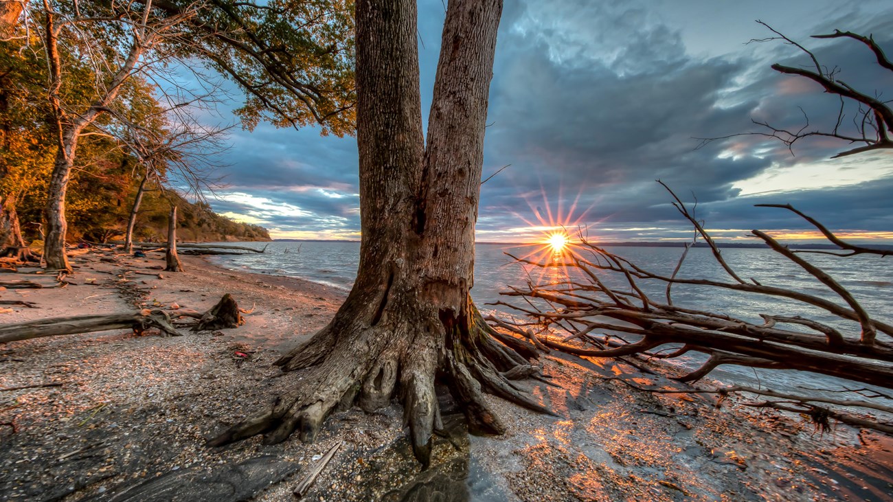
Take a walk through time to the bank of the Potomac River
BLM Photo
Douglas Point Special Recreation Management Area, managed by the Bureau of Land Management, is one of the last undeveloped tracts along the Potomac River and includes a magnificent hardwood forest, remnants of an historic home, habitat for a wide variety of terrestrial and aquatic species, unique wetlands, and the evolving ecosystem associated with the shipwrecks in Mallows Bay. Take a two-mile walk from the parking area to access the shoreline of the Potomac River to relax along the river, search for shark teeth, or enjoy a picnic at the overlook.
Trailhead: Chiles Homesite “South” Trailhead
Address: 9699 Riverside Rd, Nanjemoy, MD 20662
GPS Coordinates: 38°26'33.9"N 77°14'58.9"W
Trailhead: North Trailhead
Address: 9275 Riverside Rd, Nanjemoy, MD 20662
GPS Coordinates: 38°27'23.616"N -77°15'1.9506"W
A map of Douglas Point Special Recreation Management Area
Details
Duration
1-3 Hours
Activity
Hiking
Pets Allowed
Yes
On a leash.
Activity Fee
No
Entrance fees may apply, see Fees & Passes information.
Location
Douglas Point Special Recreation Management Area
On the Potomac River in Charles County, Maryland.
Reservations
No
Season
Year Round
Accessibility Information
There are 2 packed gravel parking areas in the Douglas Point SRMA. The North Trailhead lot has 1 designated accessible parking space with 5 other parking spots, although the entire lot should be suitable for people with mobility devices. The South Trailhead lot has 5 parking spots. None of them are designated for accessible parking but this lot should also be suitable for mobility device users.
The South Trailhead parking lot is next to the accessible Chiles Homesite Trail, which takes visitors 1/3 mile to the historic homesite. This gravel trail is relatively flat, 5 feet wide, and has interpretive panels and 1 bench near the Homesite. At the Homesite, visitors can continue north on the Cal Posey Trail 1 mile to the North Trailhead parking lot or go back to the South Trailhead parking lot. The Cal Posey Trail is “easy” but wasn’t built to be accessible.
Both the accessible Chiles Homesite Trail and the Cal Posey Trail are designated as multi-use (hiking, mountain biking, and equestrian) and are part of the Potomac Heritage National Scenic Trail.
The other trail at the site, not built to be accessible, is the 1/2-mile “easy” Blue Banks Beach Trail, which leads from the Cal Posey Trail to the Blue Bay Beach.
There are no restrooms or potable water at Douglas Point.
View images of accessibility features

Bureau of Land Management