Last updated: February 6, 2023
Thing to Do
In the Steps of Soldiers
NPS Photo
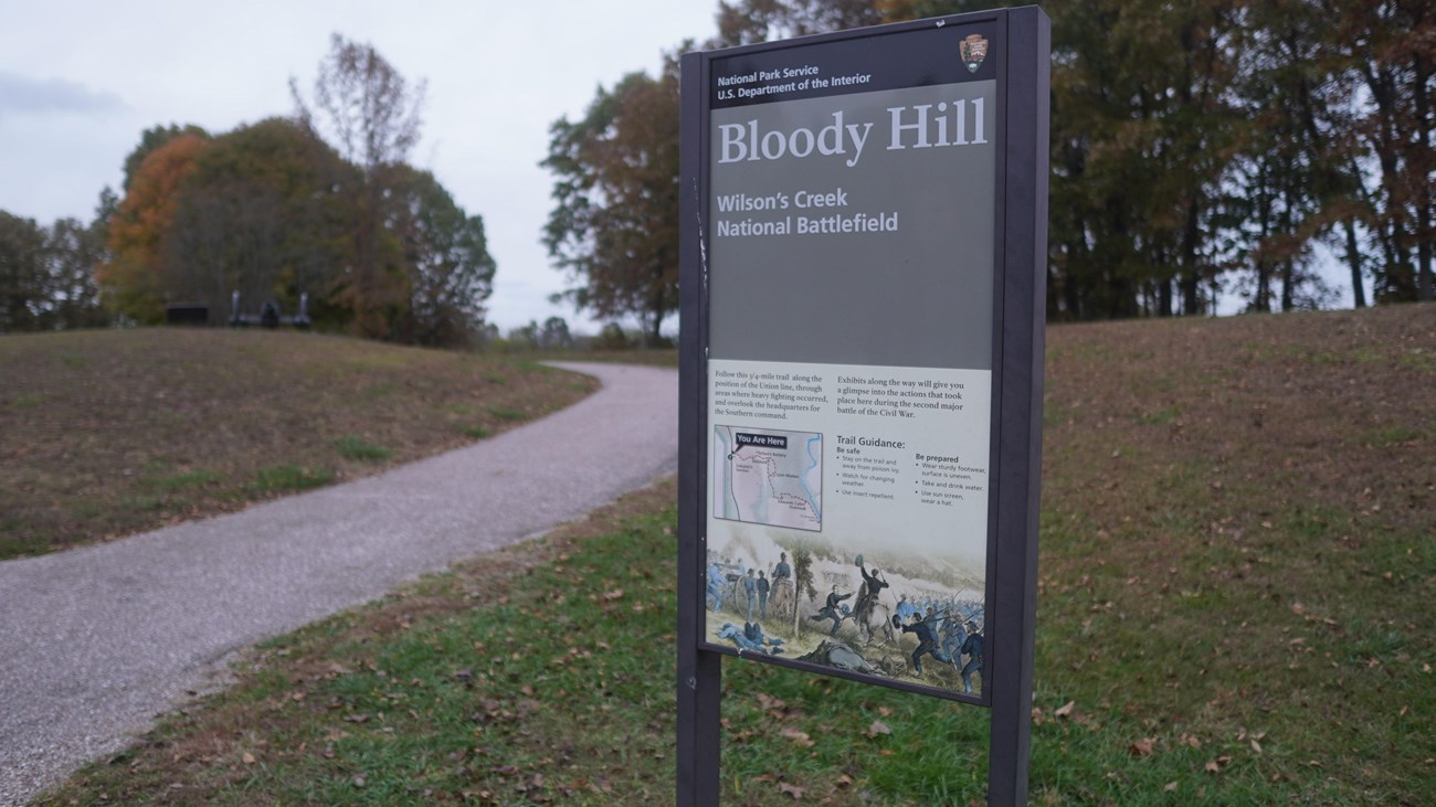
Hike in the footsteps of Federal and Southern soldiers on five walking trails varying in length between one-quarter and three-quarters of a mile. Travel along the Historic Wire Road, discover where General Lyon took his last stand on theBloody Hill Trail, or hike the rugged terrain of Manley Uplands Trail. Get your heart pumping as you traverse the Battlefield.
Details
Duration
2-3 Hours
Hiking Bloody Hill and trails can take anywhere from one hour to eight hours depending on your interest and hiking abilities. The park has over 10 miles of differently designated trails.
Activity
Self-Guided Tours - Walking
Hike in the footsteps of Federal and Southern soldiers on five walking trails varying in length between one-quarter and three-quarters of a mile. Travel along the Historic Wire Road, discover where General Lyon took his last stand on the Bloody Hill Trail, or hike the rugged terrain of Manley Uplands Trail. Get your heart pumping as you traverse the Battlefield.
Age(s)
4-90
The age for hiking depends on the persons physical and mental abilities and the trails the person chooses to hike. All ages welcome!
Pets Allowed
Yes
Pets are welcome!
Pets are allowed on a 6 foot leash and anywhere outdoors. If your pet is a service animal then it is allowed in the indoor buildings that are accessible to the public.
Pets are allowed on a 6 foot leash and anywhere outdoors. If your pet is a service animal then it is allowed in the indoor buildings that are accessible to the public.
Activity Fee
No
Entrance fees may apply, see Fees & Passes information.
Location
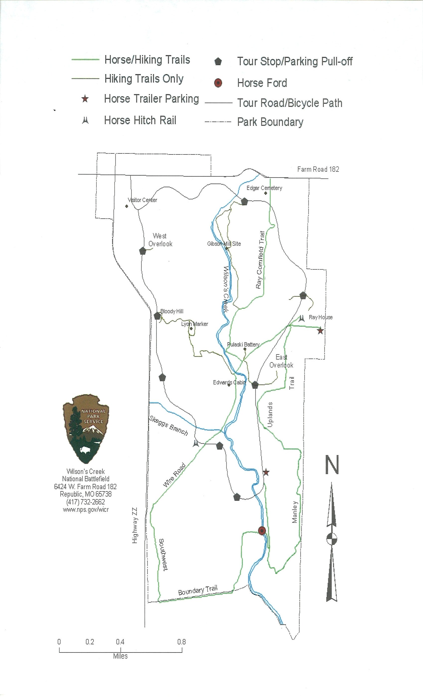
Bloody Hill
Tour Stop # 7 Bloody Hill, on driving tour map.
Reservations
No
Season
Spring
Summer months are frequently hot and humid, with occasional showers and thunderstorms. Winter months (especially January and February) are frequently cold, with occasional ice and light snow. Spring and fall months are generally pleasant, with occasional showers.
Time of Day
Day
Tour road, battlefield, and trails are open during posted hours (changes by season). Tour Road opens at 7:00 am for walkers and bicycles only. Vehicle entrance begins at 8:00 am which requires a gate token issued inside the visitor center. The visitor center and museum hours are 8:00 am to 5:00 pm daily, seven days a week.
Accessibility Information
-
The Visitor Center has three accessible parking spaces, and there is a paved sidewalk to its entrance. There is an accessible restroom, and it is all on one level. A wheelchair is available for use at the Visitor Center.
-
The brochure is not available online, or in audio description format currently. The brochure is available in braille at the visitor center information desk.
-
Please give us two weeks notice if you need an ASL Interpreter.
-
A park staff member can provide live audio description if you provide us with two weeks advanced notice.
Contact:
-
Phone: 417-732-2662
-
Email: billie_aschwege@nps.gov
Tour Road
-
The length is 4.9 miles with a 150 ft elevation change.
-
The one-way tour road is 18 feet wide. The left lane (12 feet wide) is for vehicles. The right lane is for pedestrians and bicycles.
-
At each of the 8 stops, there are parking areas with designated accessible parking spaces.
-
The waysides at Stop 1, Stop 3, Stop 4, and Stop 7 (Bloody Hill) are accessible
-
The trails off the Tour Road are natural surfaces.
-
The stops are not audio described at this time.
Trail Information
-
Gibson Mill: 1 mile and 40 ft elevation change
-
Ray Cornfield: 1 mile and 80 ft elevation change (horses allowed)
-
Ray House: <0.25 mile and 30 ft elevation change
-
Ray Springhouse: <0.25 mile and 30 ft elevation change
-
East Overlook: <0.25 mile and 60 ft elevation change
-
Pulaski Battery: <0.25 mile and 50 ft elevation change
-
Manley Uplands: 2.5 miles and 170 ft elevation change (horses allowed)
-
Southwest: 1.7 miles and 140 ft elevation change (horses allowed)
-
Wire Road: 1.7 miles and 150 ft elevation change (horses allowed)
-
Bloody Hill: 0.5 mile and 60 ft elevation change
-
Bloody Hill Spur: 0.5 mile and 100 ft elevation change
-
Du Bois’s Battery: 0.25 mile and <10 ft elevation change
-
West Overlook: 0.25 mile and <10 ft elevation change
Learn more about accessibility at Wilson’s Creek National Battlefield.
Pets are allowed at Wilson's Creek National Battlefield on a 6 foot leash.
B. A. R. K Ranger Policies
Bag your pet’s waste
Always leash your pet
Respect wildlife
Know where you can go