Last updated: December 31, 2020
Lesson Plan
Locating Glacier National Park

- Grade Level:
- Middle School: Sixth Grade through Eighth Grade
- Subject:
- Science,Social Studies
- Lesson Duration:
- 60 Minutes
- Additional Standards:
- NGSS MS-ESS2-6. Develop and use a model to describe how unequal heating and rotation of the Earth cause patterns of atmospheric and oceanic circulation that determine regional climates.
Essential Question
What are the landmarks near Glacier National Park?
Objective
Students will be able to:
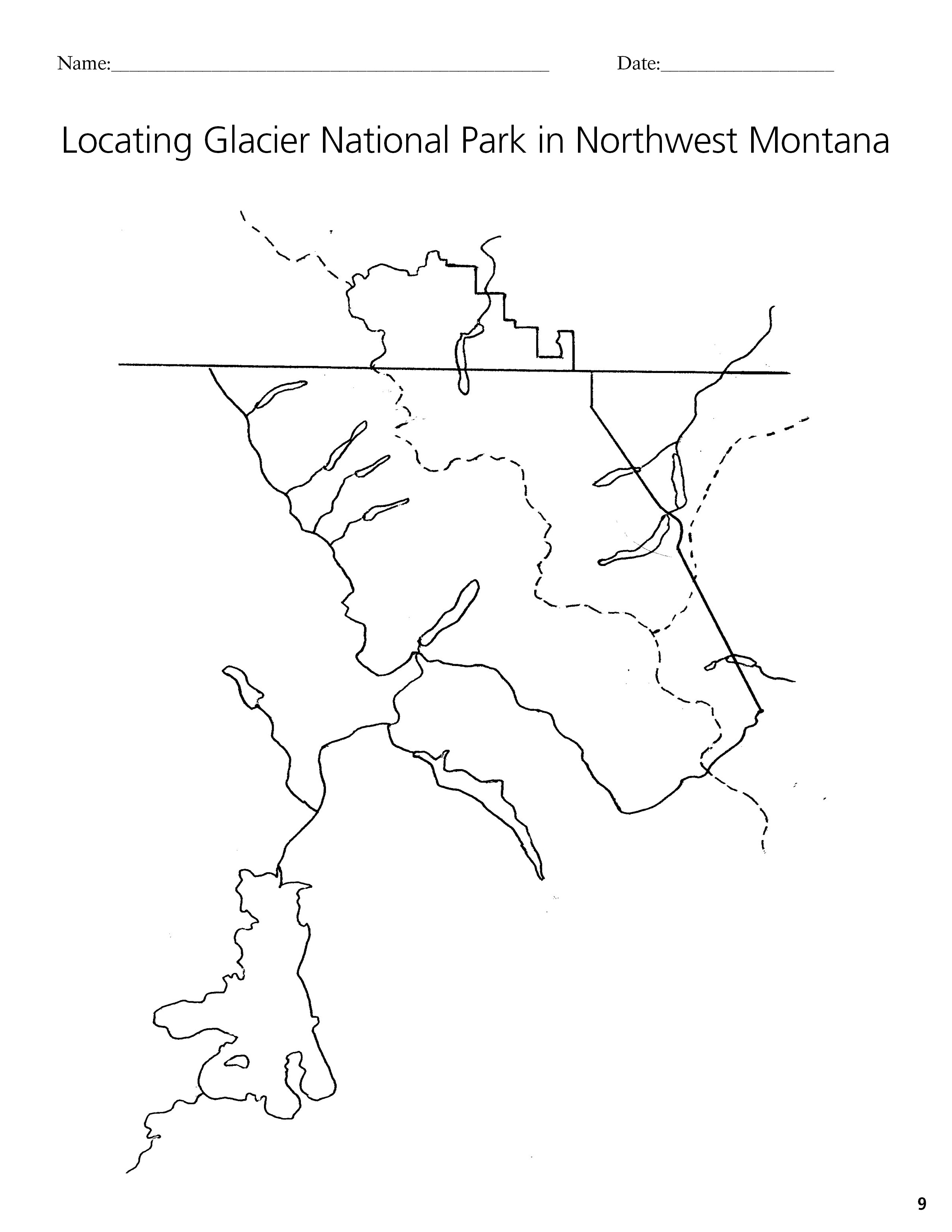
1. Locate Glacier National Park and other landmarks within Montana in relation to: the Continental Divide; Waterton Lakes National Park; Alberta and British Columbia; the three divides :Pacific, Hudson Bay and Gulf of Mexico; and the students’ community.
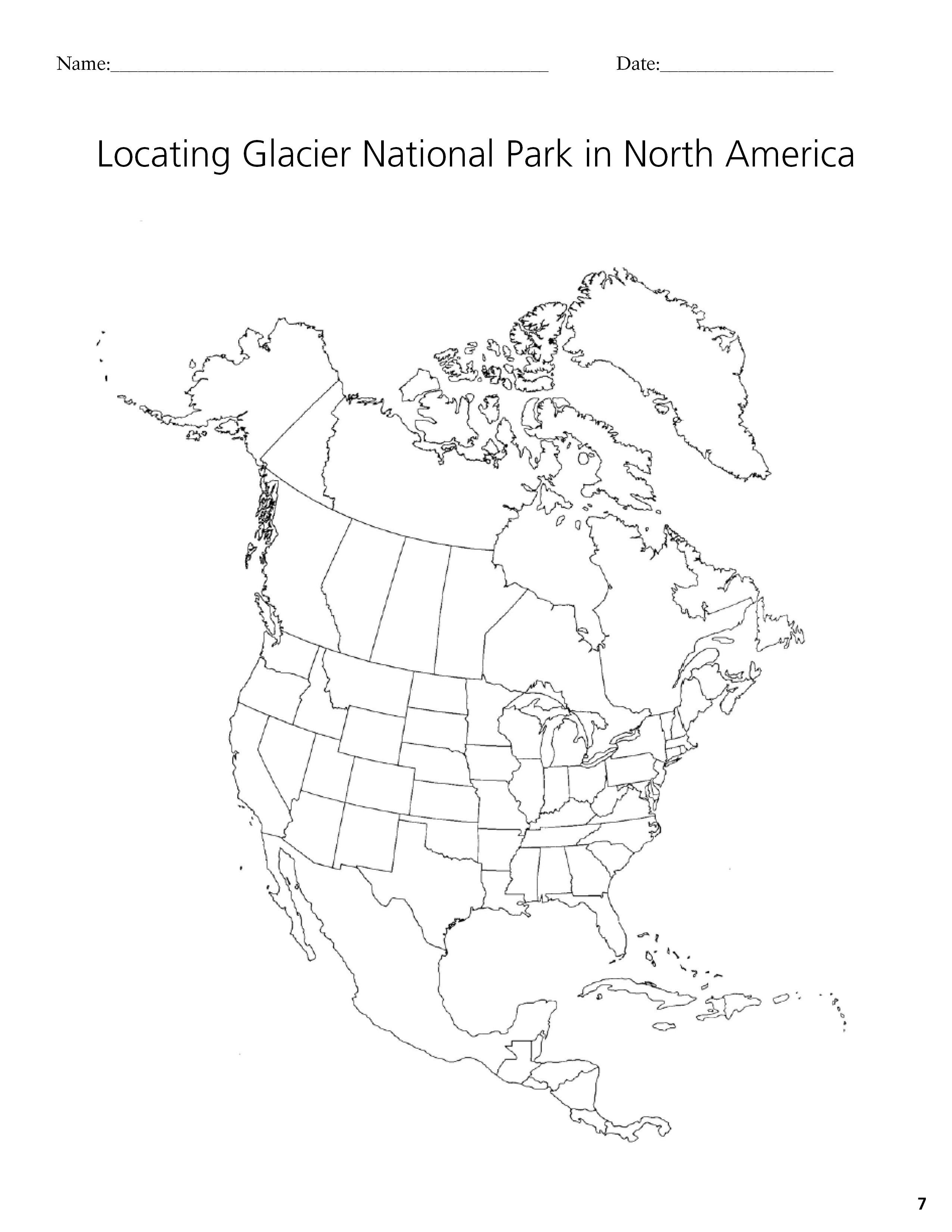
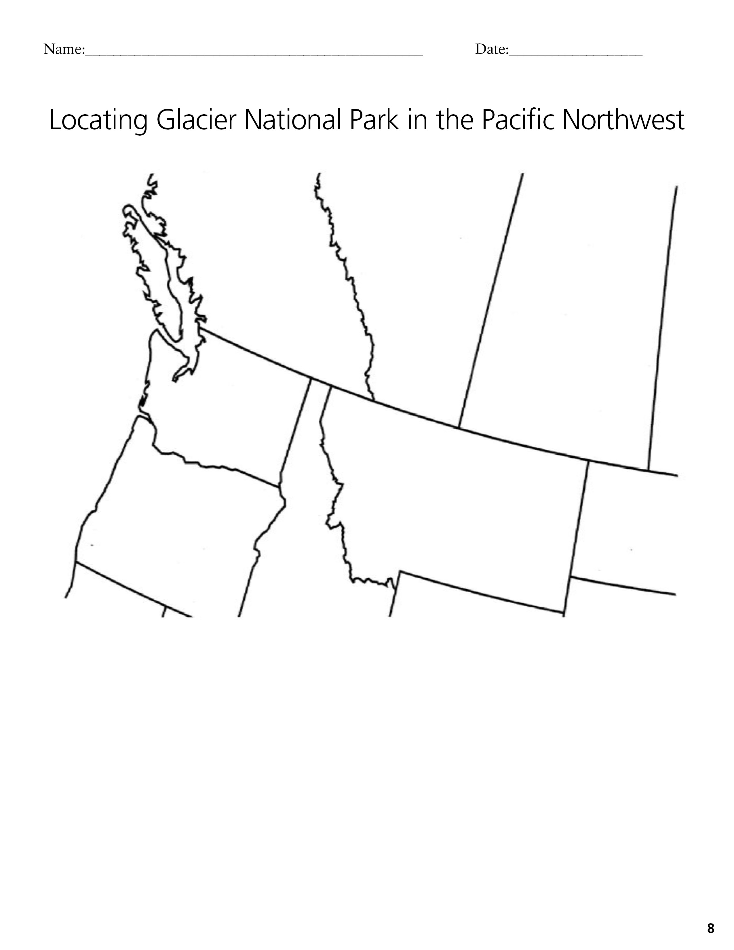
2. Locate Glacier and Montana in relation to the Pacific Northwest and in relation to North America.
3. Identify the bodies of water that Glacier’s waters ultimately flow into.
Background
Even before Glacier National Park was established in 1910, it was an important cultural and economic contributor to the state of Montana. The scenery of the area attracted visitors, mostly by train, well before the park was established. The Great Northern Railroad (now Burlington Northern Santa Fe) still runs along the park’s southern border and Amtrak still carries visitors to and from the area.
For Native Americans whose homelands encompassed Glacier, the area has great spiritual significance. The Blackfeet refer to the mountains here as the “backbone of the world.” The Kootenai translation for the Lake McDonald area refers to it as “a good place to dance.” Today, the Blackfeet Reservation shares Glacier’s eastern border. The Kootenai, Salish, and Pend d’Oreille are part of the Flathead Reservation south of Glacier
Glacier National Park straddles the Continental Divide. The divide defines watersheds. West of the divide water flows to the Pacific Ocean and east of the divide water flows to the Gulf of Mexico or Hudson Bay. Because water from the park flows in three different directions, Glacier contains a rare geologic feature-a triple divide. Water from Glacier passes through many different places on its way east or west. The people and animals living around Glacier depend on this water. For instance, Lake McDonald eventually flows into Flathead Lake via the Flathead River. Along the way that water passes through Columbia Falls and Kalispell.
The Flathead National Forest shares Glacier’s western and southern boundaries. The Blackfeet Indian Reservation shares the eastern boundary. North of the park are the Canadian provinces of Alberta and British Columbia in Canada. Waterton Lakes National Park is Glacier’s sister park in Alberta, Canada. The two parks merged in 1932 to become the world’s first International Peace Park.
Preparation
- Map handouts (Glacier National Park, Pacific Northwest and Western Canada, North America)
- List of landmarks
- Colored pencils
Materials
Download Locating Glacier National Park in North America
Download Locating Glacier National Park in Pacific Northwest
Download Locating Glacier National Park in Northwest Montana
Procedure
- Using a globe or North American map, introduce students to the location of Montana in the United States and in North America. Point out the location of various landmarks - Rocky Mountains, Canadian Border, the Pacific Ocean, Gulf of Mexico, and Hudson Bay, the plains of eastern Montana.
- Then, using the transparencies, for the United States and North America see if together as a class, you can locate and label those same landmarks.
- Discuss the location of the students’ hometown on the map of Glacier and vicinity. Also discuss the location of various protected lands within Montana - national forests, national parks. Point out the Indian Reservations, the three watersheds, and major rivers.
- Distribute a copy of the three maps to each student. Decide in advance which things on each map you want them to be able to label. On the North American map they can label the oceans, countries, and state of Montana. On the Pacific Northwest map, they could label the Canadian provinces, American states, and the ocean. On the Glacier map, they could label their home town, the rivers, the lakes, and the 3 watersheds.
Extension
Discuss the importance of the geographic location of Glacier National Park. Have students hypothesize as to why certain types of plants and plant communities live in the park. What about the different animal species that live in Glacier?
Vocabulary
Continental Divide, national forest, national park, Indian Reservation, Peace Park, triple divide, watershed.
Assessment Materials
On a road map have students trace the route from their school to Glacier National Park. Have them do the same for other landmarks on the map as well.