Last updated: March 17, 2022
Lesson Plan
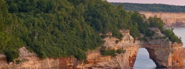
Pictured Rocks National Lakeshore Virtual Field Trip

- Grade Level:
- Upper Elementary: Third Grade through Fifth Grade
- Subject:
- Science
- Lesson Duration:
- 60 Minutes
- State Standards:
- State: MI
Math
4.MD.5, 4.G.2
Language Arts
WS.4.1, WS.4.2,
WS.4.6, SL.4.1,
RI.4.7
Science
4-ESS-1, 4-ESS2-2,
3-5-ETS1-2
Social Studies
4-H3.0.1, 4-G1.0.3,
4-G1.0.4, 4-G5.0.1,
4-C1.0.1, 4-C1.0.2,
4-C5.0.3
Art
ART.VA.I.4.3,
ART.VA.II.4.2
Essential Question
What are federal lands and waters and who owns them?
Objective
Students will explore federal lands and take a virtual field trip to Pictured Rocks National Lakeshore. Activities illustrate the functions of federal lands and waters, the techniques needed to evaluate landscapes based on National Park Service criteria, and the students role as stewards of their public lands. Activities are designed to be flexible, allowing a ranger to lead one or more activities virtually, or for classrooms to experience a self-guided program.
Preparation
Format 1: Self guided - Teacher will lead lessons at own pace using videos and worksheets listed below.
Format 2: A ranger will lead a 30-40 minute lesson that combines topics covered in the video series (Introduction to federal lands and waters, virtual field trip to Pictured Rocks National Lakeshore, landscape architect activity, and Leave No Trace.)
If using the self-guided format please send an email to piro_education@nps.gov with the school name and address, grade level, and number of students who watched the videos. We will send you an information packet that includes a map and several park brochures for your classroom as well as a sticker for each student! We are also happy to help 4th grade students receive their Every Kid Outdoors pass.
To schedule format 2 that includes a ranger leading lesson virtually, please use piro_education@nps.gov at least 2 weeks in advance. Rangers are available for programs Monday through Friday. Classrooms utilizing these formats will also receive an information packet for their classroom and help with 4th graders receiving their Every Kid Outdoors pass!
For the virtual field trip, you will need internet connection, pencil, and worksheet (or blank piece of paper). Video links are found in the procedure section.
Materials
Every Kid Outdoors Virtual Field Trip Worksheet
Federal Brochure Map Activity
Download Post Virtual Field Trip Activity
Procedure
How to Participate:
Format 1: Self guided - Teacher will lead lessons at own pace. Watch videos part 1, 2A, 2B, and 3. Download and print worksheets for students or have them work on a blank piece of paper. Videos range from 6-12 minutes each, with times to pause for student engagement. Videos need to be watched in order, but can be broken up over multiple class periods. There is an audio described version for each video.Format 2: A ranger will lead lesson virtually. Please schedule using piro_education@nps.gov.
Assessment Materials
Post Virtual Field Trip ActivityThis is a fun and creative activity after the virtual field trip where students create a new federal land, create a brochure for their new land, and include rules on how to care for the federal land or water.
Tell the students to pretend they work for the federal government and must create a new National Park, National Forest or National Wildlife Refuge in our country. Pass out a brochure (listed in the materials section) to each student and have them follow the listed instructions:
-
Where is it located? (Students may use a United States map as a reference.)
-
What does the federal land and/or water protect? (For example, areas protecting natural or historical resources and varioustypes of environments such asbeaches, mountains, rivers, grasslands, buildings, forests, lakes, etc.)
-
What activities can visitors do in their federal land and/or water? (For example, camping, exploring, hiking, swimming, picnicking, rock climbing, biking, boating, fishing, hunting, winter sports, etc.)
-
What are the rules visitors will need to follow? (For example, do not litter, stay on the trail, fish only with a permit, camp only in campgrounds, etc.)
-
How will the map assist visitors in getting around the federal land and/or water? (For example, drawing the roads to drive to scenic spots, places to camp or hike, areas to swim or fish, etc.)
