NPVuln

We know with certainty that climate change is affecting national parks and will continue to do so. To manage parks effectively, we need to know which parks are most vulnerable to climate change. That's where NPVuln comes in. This project evaluated climate change factors to determine parks' relative vulnerability and identify which ones are high priority for further study.
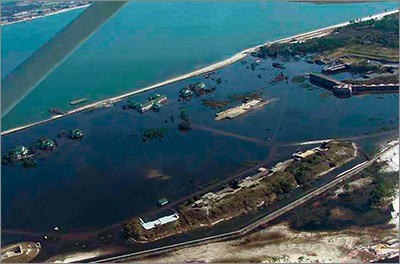
A picture taken from an airplane that shows flooding across a town
Gulf Island National Seashore’s Historic District flooding after Hurricane Ivan in 2004
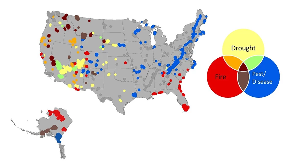
We used 47 indicators to evaluate parks' exposure to climate changes, sensitivity to these changes, and their adaptive capacity. We found that 71% of all national parks in the contiguous U.S. are at high risk from the effects of climate change, and 57% are at high risk from at least one potentially transformative, high-impact factor. (These high-impact factors include fire, drought, sea level rise, and forest pests/disease.) While many parks in the western U.S. are at high risk from these single transformative factors, inland and eastern parks tend to be high risk because of how climate change may exacerbate existing challenges such as poor air quality and restricted habitats. In all, the Great Plains and the Northern Forest and Plains ecoregional groups had the highest proportion of highly vulnerable parks.

The complete NPVuln report fully describes the 47 indicators, 21 climate factors, and much more, including a comprehensive set of results and recommendations. You can also download a summary brief [PDF] and an Overview for Park Professionals [PDF].
A U.S. map with different colored dots representing parks vulnerable to drought, fire, and pests or disease
An example of a figure from the NPVuln report. This map shows parks that met thresholds for high-impact vulnerability factors including fire, near-future forest pest and disease risks, and summer drought, with overlapping colors indicating high scores for multiple categories.

Last updated: February 5, 2024

Tools

  • Site Index