Last updated: April 23, 2025
Place
Wayside: Defining A Border

NPS
Benches/Seating, Cellular Signal, Historical/Interpretive Information/Exhibits, Wheelchair Accessible
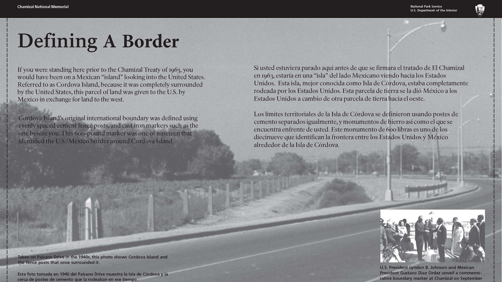
An interpretive panel at this wayside highlights the historic boundary marker (relocated) and remaining original fenceposts that once were the dividing line between the United States and Mexico’s Cordova Island. On October 28, 1967, the two countries transferred land as stipulated in the 1963 Chamizal Treaty, dividing Cordova Island and shifting the boundary to the new channel of the Rio Grande. The boundary markers and fence around the former “island” became obsolete since all Mexican land north of the river channel passed to the United States.
Interpretive Panel Text
The "Defining A Border" wayside panel presents text in both English and Spanish.
If you were standing here prior to the Chamizal Treaty of 1963, you would have been on a Mexican ‘island’ looking into the United States. Referred to as Cordova Island because it was completely surrounded by the United States, this parcel of land was given to the U.S. by Mexico in exchange for land to the west. Cordova Island’s original international boundary was defined using evenly spaced cement fence posts and cast iron markers such as the one before you. This 600-pound marker was one of nineteen that identified the US-Mexico border around Cordova Island.
Primary Photo Caption
The main panel image shows a wire fence running along a row of obelisk-shaped posts. To one side of the fence is a paved street. The other side is covered with trees and shrubs. The image is captioned, “Taken on Paisano Drive in the 1940’s this photo shows Cordova Island and the fence posts that once surrounded it.”
Inset Photo Caption
The interpretive panel has an inset photo of two men shaking hands in front of a shiny obelisk and group of people. It is captioned, “U.S. President Lyndon B. Johnson and Mexican President Gustavo Diaz unveil a commemorative boundary marker at Chamizal in October 1967.”
