Last updated: November 12, 2024
Place
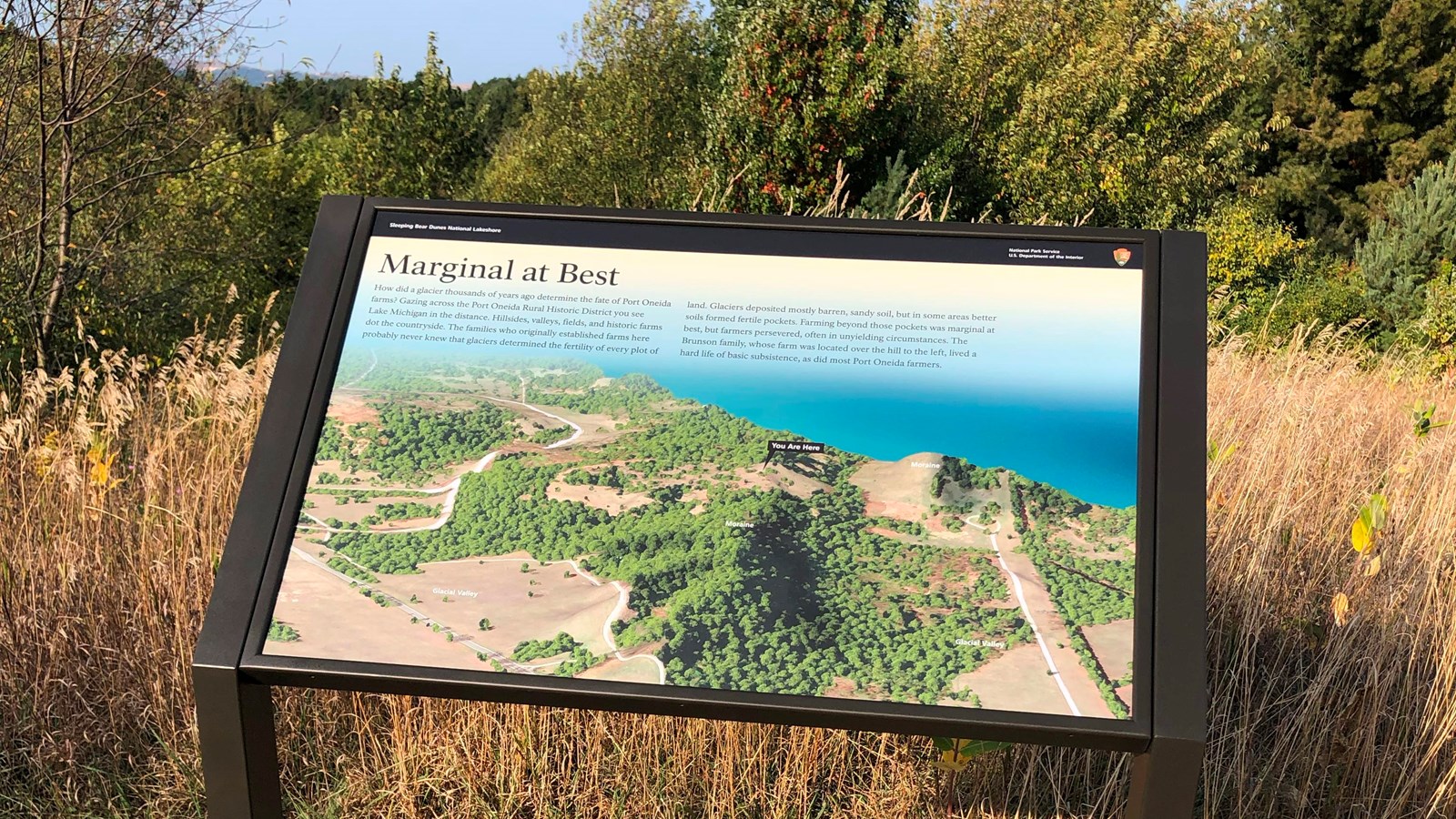
Wayside: Marginal at Best
Quick Facts
Location:
44° 56' 20.292" N, 85° 56' 58.542" W
Amenities
1 listed
Audio Description
Main Exhibit Text
How did a glacier thousands of years ago determine the fate of Port Oneida farms? Gazing across the Port Oneida Rural Historic District you see Lake Michigan in the distance. Hillsides, valleys, fields, and historic farms dot the countryside. The families who originally established farms here probably never knew that glaciers determined the fertility of every plot of land. Glaciers deposited mostly barren, sandy soil, but in some areas better soils formed fertile pockets. Farming beyond those pockets was marginal at best, but farmers persevered, often in unyielding circumstances. The Brunson family, whose farm was located over the hill to the left, lived a hard life of basic subsistence, as did most Port Oneida farmers.
Background Image
The background of this exhibit is an aerial image of the Port Oneida Rural Historic District. The image portrays the basic landscape of this area, including topography, tree cover, roads, and the shoreline where it meets Lake Michigan. Labels on the image include a "You Are Here" marker, moraines, and glacial valleys.