Last updated: November 8, 2024
Place
Wayside: A Reclaimed Wilderness
Quick Facts
Location:
45° 0' 32.92" N, 86° 5' 37.17" W
Amenities
1 listed
Audio Description
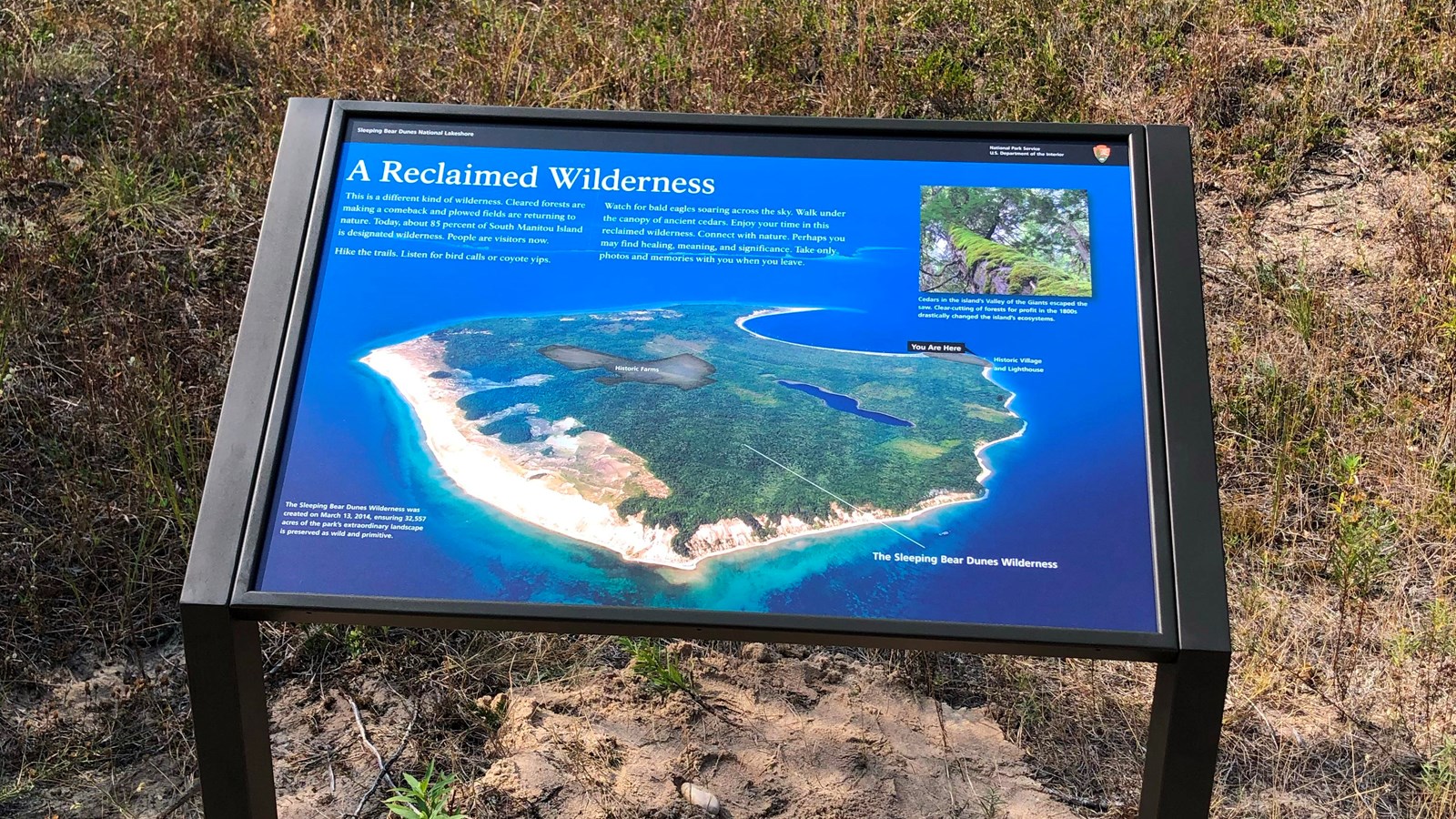
Main Exhibit Text
This is a different kind of wilderness. Cleared forests are making a comeback and plowed fields are returning to nature. Today, about 85 percent of South Manitou Island is designated wilderness. People are visitors now.
Hike the trails. Listen for bird calls or coyote yips. Watch for bald eagles soaring across the sky. Walk under the canopy of ancient cedars. Enjoy your time in this reclaimed wilderness. Connect with nature. Perhaps you may find healing, meaning and significance. Take only photos and memories with you when you leave.
Image Descriptions
Background Image
The background of this exhibit is an aerial photo of South Manitou Island. The water surrounding the island is deep blue and the island is mostly covered with green vegetation. Highlighted areas indicate a historic farm near the center of the island, and a historic village and lighthouse on the eastern shore where you are standing. A white line also points out the Sleeping Bear Dunes Wilderness area.
Caption
The Sleeping Bear Dunes Wilderness was created on March 13, 2014, ensuring 32,557 acres of the park’s extraordinary landscape is preserved as wild and primitive.
Cedar Tree (top right)
In the top right corner is a close-up image of a cedar tree trunk. The camera angle is looking up toward the canopy of the tree. The trunk is covered with bright green moss.
Caption
Cedars in the island’s Valley of the Giants escaped the saw. Clear-cutting of the forests for profit in 1800s drastically changed the island’s ecosystems.