



Last updated: June 9, 2026
Place
Warm Springs Ruby Mountains Trail Trace
Photo/L. Kreutzer
Quick Facts
Location:
About 27 miles south of Wells, Nevada, on west side of US-93 at milepost 47. GPS US-93 turnout 40.721305 -115.028542 GPS t-post at the fence 40.720795 -115.028908.
Significance:
This 2.3-mile section of original Hastings Cutoff wagon trace (1846-1850) crosses public lands from the Warm Springs area to the Ruby Mountains in Nevada.
Designation:
Historic Site on the California NHT.
MANAGED BY:
Amenities
5 listed
Historical/Interpretive Information/Exhibits, Parking - Auto, Parking - Bus/RV, Scenic View/Photo Spot, Trailhead
A faint wagon trace of the Donner-Reed Party’s route crosses a sagebrush plain from Warm Springs toward Nevada’s Ruby Mountains. Visitors can hike this 2.2-mile segment of the Hastings Cutoff, which is managed by the Bureau of Land Management. Because the route is not a loop, consider arranging a pickup at the south end on NV-229.
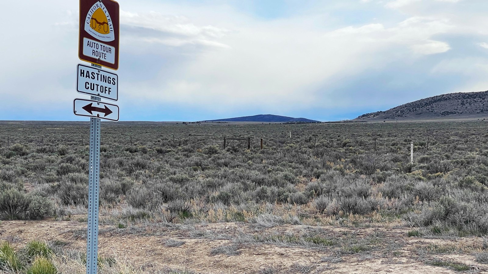
To begin, drive south on US-93 from Wells for 27 miles to milepost 47. Look for a California National Historic Trail Auto Tour Route and Hastings Cutoff sign at a turnout on the west (right) side of the highway. Park and walk to the nearby boundary fence, where a brown, t-shaped marker identifies the trail. Climb through or over the fence and follow the trail, marked by white posts, southwest for roughly 2 miles to a modern dirt road. Continue south along the road to a large turnout on NV-229.
Drivers meeting hikers can continue a mile south on US-93, then turn right on NV-229 toward Ruby Lake National Wildlife Refuge. The trail meets the highway at a gravel turnout 2.2 miles southwest of the junction.
To view the trail trace on satellite imagery, switch your mapping app to satellite mode and enter the GPS coordinates 40.720795 -115.028908. This point marks the t-shaped post at the boundary fence. From there, you can visually follow the trail southwest to the dirt road intersection.
Site Information
Location (About 27 miles south of Wells, Nevada, on west side of US-93 at milepost 47. GPS US-93 turnout 40.721305 -115.028542 GPS t-post at the fence 40.720795 -115.028908.)