Last updated: March 17, 2026
Place
Arizona: Walnut Canyon Bridge
Photo/Rhys Martin
Quick Facts
Location:
12771-12829 Townsend-Winona Rd Flagstaff, Arizona 86004
Significance:
Historic bridge along Route 66
Designation:
National Register of Historic Places
Amenities
1 listed
Historical/Interpretive Information/Exhibits
In 1922, the United States Bureau of Public Roads undertook a 23-mile road-building project along the Winslow Highway that stretched between Flagstaff and Angel through the Coconino National Forest in Arizona. The largest structure built as part of the project was the Walnut Canyon Bridge, which spans the canyon crossing Walnut Creek one mile northwest of Winona. Soon after its completion in 1924, the road and the bridge became part of Route 66.
After Arizona became a State in 1912, roads advocates began lobbying for assistance to upgrade Arizona’s roads. Individual counties had the primary responsibility for road building and maintenance in Arizona during the 1910s, and county governments were unable to meet the public demand for roads. Grades were rough and often treacherous, and bridges were few. In 1916, the Federal Government began distributing Federal money to State highway departments. Arizona received $3.7 million for the initial five-year program. In response, the existing State Engineer’s Office became the Arizona Highway Department, which quickly became the State’s largest agency. Right away, surveyors began work on the system that officially became Route 66 in 1926.
The 1922 Bureau of Public Roads projects were part of the period boom in road construction. Arizona received $216,507 in Forest Highway funds that year, part of a $6.5 million national appropriation for construction of highways through the country’s national forests. Federal engineers in Phoenix completed drawings for the Walnut Canyon Bridge in December 1922 and builders finished it by June of 1924.
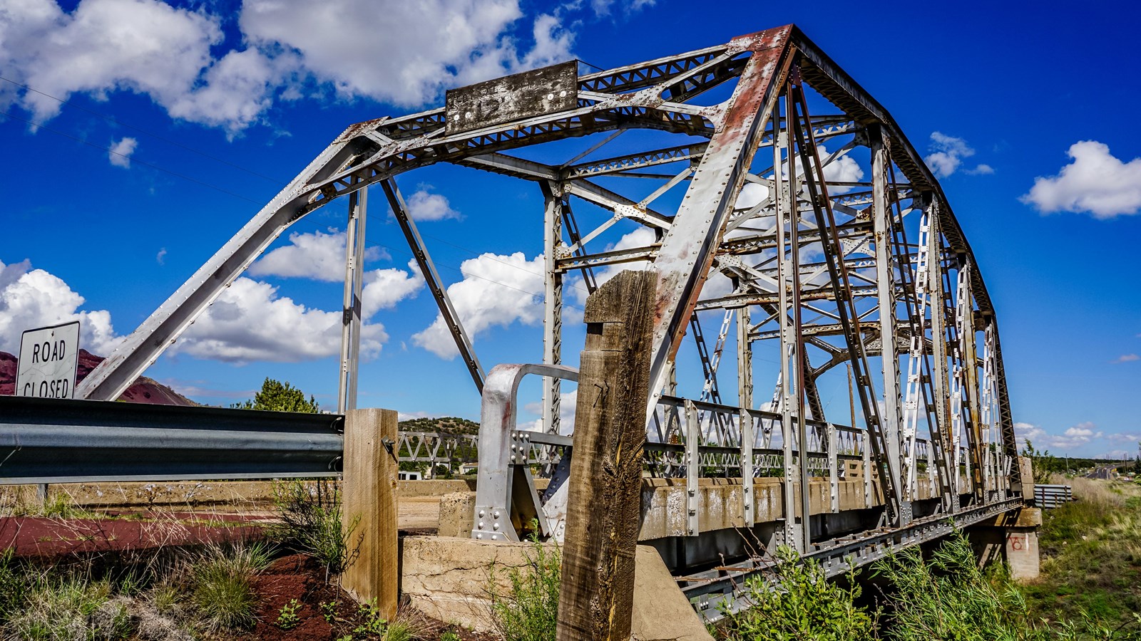
The bridge employs a straightforward design. It has a single span of 101 feet and a 19-foot-wide roadbed. The superstructure is of riveted steel and uses a five-panel Parker through truss. Truss bridges have a combination of members, usually arranged in a triangular configuration, to form a rigid framework. A Parker truss includes an additional element: an upper polygonal chord. The substructure has concrete abutments and wing walls. The floor is a concrete deck over steel stringers. The bridge has steel lattice guardrails with concrete curbs. The design and materials were efficient.
While the Walnut Canyon Bridge represents common construction of its time, it is now a rare surviving example on Route 66. The bridge is closed to traffic, but remains intact on a short stretch of abandoned roadbed. The National Park Service listed the Walnut Canyon Bridge in the National Register of Historic Places in 1988.
Site Information
Location (The Walnut Canyon Bridge is one mile northwest of Winona, AZ, and crosses Walnut Canyon on a former alignment of the Townsend-Winona Road/County Road 394 just north of the current alignment. A pullout provides a place to park and view the bridge; west of the bridge is North Copley Road and east of it is Bridge Road, both which run north from the Townsend-Winona Road.)