Last updated: December 31, 2024
Place
Wahweap Overlook
NPS
Quick Facts
Location:
off US Hwy 89, 3 miles north of Glen Canyon Dam
Significance:
Scenic View
Amenities
6 listed
Benches/Seating, Parking - Auto, Parking - Boat Trailer, Parking - Bus/RV, Scenic View/Photo Spot, Trash/Litter Receptacles
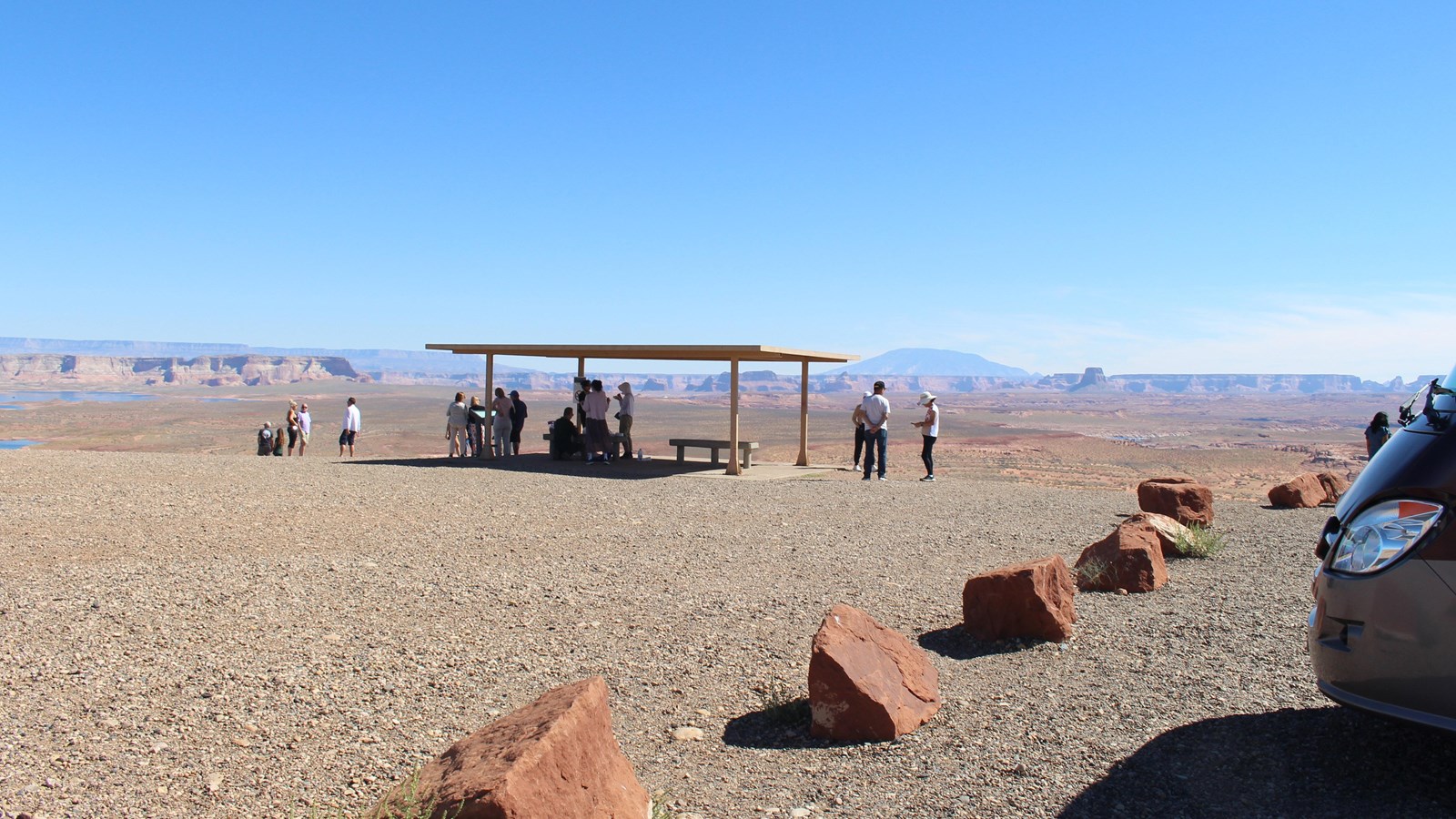
A short journey from the Carl Hayden Visitor Center, you will find the Wahweap Overlook. This high point offers a 360-degree panorama of the Glen Canyon National Recreation Area. It is a “must see” at anytime of day, however, sunrise and sunset adds a fusion of brilliant color to this awe-inspiring scene. There is a shade shelter and a bench for your viewing comfort. Bring a picnic, camera, and binoculars along and enjoy this delightful view.
Safety Comes First
Take plenty of water. Wear sunglasses, sunscreen, and a hat. Avoid hiking in the hottest part of the day. Tell a friend where you are hiking and when you will be home. There is no railing at the viewpoint. Parts of the edge are very slippery. Watch your footing, and keep track of your children!
Leave No Trace
Pack garbage out. Don’t disturb any plants or animals you come across. Dogs must stay on leashes no longer than six feet.
In every view, there is a story. Like a window to the past, the landscape before you represents a timeline of natural and cultural events. Within the panorama that is Glen Canyon, stories and secrets are revealed; and through exploration, we discover some of its mysteries. Glance over the Glen Canyon landscape, and imagine events form a distant past.
The Colorado River and Lake Powell
In 1869 Major John Wesley Powell led an expedition down the Colorado River, taking copious notes about the geography, geology, natural and cultural history he encountered along the way. With the building of the Glen Canyon Dam, nearly a century later, this reservoir would be his namesake. Lake Powell and the Colorado River provide water, vital to western habitation, by contributing to crop irrigation and water resources for the lower basin states of California, Nevada and Arizona, as well as Mexico. In addition, it provides clean hydroelectric power.
Throughout the years, the Colorado River has been both friend and foe. It has been a barrier to cross and conquer, a way to explore uncharted territories, a provider of vital resources, and simply a means to experience the adventure of it all. Lake Powell and the Colorado River continue to fulfill our zest for adventure.
Stories Within the Stone
On the north side of Lake Powell, the geological layers of the Straight Cliffs, Tropic Shale, and Dakota formations allude to a world long gone. Within the fossil record, a remnant of the Cretaceous period (144-65 million years ago) is revealed. Plesiosaurs, Ichthyosaurs, and Tortoises swam in a vast inland seaway. The shoreline sported a lush habitat and the first flowering plants appeared. Among them, dinosaurs roamed the earth and early mammals flourished.
Franciscan Explorers
On July 29, 1776 two Franciscan Priests, Padres Francisco Atanasio Domínguez, and Silvestre Vélez de Escalante set out on a quest. With a small assemblage of men, horses, and cattle, they departed Santa Fe, New Mexico in search of a trade route to Monterey, California. With winter soon at their heels, they decided to turn back, reaching the Colorado River at the Paria confluence on October 26. Finding the river difficult to cross, the padres dispatched scouts to seek out a better location. Think of the frustration experienced by these hungry, exhausted, explorers. Imagine the desperate hope that motivated their search. On November 7, they finally forded the river in present day Padre Bay at a location now known as Crossing of the Fathers. Though they failed in their quest to reach Monterey, part of their original route would come to be known as the Old Spanish Trail.
Kaiparowits Plateau
Opposite Navajo Mountain, the Kaiparowits Plateau reaches in from your left. Though the origin of its name is unknown, some sources have revealed two possible, yet unsubstantiated meanings: “Big Mountain’s Little Brother”, or “One Arm”. One thing is certain, archeological evidence reveals the fact that Ancestral Puebloans hunted and gathered here. The diversity of the Pinion-Juniper woodland provided nuts, berries and grains to gather, as well as rabbits and deer to hunt. What kind of tools do you think prehistoric humans created to help them survive in a harsh desert environment?
Wahweap Creek
Nested on the edge of the canyon, Wahweap Marina serves as a destination resort and launch point for modern day explorers seeking recreational adventure on present day Lake Powell. Wahweap Bay curves around from the left eventually joining the main channel of the Colorado River. Before the building of Glen Canyon Dam, Wahweap Creek meandered as an intermittent stream. Along this channel, seeps and springs occur, and the Paiute name of Wahweap, referring to the bitter taste of these alkaline seeps, is bestowed upon this canyon. Early river runners hiked up Wahweap Creek to seek out these cool grottoes. Other seep springs thrive within Glen Canyon providing vital habitats for many plant and animal species. Our continued stewardship will help protect these fragile and unique habitats.
Navajo Mountain
On the far horizon, Navajo Mountain looms, a big dome erupting from the canyon landscape - a laccolith, a volcano that never came to be. Reaching an elevation of 10,388 feet (3,166m) above sea level, Navajo Mountain supports several plant life zones: desert scrub, riparian, pinion-juniper woodlands and ponderosa pine forests. It is one of many mountains sacred to the Navajo People.
Tower Butte
Glancing across from left to right many buttes and formations appear. The most prominent on the far right is Tower Butte. Once a part of Romana Mesa, time and the erosive forces of water and weather carved and washed away the materials that connected them. Now this 1600-foot (488m) monolith stands solo and someday it too will crumble and disappear into the landscape.
The Dynamic Force of Water
Water has played a significant role in Glen Canyon’s past, and continues to do so today. Deposits left by ancient sea beds, runoff from a melting ice age, undercutting seeps that create a desert oasis, erosion, and the flowing force of the Colorado River have all contributed to the dynamic scene before you. Within this tough and rugged landscape resides the delicate beauty of life. Butterflies dance from one wildflower to another, coyotes lurk in the shadows of twilight, ravens play in the air currents overhead. Water is the liquid gold that makes life possible within the desert environment, however, periodic drought can challenge even the heartiest species. We must be ever mindful of the challenges that plants and animals must endure, remembering we are respectful visitors in their desert home.