Last updated: July 15, 2025
Place
Volcanoes Day Use Area Audio Tour Stop 13
NPS Photo / Ben Holt
Quick Facts
Amenities
1 listed
Cellular Signal
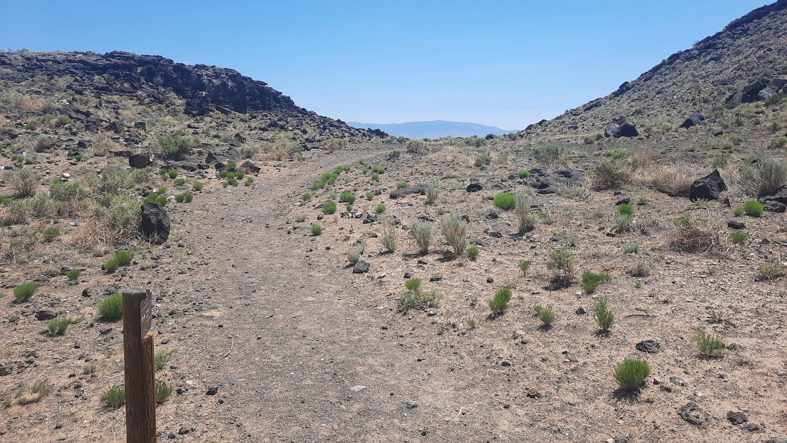
You have now reached stop 13 of the Volcanoes Day Use Area audio tour. You have walked 3.81 miles or 6.13 kilometers, and this is the last stop of the audio tour. Looking east from this spot, you can see the trail passing through a lower area with higher slopes of volcanic rock on both sides. This curious slope records one of the most dramatic events in the geologic history of the monument: a final, dramatic eruption.
This volcanic landscape is the result of eight distinct lava flows. The vast majority of this history was relatively gentle, particularly the first two lava flows which were relatively thin and smooth. The rock record shows us that over time the lava flows became progressively thicker and more viscous. Molten material that is viscous is thicker and requires greater pressure build-up in order to erupt. The final eruption in this area was a large blast that split Vulcan’s dome into the north and south half-dome remnants you see today. In addition to the dramatic split in Vulcan you see at this stop, there is more evidence for this blast in the pyroclastic rocks which can be found around Vulcan. These features serve as a reminder of how geology has shaped the land in the past and created the unique landscape of Petroglyph National Monument we have today. Presently, these spatter cones are extinct, but they are part of a larger volcanic field that remains potentially active due to the Rio Grande Rift. It is possible for a new volcano to form within this area but not likely within our lifetimes.
This marks the end of the audio tour. Continue south around the west-facing slope of Vulcan and from there follow signs back to the parking lot which is 1.07 miles or 1.72 kilometers from this point. Thank you for visiting Petroglyph National Monument.