Last updated: April 4, 2025
Place
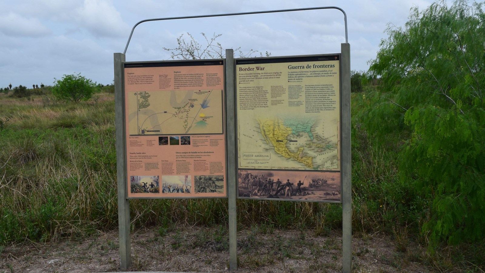
Explore Wayside
NPS Photo
Quick Facts
Location:
Brownsville, TX
Main Text
This half mile-long trail before you leads to the heart of the Palo Alto battlefield , the scene of the first major clash of the U.S.-Mexican War. Allow at least one hour to explore. Take it easy in hot weather.For Your Safety
- Stay on the trails.
- Protect yourself from sun and biting insects.
- Watch out for venomous snakes.
- Avoid sharp, thorny plants.
- Keep dogs on leash.
- No vehicles
- No bicycles
- No relic hunting
- No weapons
Sub Text
Three other 1846 battlefields can be found between here and the Rio Grande.Resaca de la Palma
A battle five miles south of here on the day after the fighting at Palo Alto clinched the United States’ control of the lands north of the Rio Grande.
Fort Texas
General Taylor ordered an earthen fortification built on the north bank of the Rio Grande near today’s downtown Brownsville. General Arista besieged and shelled Fort Texas for six days, an action that brought two armies to Palo Alto.
Rancho Carricitos
Two weeks before the main armies clashed here at Palo Alto, Mexican cavalrymen first skirmished with U.S. troops in a brush corral 25 miles to the west. This incident led to a declaration for war by the U.S. Congress.
Image descriptions
TopTrail map showing locations of Visitor Center, roads, parking lots, main trail, Mexican battle line trail, U.S. battle line trail, and battlefield overlook.
Center Left
Coiled western diamondback rattlesnake.
Center
Coastal prairie
Center Right
Thorny brush
Bottom Left
Battle scene from the Battle of Resaca de la Palma.
Caption: May 9, 1846
Bottom Center
Scene from the siege of Fort Texas
Caption: May 3-9, 1846
Bottom Right
Battle scene from the Battle of Rancho de Carricitos.