Last updated: April 23, 2025
Place
Vantage Point: The Memorial Landscape

Benches/Seating, Cellular Signal, Pets Allowed, Wheelchair Accessible
Chamizal National Memorial commemorates the longstanding boundary dispute that was resolved by the treaty called the Chamizal Convention. Implementing the treaty involved carving a new river channel and transferring three parcels of land to opposite sides of the boundary marked by the relocated river channel. For those unfamiliar with the area before these changes, it can be challenging to imagine where they are on today's landscape. Let's identify some landmarks that help to visualize the parcels of land involved in the treaty.
El Chamizal: The Disputed Land
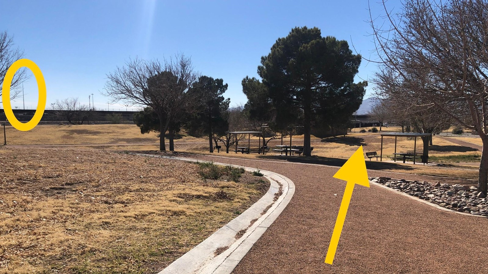
This land, which had belonged to Mexico but was transferred to the north side of the river, is generally located south of downtown El Paso. With the treaty, the new river channel was shifted to the north, returning a long, somewhat triangular area of land south of the border. The point of the triangle is just west of the Paso del Norte international bridge, and it widens to about three fouths of a mile wide on its eastern end. The parcel is southwest of Chamizal National Memorial. If you are standing on the trail at this vantage point and look at the mountains in the distance to the right of our comfort station (building in the picnic area), your gaze passes over the top of the disputed Chamizal land. In other words, the Memorial is not situated on the disputed land. That parcel was returned to Mexico. So what land was used to commemorate this diplomatic achievement?
Cordova Island
In the late 1900s, the Rio Grande had formed a large bend around this location. Its channel suddenly turned from an easterly direction to flow about a mile north, making a rough horseshoe bend and back to the south before continuing on its course to the Gulf of Mexico. When this bend in the river would flood, water would back up into El Paso and Ciudad Juárez causing extensive damage. By 1900, the two countries worked together to cut off this bend in the river by creating a straight channel through its narrow base. The river ran straighter almost a mile to the south, but it left an "island" of Mexican land on its north bank. This area became known as Cordova Island. While the island was not disputed land, the Chamizal Treaty proposed to carve the new river channel straight through the middle of Cordova Island instead of attempting to wind around it as the river had done before. Mexico would give the part of the island remaining on the north side of the river to the United States. Chamizal National Memorial was built on part of that land. Mexico also built a Chamizal commemorative park on the southern half of Cordova Island, which remained in its possession. The straightened river channel eased concerns of flooding, but it also meant that another parcel of land needed to be transferred to Mexico to compensate for the northern part of Cordova Island coming to the United States.
Cordova Gardens
From where you are standing, try to locate the "Mega Bandera", a monumental Mexican flag visible from these park grounds. You can spot the tall flagpole even when this enormous flag is not flying. It is a useful landmark to visualize the location of a former US neighborhood called Cordova Gardens. The neighborhood was east of Cordova Island and was transferred to Mexico to make up for the acreage of Cordova Island transferred to the United States. The Mega Bandera marks the western side of the former Cordova Gardens, and the large, red X-shaped structure marks its eastern side.
