Last updated: October 6, 2022
Place
Upper Cottonwood Wash

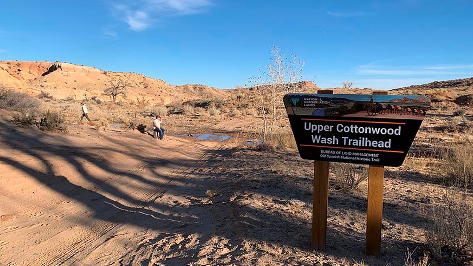
Photo/BLM State Office, Parker Wertz
Historical/Interpretive Information/Exhibits, Parking - Auto, Trailhead
Upper Cottonwood Wash has been a well-traveled route throughout time. The Native Americans were the first to trailblaze this area hundreds of years ago before the arrival of the Spanish in the late 1400s. The trails most popular use occurred with the establishment of the Old Spanish Trail in 1829. Though the first official expedition occurred on the Armijo Route further south, trading caravans would more commonly use the Northern Route that passes through this wash due to the easier paths and more abundant resources.
Trading died down after Mexico ceded most of the West to the US in 1848 with the Treaty of Guadalupe Hidalgo. However, the trail still was still used sporadically by various groups. Captain John W. Gunnison led an expedition through this wash as well as other parts of the Old Spanish Trail as they searched for a railroad route through Utah. The Elk Mountain Mission, comprised of Latter-Day Saints, passed through as they headed further south from Salt Lake to settle parts of southeastern Utah. Shortly after, locals within Emery County would use this route as a wagon road between Castle Dale and Green River. Visual remnants such as stone culverts, unfinished railroad grades, and dugways can be found on the nearby ATV trails verifying the kind of travel this area used to receive. Eventually, as automotive technology and infrastructure improved, Upper Cottonwood Wash saw less and less traffic, and now is used mainly for recreation.
Site Information
Location (Latitude: 39.062745 Longitude: -110.415556)
The trailhead for Upper Cottonwood Wash is in Emery County, Utah. It can be reached by taking the Smith Camp Road off Highway 89 and heading west along a series of dirt roads.
This trailhead is in a remote location where 4WD and high clearance are needed to reach it safely. During or shortly after rainfall the roads will be impassible and flash floods may occur on the trail, so only attempt this hike under good weather conditions.
A sign and interpretation kiosk mark the start of the trail. Cottonwood trees and various shrubs such as sagebrush are prominent throughout, especially in the spring and early summer. The trail is sandy and rocky from deposition as water flows down into the wash when it rains.
The most notable element of the trail, however, is the historic inscriptions written on the walls by past travelers. Some have been written in the grease they used to lube their wagon axels with, and others were sketched into the rock. There are at least eight inscriptions that have been recorded, some can be read while others have faded or eroded over time, leaving them indecipherable. See if you can find more!
This five mile trail is lightly trafficked and fairly level. There is little shade, and the environment gets very hot in the afternoon. Make sure to travel in the morning or evening and bring plenty of water to prevent heat exhaustion. As you walk through this trail, the setting you will witness is almost the exact same as what travelers on the Old Spanish Trail saw when they came through here over a hundred years ago!
Safety Considerations
More Site Information
Exhibit Audio Description available
Old Spanish National Historic Trail
-
Emery County - Upper Cottonwood Wash Exhibit Audio Description
Listen to the audio description of the Emery County - Upper Cottonwood Wash exhibit.
- Date created:
- 09/09/2021
