Last updated: January 11, 2024
Place
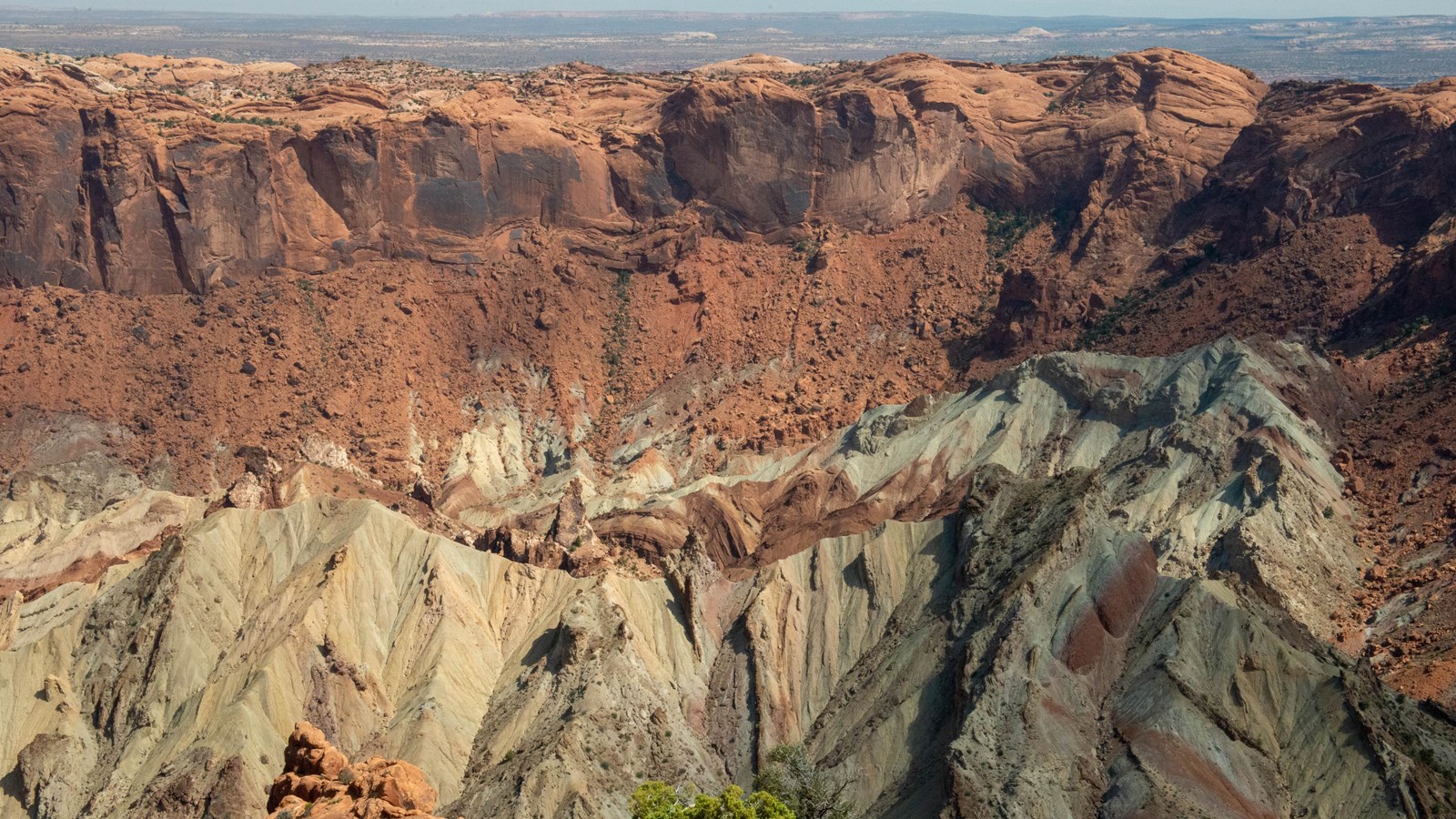
Upheaval Dome
NPS/Veronica Verdin
Quick Facts
Location:
Island in the Sky, Canyonlands National Park
Significance:
Geologic Feature
Amenities
3 listed
Picnic Table, Toilet - Vault/Composting, Trailhead
This unusually circular and tilted geologic formation is a bit of a mystery, obviously different from what's around it. For the best view, hike the one-mile roundtrip (1.5 km) trail to the first overlook (climbing 100 feet/30 meters).
What Happened Here?
Canyonlands is a place of relative geologic order, with rock layers that have not been altered, tilted or folded significantly in the millions of years since they were laid down by ancient seas, rivers or winds.
In the area of Upheaval Dome, approximately three miles (5 km) across, rock layers are dramatically deformed. In the center, the rocks are pushed up into a circular structure called a dome, or an anticline. Surrounding this dome is a downwarp in the rock layers called a syncline. What caused these folds at Upheaval Dome? Geologists do not know for sure, but there are two main theories which are hotly debated.
Salt Dome Hypothesis
A thick layer of salt, formed by the evaporation of ancient landlocked seas, underlies much of southeastern Utah and Canyonlands National Park. When under pressure from thousands of feet of overlying rock, the salt can flow plastically, like ice moving at the bottom of a glacier. In addition, salt is less dense than sandstone. As a result, over millions of years salt can flow up through rock layers as a "salt bubble", rising to the surface and creating salt domes that deform the surrounding rock.
When geologists first suggested that Upheaval Dome was the result of a salt dome, they believed the land form resulted from erosion of the rock layers above the dome itself. Recent research suggests that a salt bubble as well as the overlying rock have been entirely removed by erosion and the present surface of Upheaval Dome is the pinched off stem below the missing bubble. If true, Upheaval Dome would earn the distinction of being the most deeply eroded salt structure on earth.
Impact Crater Hypothesis
When meteorites collide with the earth, they leave impact craters like the well-known one in Arizona. Some geologists estimate that roughly 60 million years ago, a meteorite with a diameter of approximately one-third of a mile hit at what is now the Upheaval Dome. The impact created a large explosion, sending dust and debris high into the atmosphere. The impact initially created an unstable crater that partially collapsed. As the area around Upheaval Dome reached an equilibrium, the rocks underground heaved upward to fill the void left by the impact. Erosion since the impact has washed away any meteorite debris, and now provides a glimpse into the interior of the impact crater, exposing rock layers once buried thousands of feet underground.
Upheaval Dome Today
Recent research findings support the meteorite hypothesis, but questions still remain. Within Canyonlands National Park, Upheaval Dome serves as a protected geologic laboratory where all can learn about, and be inspired by, the mysteries of nature. Perhaps, with time, we may solve the mystery of this crater and others on our planet.