Last updated: August 6, 2025
Place
Trailhead for Gichi Onigaming, the Grand Portage
NPS photo / L. Morrison
Quick Facts
Amenities
2 listed
Historical/Interpretive Information/Exhibits, Trailhead
Canoe Loading across from the Historic Site
From Thursday August 7 to Sunday August 10, please load/unload canoes off road near the Grand Portage trailhead sign at the corner of Store and Mile Creek Roads. Please do not cross the intersection with packs or canoes during this time.
Flooding at the Poplar Creek Crossing on the Grand Portage Trail
Increased rain and beaver dam activity can flood the Poplar Creek Crossing along the Grand Portage Trail. Please exercise caution as you pass through the water. (see map)
Hiking the Historic Trail
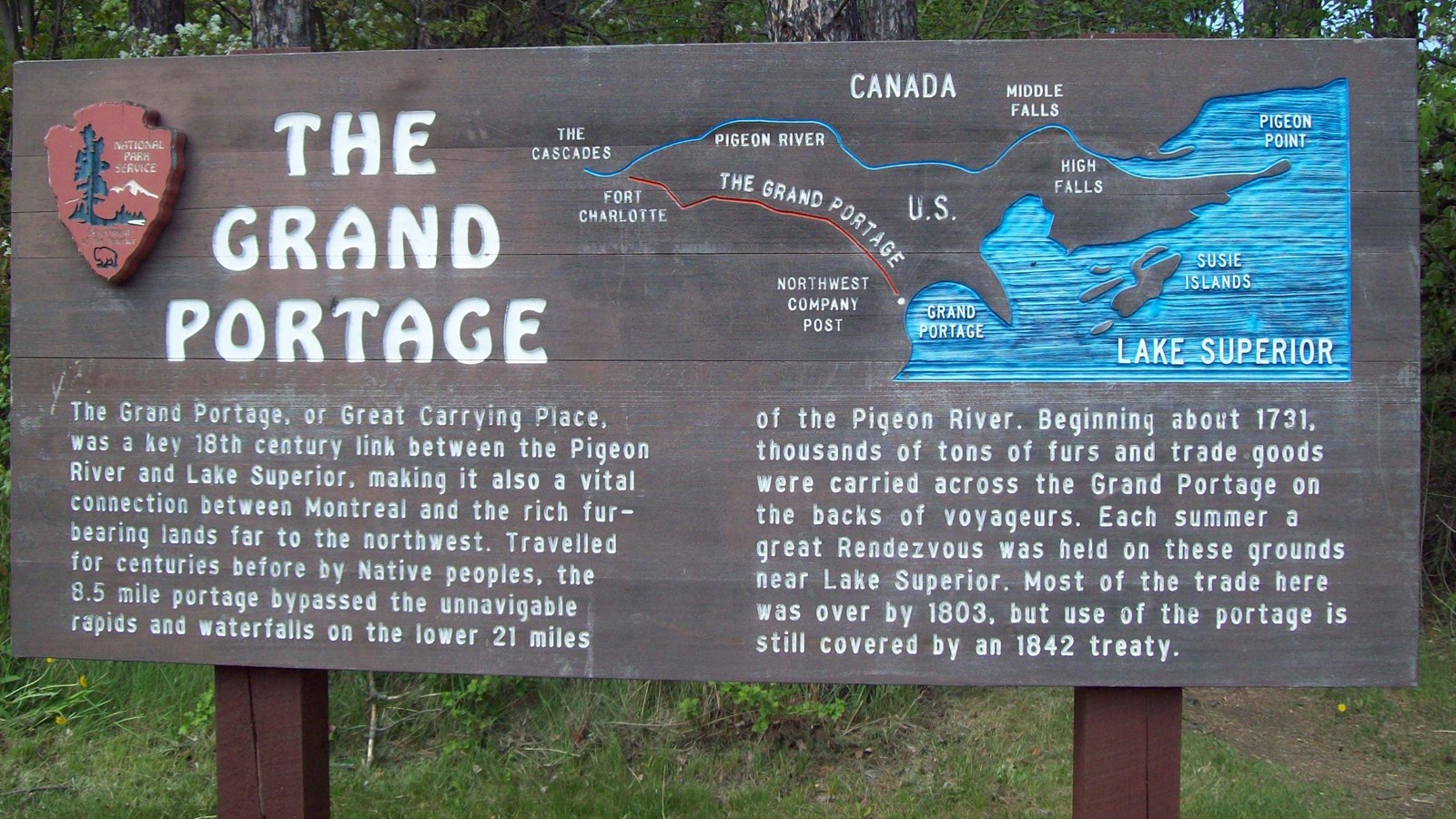
Today's eight-and-a-half mile (13.7 kilometers) portage trail corridor can be thought of in two parts: the eastern "half" that passes through gaps and valleys to avoid the high rocky ridges and the western "half" that passes over elevated terrain to avoid steep slopes and swamps. The parking area at Old Highway 61 approximately divides the halves so hikers can choose the "exploration into history" of their choice.
Click here to make a camping reservation at Fort Charlotte.
-
Hike the Grand Portage footpath from the stockade to Old Highway 61 (eight miles round trip - three to four hours)
-
Hike the Grand Portage from Old Highway 61 to Fort Charlotte (nine miles round trip - six to eight hours)
-
Hike the entire Grand Portage footpath from the stockade on Lake Superior to Fort Charlotte and back (17 miles round trip eight to 16 hours)