Last updated: April 15, 2026
Place
The Tower
NPS
Quick Facts
Significance:
National Register of Historic Places
OPEN TO PUBLIC:
No
The Tower is a High Potential Historic Site on the Lewis and Clark National Historic Trail and Missouri National Recreational River.
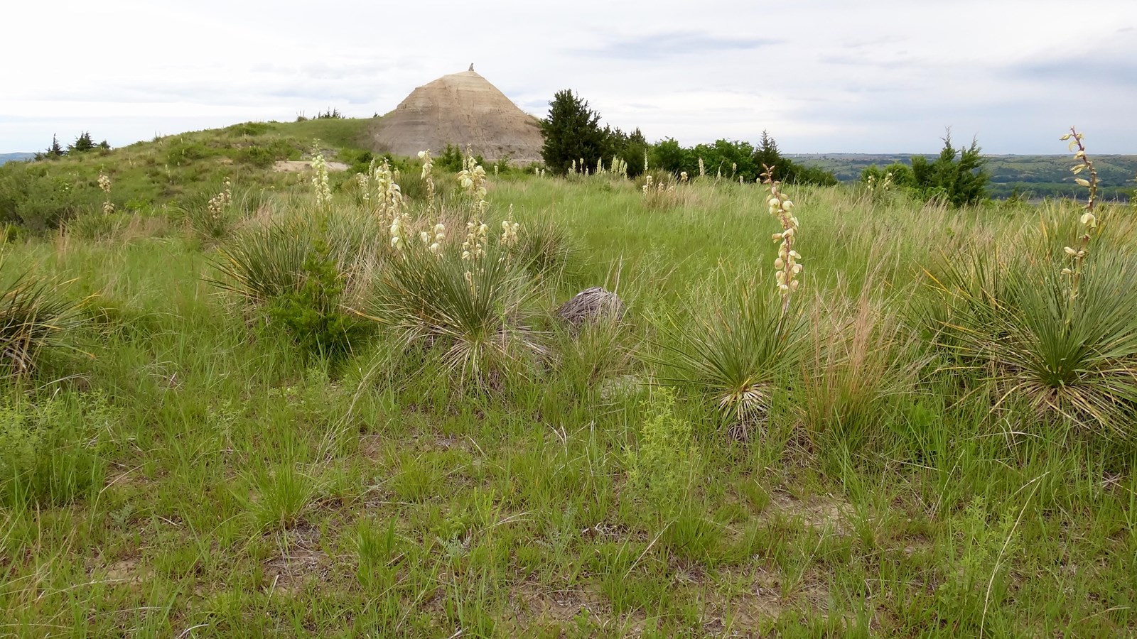
On September 7, 1804, the expedition landed near “the foot of a round mounting […] resembling a dome”, which Clark had sighted the previous day. Clark wrote, “Capt Lewis & my Self walked up, to the top which forms a Cone and is about 70 feet higher than the high lands around it, the Bass is about 300 foot in decending this Cupola, discovered a Village of Small animals that burrow in the grown (those animals are Called by the french Pitite Chien).” They managed to kill one prairie dog and capture a second, which joined the expedition and survived the winter at Fort Mandan. In the spring, it (along with other collected specimens) was sent downriver and transported to Washington, D.C., to be received by President Jefferson on October 4, 1805. Lewis and Clark are credited with the first scientific description of the prairie dog, or Cynomys ludovicianus.
The appearance of the Tower has changed very little since it was first documented by Lewis and Clark. Located about a half-mile south of the Missouri River in Boyd County, Nebraska, the landform rises an additional 70 feet above a line of bluffs along the southern edge of the Missouri valley. The surrounding landscape is characterized by open prairie and burr oak woodlands. In 2005, a 524-acre conservation easement was enacted to protect the Tower and the environs. Although the site is privately owned, it can be viewed from multiple vantage points along nearby roadways.
Lewis and Clark NHT Visitor Centers and Museums
This map shows a range of features associated with the Lewis and Clark National Historic Trail, which commemorates the 1803-1806 Lewis and Clark Expedition. The trail spans a large portion of the North American continent, from the Ohio River in Pittsburgh, Pennsylvania, to the mouth of the Columbia River in Oregon and Washington. The trail is comprised of the historic route of the Lewis and Clark Expedition, an auto tour route, high potential historic sites (shown in black), visitor centers (shown in orange), and pivotal places (shown in green). These features can be selected on the map to reveal additional information. Also shown is a base map displaying state boundaries, cities, rivers, and highways. The map conveys how a significant area of the North American continent was traversed by the Lewis and Clark Expedition and indicates the many places where visitors can learn about their journey and experience the landscape through which they traveled.