Last updated: March 23, 2021
Place
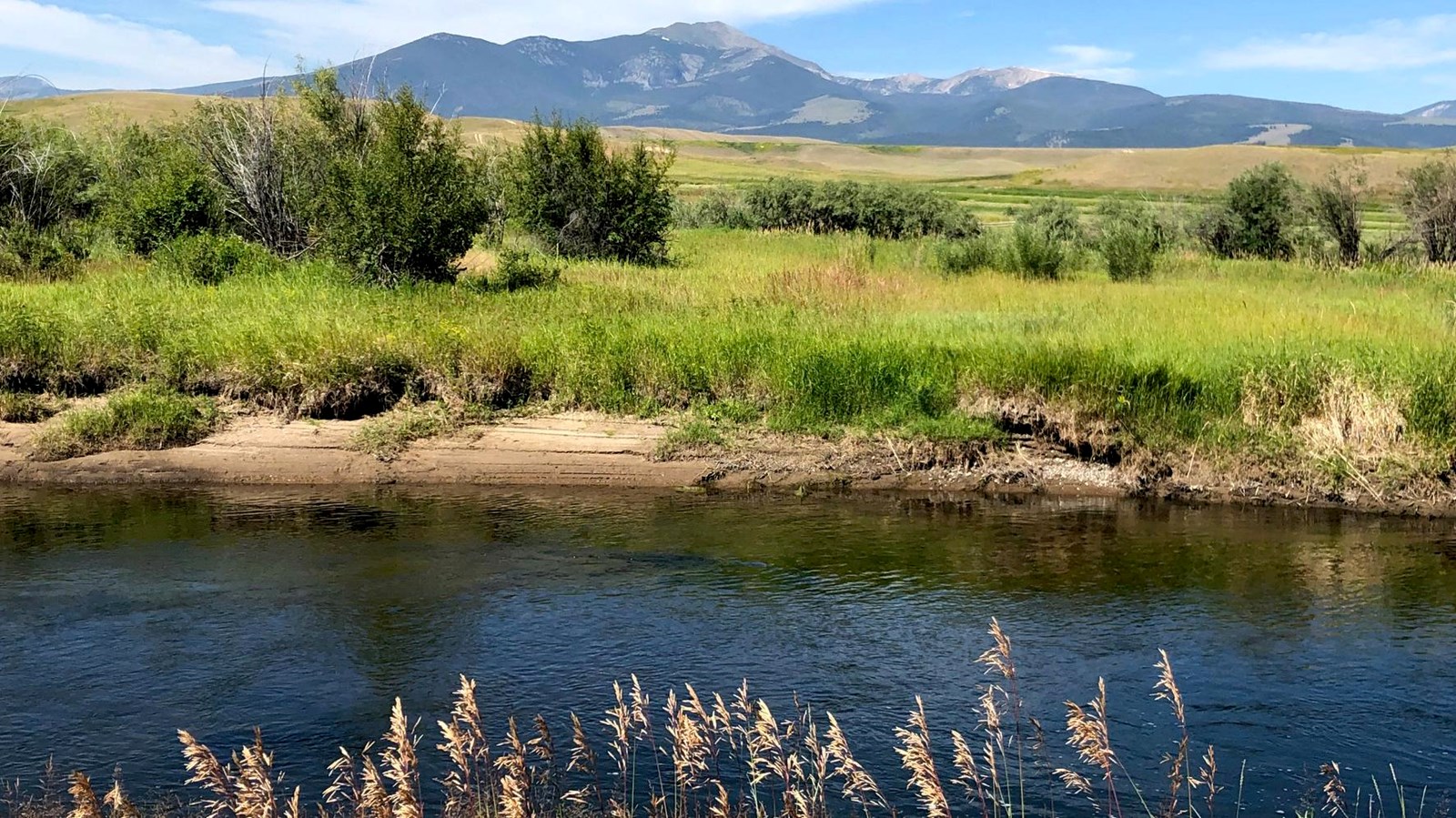
The Clark Fork River
NPS/Grant-Kohrs Ranch
Quick Facts
Location:
Deer Lodge, MT
Significance:
Natural Landscape/River
Designation:
National Historic Site
Amenities
4 listed
Beach/Water Access, Cellular Signal, Scenic View/Photo Spot, Trailhead
The Clark Fork is the largest river in Montana by volume and one of the longest rivers in the state. It’s considered to be the headwaters of the Columbia River Basin and stretches more than 280 miles from its origins south of Grant-Kohrs Ranch at the confluence of Silver Bow Creek and Warm Springs Creek to the Idaho border. The Clark Fork River enters the ranch from the parks southern border and flows for approximately 2.5 miles before exiting the ranch towards the north.
There are at least 35 species of mammals that live on the ranch and more than 230 species of birds can be found passing seasonably through the park. The Clark Fork River and the surrounding riparian habitat provide important food and shelter for a variety of these wildlife species. It’s not uncommon to take a walk along the river’s edge and observe beavers, muskrats, river otters, moose, deer, ospreys, geese, bald eagles, ducks, kingfishers, and much more.
Montana is known as a fishing paradise and the Clark Fork River supports a variety of fish species including rainbow, cutthroat, and brown trout. Both bait and fly fishing is allowed on the ranch. A Montana fishing license is required for anyone 15 years or older and state regulations must always be followed. The fishing access within in the park is by walk in only. Please stop by the visitor center to pick up a trail map.
For centuries, the river provided sustenance for several Native American tribes. In the early 1800’s the Lewis and Clark Expedition explored much of the Clark Fork River Basin and it was eventually named after William Clark. As the Clark Fork River meanders its way through the Deer Lodge Valley it provides a crucial lifeline for ranchers that utilize it for watering livestock and growing hay. Johnny Grant chose to build his home near the banks of the Clark Fork River for the same reason and constructed the ranch’s first irrigation system in the 1860’s. Grant utilized water from the river and several smaller springs to water his cattle and irrigate his crops.
Beginning in the 1880’s Montana became the center of a copper mining boom that would last for over a century. The mining and subsequent smelting operations upstream in Butte and Anaconda created a significant amount of waste. A massive flood in 1908 washed millions of tons of toxic sediments into the Clark Fork River that contaminated the surrounding soil, and polluted ground water for 120 miles. Over the years, natural water cycles and floods continued to wash more toxic sediments downstream.
Historically the riparian area of Grant-Kohrs Ranch had rich soil and vegetation, which supported a mix of shrubs and forest. The healthy vegetation was used by wildlife and cattle to shelter from summer heat and winter cold. However, by the 1930’s ranch staff began documenting areas of exposed mining waste, dying vegetation, and bare soil along the river throughout the ranch.
In 1992 the Clark Fork River from its confluence near Warm Springs to the former site of the Milltown Dam east of Missoula was designated as a Superfund Site. In the spring of 2018 work began on the ranch to remove contaminated soil, stabilize the eroding banks of the Clark Fork River, and re-vegetate the riparian area.