Last updated: June 8, 2025
Place
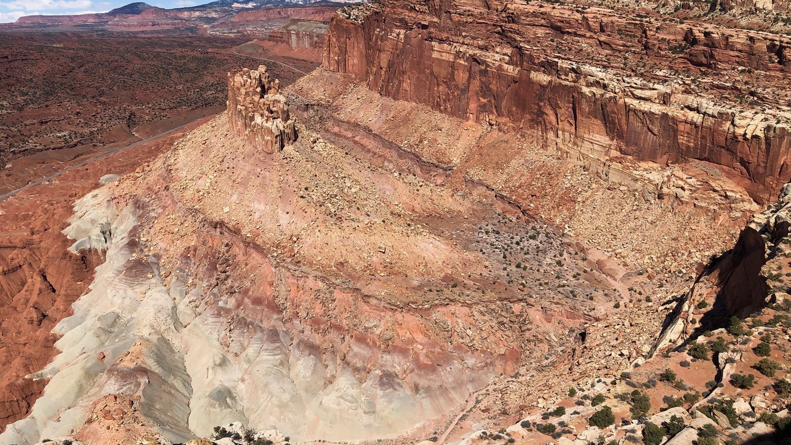
The Castle Viewpoint
NPS
Erosion carved a U-shaped moat behind a chunk of the cliffs above the highway. This created an isolated bluff of Wingate Sandstone we call The Castle. Currently, at eye level are the reddish-brown sheets of the Moenkopi Formation. Above that are the gentle, gray-green and maroon mounds of the Chinle Formation. The Chinle is strewn with large slabs eroded from the massive, vertical cliffs of the Wingate Sandstone. Above the Wingate is the Kayenta Formation, which is often thinner and covered with piñon pines and juniper trees. Rising at the tops of the cliffs are the rolling, pale domes of the Navajo Sandstone. These rock layers are star players across many public lands of southern Utah. They are present across Arches National Park, Canyonlands National Park, Zion National Park, Natural Bridges National Monument, Grand Staircase-Escalante National Monument, and many more.
At this point, the scenery of this tour changes notably. In the Fremont River Corridor to the east, the walls close in around verdant riparian plant communities. To the west, the viewshed opens up to rolling piñon-juniper forests and rising red mesas. Keep an eye on the tilt of the rock layers. Toward the east, the layers begin to steeply dip down into the ground. The Chinle will disappear, followed by the Wingate, Kayenta, Navajo, and so on—each generally younger than the layer below it.
At this point, the scenery of this tour changes notably. In the Fremont River Corridor to the east, the walls close in around verdant riparian plant communities. To the west, the viewshed opens up to rolling piñon-juniper forests and rising red mesas. Keep an eye on the tilt of the rock layers. Toward the east, the layers begin to steeply dip down into the ground. The Chinle will disappear, followed by the Wingate, Kayenta, Navajo, and so on—each generally younger than the layer below it.