Last updated: March 15, 2024
Place
The Big Relief Map

NPS
Benches/Seating, Cellular Signal, Gifts/Souvenirs/Books, Historical/Interpretive Information/Exhibits, Information, Information - Maps Available, Information - Ranger/Staff Member Present, Internet/WiFi Available, Parking - Auto, Picnic Table, Restroom, Restroom - Accessible, Restroom - Family, Supplies - Camping/Outdoor, Tactile Exhibit, Toilet - Flush, Trash/Litter Receptacles, Water - Drinking/Potable, Wheelchair Accessible
The Map of The Lake That Was Built Before The Lake
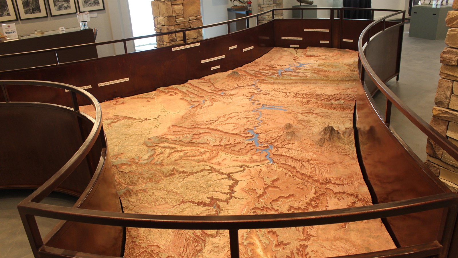
During the construction of Glen Canyon Dam, The U.S. Bureau of Reclamation commissioned a scale model relief map of what would be Lake Powell and the surrounding area. Model map builder Robert Miller used information from topographic maps and overflights of the area to construct the model in his basement. It took over a year to complete. He cut the map into seven pieces to be transported to the opening of the Glen Canyon Visitor Center, later renamed after Arizona senator and water use proponent Carl Hayden.
This terrain relief model of the Glen Canyon National Recreation Area and vicinity can only be described as precisely accurate. The topography shown was based on both topographic maps and aerial photographs. Everything on the map actually exists just as it appears to, considering the vertical scale of the model. When it was installed at the visitor center at Glen Canyon Dam, is was oriented to real life. You could use it for wayfinding.
In 2017, during the installation of new exhibits at Carl Hayden Visitor Center, the relief map was cut into the original seven pieces and removed from the building. Two years later, park partners Glen Canyon Conservancy retrieved the pieces and reassembled the map at their Flagship office and retail store for the public to once again enjoy and plan trips. In mid-2023, renovations at the Powell Museum & Archives were complete, so the map has a forever home amongst relevant exhibits. Over 55 years after its construction, aside from a few new roads, the map still accurately depicts the landscape of and around Glen Canyon National Recreation Area.
Map Stats
Model Maker: Robert S. Miller Dimensionals, Colorado
Year Constructed: 1967
Cost at the time: $24,000
Modeling Method:
-
Built in seven different sections
-
Carved and routed by hand (NOT molded)
-
Dentist tools used to do the fine carving
-
Rock sample or a vial of sand was taken from 38 different locations to produce 78 different shades of color
-
Model carved in Robert Miller’s shop
-
Pieces were brought to the Carl Hayden Visitor Center to be assembled and painted
Carving time: 1,952 hours (279 eight hour work days; 49 work weeks)
Painting Time: 698 hours (87 eight hour work days; 17 work weeks)
Total Work Time: 2,921 hours (365 eight hour work days; 1 year)
Area Shown: 10,000 square miles (6,400,000 acres)
Lake Level Painted: 3,640 feet above sea level (60 feet below “full pool” elevation of 3,700 feet above sea level)
Major Features
National Parks: Grand Canyon,Capitol Reef, Canyonlands
National Monuments: Rainbow Bridge, Natural Bridges, Grand Staircase-Escalante, Bears Ears
Utah State Parks: Goosenecks
Navajo Tribal Parks: Monument Valley, Lake Powell (Antelope Canyon[Upper, Lower], Waterholes Canyon)
Henry Mt Range: Mt. Pennell 11,371 ft, Mt. Hillers 10,723 ft, Mt. Holmes 7,930 ft, Mt. Ellsworth 8,235 ft
Other Mts: Navajo Mountain 10,388 ft
Rivers: Colorado, Green, Dirty Devil, Escalante, San Juan, Paria
Marinas: Wahweap, Antelope Pt (almost), Dangling Rope, Bullfrog, Halls Crossing, Hite
Bonus secret: Bob Miller created the map with such accuracy, he included 12 natural bridges and arches in the topography. How many can you find?
