Last updated: March 14, 2024
Place
"The Big Dig" Sign

NPS Photo/M Mark
Historical/Interpretive Information/Exhibits
Description
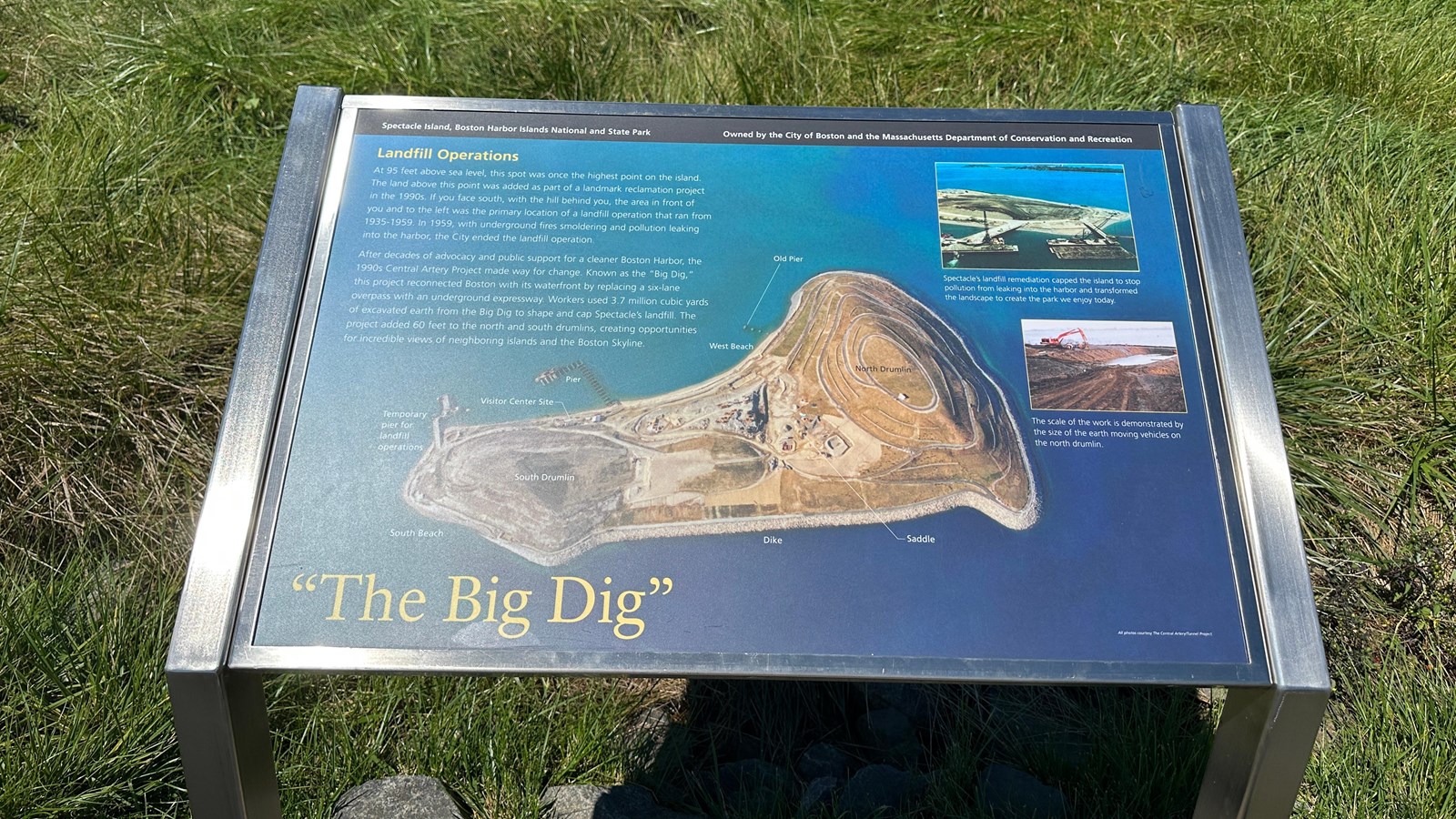
Low-profile wayside that is 40.5 x 24 3/8 inches, with interpretation panel spanning 36.5 inches wide. It has a grey square base with two rectangular pillars supporting the panel. The panel is framed in grey metal. The sign is located on the interpretive trail on the North Drumlin.
Layout
At the top of the sign is a black banner with white text. Aligned to the left is text that reads “Spectacle Island, Boston Harbor Islands National and State Park.” Aligned to the right is text that reads “Owned by the City of Boston and the Massachusetts Department of Conservation and Recreation. ” The section of text is title, “Landfill Operations” is in yellow text aligned to the left just underneath the black banner. The panel background is filled with an aerial image of Spectacle Island viewed from directly above. On the left, there is one column of white text composed of three paragraphs. On the right, two images are stacked on top of one another. At the bottom of the panel the title reads “The Big Dig” in yellow text.
Image (right top row)
Aerial view of Spectacle Island depicting a drumlin being capped. The drumlin is beige in color with some patches of green grass across the top. It stands out from the blue water surrounding it. In the front of the image are two barges and cranes perpendicular to the island that are connected to the island through piers. The barges have earthen material on them. Long Island sits beyond Spectacle, full of green vegetation, some brick buildings, and a white water tower.
Image Caption (right top row)
Spectacle’s landfill remediation capped the island to stop pollution from leaking into the harbor and transformed the landscape to create the park we enjoy today.
Image (right bottom row)
A construction scene on the north drumlin. Brown dirt surround a shallow hole that is full of water. Machinery tracks lead to and around the hole. The hole is on the edge of the island and the water can be seen over the edge, with the Boston harbor extending in the distance. To the left of the hole in the ground is a red backhoe that is used to move materials. In front of it is a small yellow station set up to monitor the work.
Image Caption (right bottom row)
The scale of the work is demonstrated by the size of the earth moving vehicles on the north drumlin.
Image (background)
An aerial view of Spectacle Island under restoration. The Island sits in the middle of blue green water. The South Drumlin is still under construction and is beige with dark spots on it. A temporary pier juts from the southwest side. On the west coastline in front of the South Drumlin is the visitor center under construction; machinery and equipment are around the site. The pier near the visitor center is under construction as well. The North Drumlin has undergone restoration; the hiking paths and the retaining walls have been newly formed and the ground is a yellowish color as plants have not yet been planted or grown. The remains of the old pier are coming off the North Drumlin near West Beach. Machinery is scattered around the construction zone in the middle of the island, between the two drumlins. The eastern edge of the island has a paved path and a retaining sea wall that goes from the South Drumlin to the North Drumlin. Labeled on the image is the “Old Pier,” “West Beach,” the “Pier” which is under construction, the “Visitor Center Site,” the “Temporary Pier for Landfill Operations,” “South Beach,” on the edge of the South Drumlin, the “Dike” on the eastern coastline connecting the two drumlins, the “Saddle” just south of the North Drumlin, and then each Drumlin itself: “South Drumlin” and “North Drumlin.”
Image Credit (background)
All photos courtesy The Central Artery/Tunnel Project
Main Text
At 95 feet above sea level, this spot was once the highest point on the island. The land above this point was added as part of a landmark reclamation project in the 1990s. If you face south, with the hill behind you, the area in front of you and to the left was the primary location of a landfill operation that ran from 1935-1959. In 1959, with underground fires smoldering and pollution leaking into the harbor, the City ended the landfill operation.
After decades of advocacy and public support for a cleaner Boston Harbor, the 1990s Central Artery Project made way for change. Known as the “Big Dig,” this project reconnected Boston with its waterfront by replacing a six-lane overpass with an underground expressway. Workers used 3.7 million cubic yards of excavated earth from the Big Dig to shape and ca Spectacle’s landfill. The projected added 60 feet to the north and south drumlins, creating opportunities for incredible views of neighboring islands and the Boston Skyline.
