Last updated: September 5, 2023
Place
Tavern Cave, Missouri
Library of Congress, Geography and Map Division
Quick Facts
Location:
This location is not accessible to the public.
Significance:
Meriwether Lewis and William Clark visited this cave in 1804.
Designation:
Lewis and Clark National Historic Trail, National Register of Historic Places
OPEN TO PUBLIC:
No
MANAGED BY:
This location is not accessible to the public.
Many of the places where Meriwether Lewis and William Clark’s party camped, hunted, canoed, and walked no longer look like they did in 1803–1806. They have been lost to erosion or changes in the river, both natural and man-made (whether dams and other developments).
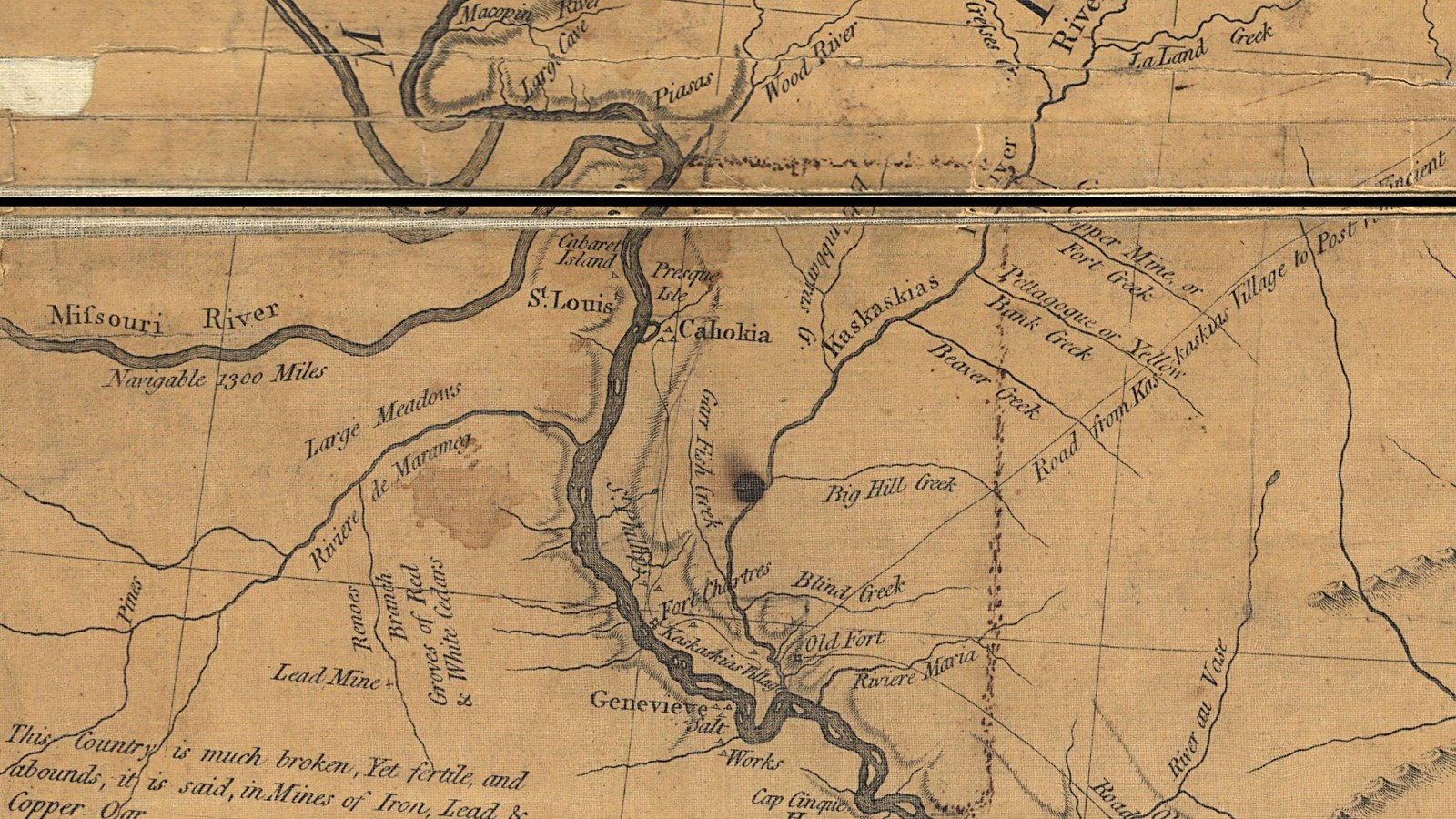
Tavern Cave, however, remains much as it was when Lewis and Clark visited on May 23, 1804, a few days after leaving St. Charles, Missouri.
For thousands of years, Indigenous people used Tavern Cave as a shelter. Later, European-American fur traders and other Missouri River travelers also utilized it. The cave entrance is at the base of a large sandstone bluff on the south bank of the river. Rocks jutting out over the cave opening made it a highly visible landmark. Many maps of the area, including the Mackay-Evans map, noted its location. Names and markings etched into the cave wall showed the centuries of use. Clark remarked that “many names are wrote up on the rock,” and he felt compelled to add his. Some of the markings, possibly even Clark’s, still exist today.
Tavern Cave is notable for another reason. Lewis nearly fell to his death climbing on the rocks above the cave. According to Clark’s account, Lewis attempted to scale the sandstone cliffs to the rocks protruding out over the cave entrance. The brittle sandstone could not withstand Lewis’ weight, however, and he lost his footing. He fell about twenty feet before he “Saved himself by the assistance of his Knife,” presumably driving it into the rock wall to break his fall.
About this article: This article is part of series called “Pivotal Places: Stories from the Lewis and Clark National Historic Trail.”
Lewis and Clark NHT Visitor Centers and Museums
This map shows a range of features associated with the Lewis and Clark National Historic Trail, which commemorates the 1803-1806 Lewis and Clark Expedition. The trail spans a large portion of the North American continent, from the Ohio River in Pittsburgh, Pennsylvania, to the mouth of the Columbia River in Oregon and Washington. The trail is comprised of the historic route of the Lewis and Clark Expedition, an auto tour route, high potential historic sites (shown in black), visitor centers (shown in orange), and pivotal places (shown in green). These features can be selected on the map to reveal additional information. Also shown is a base map displaying state boundaries, cities, rivers, and highways. The map conveys how a significant area of the North American continent was traversed by the Lewis and Clark Expedition and indicates the many places where visitors can learn about their journey and experience the landscape through which they traveled.