



Last updated: August 21, 2026
Place
Swale to Wolf River
NPS Photo
Quick Facts
Location:
Trail crossing signs are 1.5 miles north of unincorporated community of Fanning. They are on Heartland Rd, about 150 yards south of intersection with 240th St/Friendship Landing. GPS approximately 39.855619 -95.162437 More route signs are at the corner, directing onto 240th St. Swales visible from Heartland Rd (opposite barn and animal pens at mailbox 1707) on private land to the east, descending diagonally from the crest of the hill toward the unnamed creek. View from road GPS approximately 39.856854 -95.162437
Significance:
Wagon swales descend a hillside toward Wolf River on the St. Joe Road in northeastern Kansas. They are part of the California Trail.
Designation:
Historic site on the California National Historic Trail.
OPEN TO PUBLIC:
No
MANAGED BY:
Private
Amenities
1 listed
Scenic View/Photo Spot
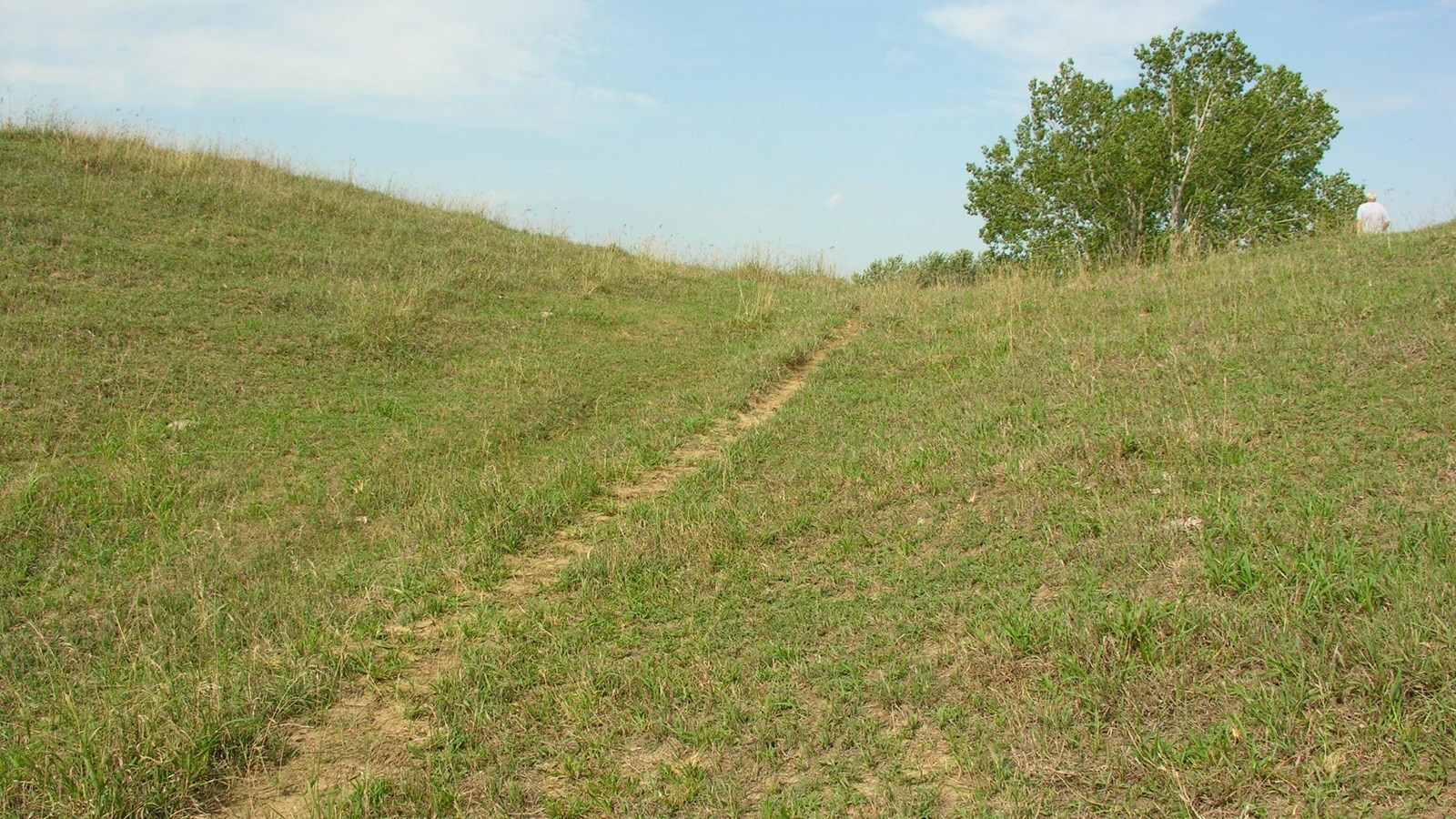
Wagon swales cross the crest of a hill where the California Trail drops into the Wolf River Valley about 1.5 miles north of Fanning, in northeastern Kansas.
Traveling along the St. Joe Road route of the California Trail out of St. Joseph, Missouri, emigrants passing through this area often met Native Americans who requested payment as compensation for crossing their lands. The Native people may have been Kanza, also called Kaw, as this was their original homeland.
Some years, the Native inhabitants charged a toll for crossing a bridge or for their help in fording the Wolf River. James Hutching, crossing on June 9, 1849, recorded in his journal that a group of Native men asked in English for a 50-cent toll, which the emigrants paid.
“By signs,” Hutching continued, “we requested these men to help us push our wagon to the opposite side of Wolf Creek. The chief consented and the whole number put their shoulders to the back of the wagon. . .but the load was too heavy . . .and we had to unload and carry the whole of the provisions on our backs up the steep bank.”
To view the swales, follow US-36 west from Troy, KS and turn right (north) onto KS-7. Drive 3.5 miles and turn right (east) onto unpaved 230th Rd. In about 0.4 mile, 230th turns north and becomes Heartland Rd. Continue north for about 1 mile, passing 2 small, red barns on the right. On the left, across from the second barn, stands a brown trail crossing sign facing the opposite direction, and a second sign facing south stands several yards ahead among a roadside grove of trees. Continue slowly up the hill, passing through the grove, and stop alongside the road opposite a red barn and livestock pens on the left. Look into the pasture on the right to see where wagons cut a distinct notch in the crest of the hill and continued down toward today’s road. Below the notch, a few small trees grow in the swale before it disappears among the roadside grove. A second likely swale, appearing as a shallow, green trough, descends the hillside diagonally and merges with the first among the trees.
Please view from the road and do not enter the pasture. The accompanying photo was taken during a group tour with landowner permission.
Site Information
Location (Trail crossing signs are 1.5 miles north of unincorporated community of Fanning. They are on Heartland Rd, about 150 yards south of intersection with 240th St/Friendship Landing. GPS approximately 39.855619 -95.162437 More route signs are at the corner, directing onto 240th St. Swales visible from Heartland Rd (opposite barn and animal pens at mailbox 1707) on private land to the east, descending diagonally from the crest of the hill toward the unnamed creek. View from road GPS approximately 39.856854 -95.162437)