Last updated: May 29, 2025
Place
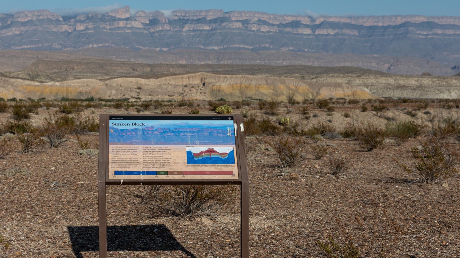
Sunken Block Exhibit
NPS/CA Hoyt
Quick Facts
Location:
Big Bend National Park
Amenities
5 listed
Historical/Interpretive Information/Exhibits, Parking - Auto, Parking - Bus/RV, Scenic View/Photo Spot, Wheelchair Accessible
The Sierra del Carmens dominate the eastern horizon, their limestone cliffs towering thousands of feet above the Rio Grande. This roadside exhibit explains when and how these mountains formed. This is also a great location from which to view sunset.
The text on the exhibit reads:
"About 20 million years ago, the rocks below your feet were level with the top of the Sierra del Carmens. But the continental plate under western North America was stretching. Stresses caused movement along faults, forming a series of downdropped basins and uplifted ranges that now dominate the western Basin and Range landscape.
In Big Bend, a massive wedge of strata - from the Sierra del Carmens to Mesa de Anguila near Santa Elena Canyon - downdropped several thousand feet. This fault-bounded basin cradles the park and is known as the Sunken Block.
As the uplands eroded, sediments filled the basin, protecting the rocks, fossils, and ancient soils that tell a 130-million-year story of life in Big Bend. To learn more, visit the Fossil Discovery Exhibit, located 8 miles north of Panther Junction.