Last updated: November 28, 2023
Place
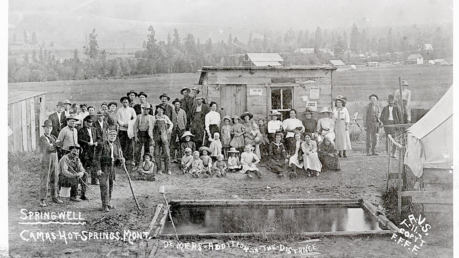
Sulfur Spring
Archival Photographs from the University of Montana
Quick Facts
Significance:
Sacagawea drank from these springs when she was sick while traveling with the Lewis and Clark Expedition.
Designation:
Lewis and Clark National Historic Trail
Amenities
4 listed
Historical/Interpretive Information/Exhibits, Parking - Auto, Scenic View/Photo Spot, Trailhead
When the Lewis and Clark Expedition had almost reached her Shoshone family, Sacagawea got sick. Really sick.
Her French-Canadian husband, Toussaint Charbonneau, volunteered her for this American military mission. Meriwether Lewis and William Clark knew that they would need to trade for horses with Shoshone people—who Sacagawea had lived with for over a decade—to cross the mountains.
She had her infant son, Jean Baptiste, with her. He was only four months old at the time.
What was it like to be so sick? Did her husband rock the baby to sleep while she laid in the shade of the pirogue?
Clark and Lewis took all measures to help Sacagawea. They needed her. They could not get over the Rocky Mountains without her help. They needed her to live.
Clark bled Sacagawea for a few days (a popular treatment in Western medicine at the time), but it likely only made her symptoms worse. He also gave her salts, bark, and opium.
A week into her illness, the expedition reached a sulfur spring. Indigenous and non-Native people across the continent drank from sulfur springs to help heal a range of maladies.
Soon after Sacagawea drank from the spring, she felt better. It may have been that the illness just ran its course, but regardless, she recovered and helped the group through the Great Falls portage a few days later.
Was Sacagawea still weak in those days after she drank from the spring? Could she hold her baby without feeling faint? She must have known how desperately the American men needed her—did that give her solace or add pressure to her recovering body and mind?
About this article: This article is part of a series called “Pivotal Places: Stories from the Lewis and Clark National Historic Trail.”
Lewis and Clark NHT Visitor Centers and Museums
This map shows a range of features associated with the Lewis and Clark National Historic Trail, which commemorates the 1803-1806 Lewis and Clark Expedition. The trail spans a large portion of the North American continent, from the Ohio River in Pittsburgh, Pennsylvania, to the mouth of the Columbia River in Oregon and Washington. The trail is comprised of the historic route of the Lewis and Clark Expedition, an auto tour route, high potential historic sites (shown in black), visitor centers (shown in orange), and pivotal places (shown in green). These features can be selected on the map to reveal additional information. Also shown is a base map displaying state boundaries, cities, rivers, and highways. The map conveys how a significant area of the North American continent was traversed by the Lewis and Clark Expedition and indicates the many places where visitors can learn about their journey and experience the landscape through which they traveled.