Last updated: March 28, 2024
Place
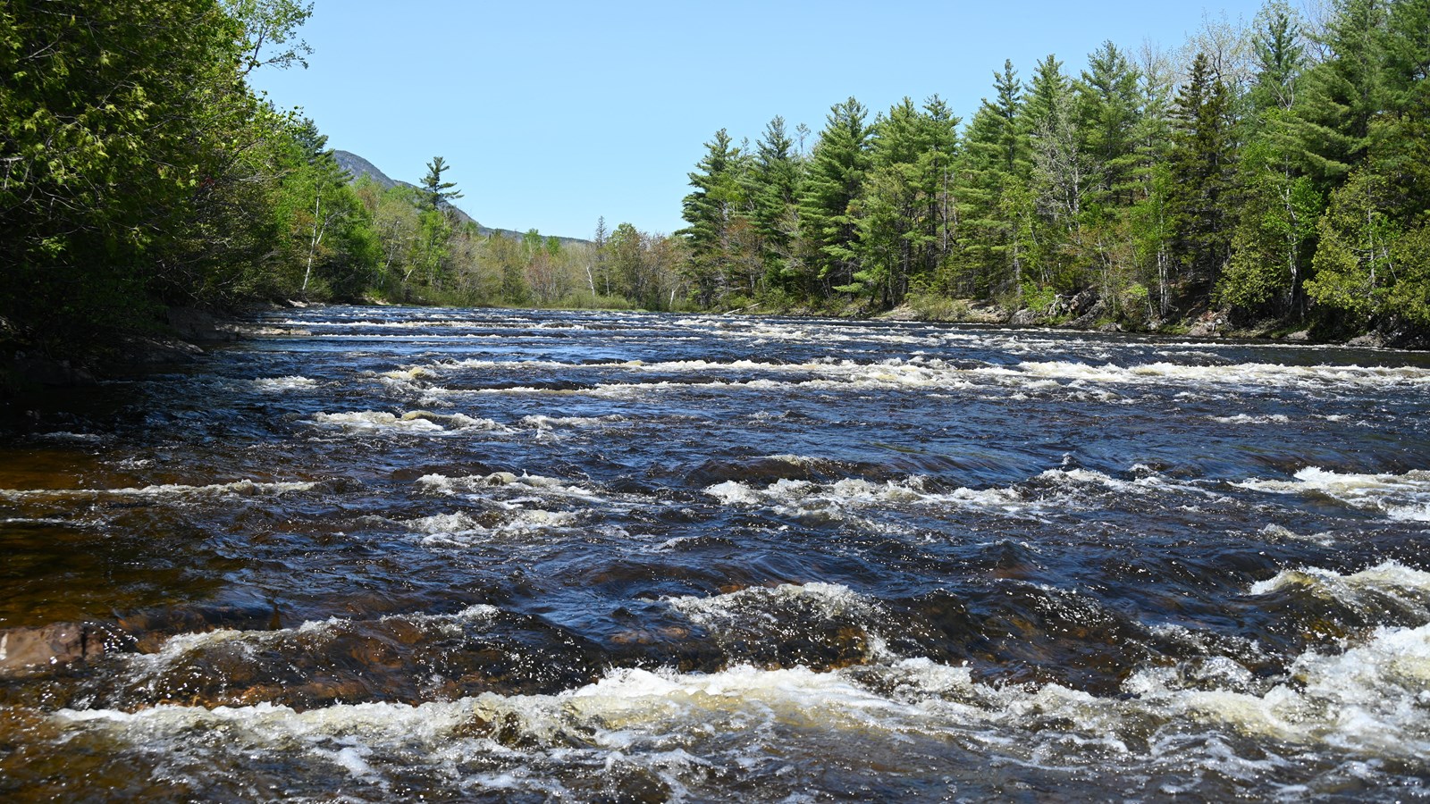
Stair Falls
NPS / Grace Kirk
Quick Facts
Location:
46.086878, -68.775921
Amenities
1 listed
Scenic View/Photo Spot
The East Branch of the Penobscot River flows over a series of parallel bedrock ridges that cause the river to appear to be flowing over stairs as it drops 18 feet within 8/10 of a mile. The name came from Maynard Marsh through a survey commissioned by the Commonwealth of Massachusetts in 1793. In his field notes Marsh wrote, "...at the foot of the handsomest falls I ever saw... as regular as a stair case." Stair Falls was recognized as a significant rapid in the state of Maine's evaluations of critical areas in the late 1970s and early 1980s. Access to the falls is along the International Appalachian Trail, with the fastest route beginning at Haskell Gate. Please be mindful that there is a campsite in this area.
Elevation Gain: 87ft / 26m
Distance (Round-Trip): 4 miles
Difficulty: Easy
Restrooms: The closest vault toilets are located at the North Gate parking lot and the Oxbow Picnic Area.
Parking: Parking is available at the Haskell Gate trailhead on New River Road.
Trail Etiquette: Leashed pets are allowed on this trail. Carry out all trash and food waste (fruit peels, shells, etc.). Do not feed the wildlife. Be mindful of the campsite area when visiting the falls.