Last updated: December 13, 2023
Place
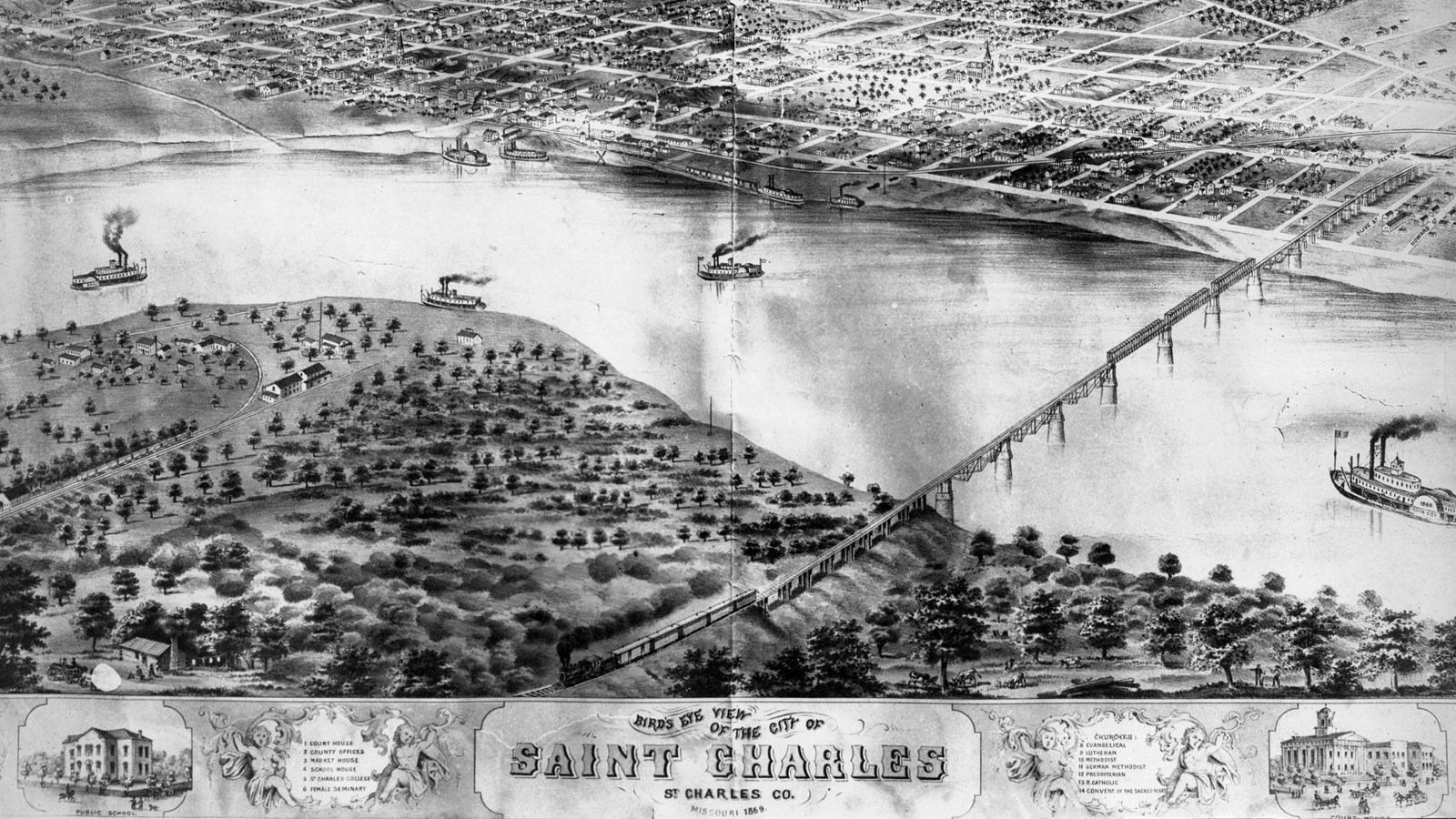
St. Charles Historic District, Missouri
John J. Buse Collection, The State Historical Society of Missouri
Quick Facts
Location:
1050 S Riverside Dr, St Charles, MO 63301
Significance:
Several French-Canadian and Métis boatmen joined the Lewis and Clark Expedition in St. Charles in 1804.
Designation:
Lewis and Clark National Historic Trail, National Register of Historic Places
MANAGED BY:
Amenities
9 listed
Accessible Rooms, Beach/Water Access, Benches/Seating, Gifts/Souvenirs/Books, Historical/Interpretive Information/Exhibits, Parking - Auto, Restroom - Accessible, Restroom - Family, Wheelchair Accessible
After departing Camp Dubois, William Clark led the expedition twenty miles upriver to St. Charles, where they waited for Meriwether Lewis.
St. Charles was the last major European-American settlement on the Missouri River. The village consisted of about a hundred houses inhabited by mostly French-Canadian settlers. There were also Osage and Kickapoo towns nearby. According to Clark, when the boats arrived in St. Charles about noon on May 16 “a number Spectators french [sic] & Indians flocked to the bank to See the party.” The group remained in St. Charles until Lewis arrived on May 20.
While in St. Charles, the captains hired about a dozen mostly French-Canadian boatmen, or engagés, including Pierre Cruzatte and François Labiche. Many of the engagés had traveled and traded on the Missouri. They knew the river and could help navigate its trickier sections. Cruzatte, who Clark called “our principal waterman,” was especially skilled at reading river waters and saved the party from disaster on many occasions.
The engagés also served as hunters and interpreters. Cruzatte and Labiche were Métis, people with both Indigenous and European, mainly French, heritage. Cruzatte and Labiche each had a French-Canadian father and an Omaha mother. They spoke multiple languages and had first-hand knowledge of many of the Indigenous communities along the river.
For example, Labiche had experience trading with Otoe communities and spoke some Chiwere, the Siouan language spoken by Otoe people. When the expedition encountered a group led by the Otoe leader We ‘ar ruge nor (Little Thief), Labiche served as an envoy and interpreter. Cruzatte, Labiche, and the other French and Métis boatmen helped to ensure the success and safety of the expedition from beginning to end.
About this article: This article is part of series called “Pivotal Places: Stories from the Lewis and Clark National Historic Trail.”
Lewis and Clark NHT Visitor Centers and Museums
This map shows a range of features associated with the Lewis and Clark National Historic Trail, which commemorates the 1803-1806 Lewis and Clark Expedition. The trail spans a large portion of the North American continent, from the Ohio River in Pittsburgh, Pennsylvania, to the mouth of the Columbia River in Oregon and Washington. The trail is comprised of the historic route of the Lewis and Clark Expedition, an auto tour route, high potential historic sites (shown in black), visitor centers (shown in orange), and pivotal places (shown in green). These features can be selected on the map to reveal additional information. Also shown is a base map displaying state boundaries, cities, rivers, and highways. The map conveys how a significant area of the North American continent was traversed by the Lewis and Clark Expedition and indicates the many places where visitors can learn about their journey and experience the landscape through which they traveled.